Horné Srnie
| Horné Srnie | ||
|---|---|---|
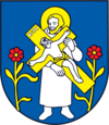
| coat of arms | map | |

|
|
|
| Basic data | ||
| State : | Slovakia | |
| Kraj : | Trenčiansky kraj | |
| Okres : | Trenčín | |
| Region : | Stredné Považie | |
| Area : | 27.262 km² | |
| Residents : | 2,749 (Dec. 31, 2019) | |
| Population density : | 101 inhabitants per km² | |
| Height : | 257 m nm | |
| Postal code : | 914 42 | |
| Telephone code : | 0 32 | |
| Geographic location : | 49 ° 0 ′ N , 18 ° 6 ′ E | |
| License plate : | TN | |
| Kód obce : | 506036 | |
| structure | ||
| Community type : | local community | |
| Administration (as of November 2018) | ||
| Mayor : | Jozef Húserka | |
| Address: | Obecný úrad Horné Srnie Družstevná 430 91442 Horné Srnie |
|
| Website: | www.hornesrnie.sk | |
| Statistics information on statistics.sk | ||
Horné Srnie (Hungarian Felsőszernye - until 1902 Felsőszrnye or older also Trencsénszrnye ) is a municipality in Trenčiansky kraj in western Slovakia .
The place is located on the Vlára river coming from Moravia , partly in the White Carpathians , 18 km northeast of Trenčín and 15 km south of Brumov-Bylnice ( Czech Republic ). In the White Carpathians there are some small settlements, one of which - Sidónia - has belonged to the Czech Republic as Sidonia since 1997.
Several finds from the Latène period have been found in the municipality . The place was mentioned for the first time in 1439 as villa Zerny and was on a royal road from Hungary to Moravia, which ran over the Wlarapass . The community has been an industrial town since the end of the 18th century, first with a glassworks , then since the 19th century with a cement works.
