Drietoma
| Drietoma | ||
|---|---|---|
| coat of arms | map | |

|
|
|
| Basic data | ||
| State : | Slovakia | |
| Kraj : | Trenčiansky kraj | |
| Okres : | Trenčín | |
| Region : | Stredné Považie | |
| Area : | 35.832 km² | |
| Residents : | 2,271 (Dec. 31, 2019) | |
| Population density : | 63 inhabitants per km² | |
| Height : | 242 m nm | |
| Postal code : | 913 03 | |
| Telephone code : | 0 32 | |
| Geographic location : | 48 ° 54 ' N , 17 ° 51' E | |
| License plate : | TN | |
| Kód obce : | 505960 | |
| structure | ||
| Community type : | local community | |
| Administration (as of November 2018) | ||
| Mayor : | Jaroslav Mego | |
| Address: | Obecný úrad Drietoma 29 91303 Drietoma |
|
| Website: | www.drietoma.sk | |
| Statistics information on statistics.sk | ||
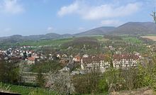
Drietoma (Hungarian Drétoma - until 1902 Drietoma ) is a municipality in western Slovakia . It is located six kilometers west of Trenčín on the border with the Czech Republic in the White Carpathians . The village with about 2050 inhabitants extends in the valley of the Drietomica river and forms an entrance gate from Moravia to Slovakia.
The Drietomica brook flowing through the municipality was first mentioned in 1244, and in 1321 the place was mentioned directly as Drethma . In the sources of the late Middle Ages, the place is divided into an upper and a lower town, the lower town is now part of Kostolná-Záriečie (Kostolná is still mentioned as Kostolna Drietoma in 1773 ), while the upper town has become today's Drietoma.
Around 1800 the current districts of Hrádok , Kraľovany , Biskupské and Rožen were incorporated.
Personalities
- Ján Pettko , Slovak geologist and mineralogist

