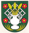
Motešice
| Motešice | ||
|---|---|---|
| coat of arms | map | |

|
|
|
| Basic data | ||
| State : | Slovakia | |
| Kraj : | Trenčiansky kraj | |
| Okres : | Trenčín | |
| Region : | Stredné Považie | |
| Area : | 17.393 km² | |
| Residents : | 793 (Dec. 31, 2019) | |
| Population density : | 46 inhabitants per km² | |
| Height : | 270 m nm | |
| Postal code : | 913 26 | |
| Telephone code : | 0 32 | |
| Geographic location : | 48 ° 50 ' N , 18 ° 11' E | |
| License plate : | TN | |
| Kód obce : | 506273 | |
| structure | ||
| Community type : | local community | |
| Structure of the municipality: | 3 parts of the community | |
| Administration (as of November 2018) | ||
| Mayor : | Martin Mach | |
| Address: | Obecný úrad Motešice Machnáčska 288 913 26 Motešice |
|
| Website: | www.motesice.sk | |
| Statistics information on statistics.sk | ||
Motešice (Hungarian Motesic ) is a municipality in the north- west of Slovakia with 793 inhabitants (December 31, 2019) . It belongs to the Okres Trenčín , a district of the parent Trenčiansky kraj .
geography
The municipality is located between two branches of the Strážovské vrchy Mountains , at the northernmost tip of the Nitrianska pahorkatina , a lower part of the Slovak lowlands . The Machnáč brook , which belongs to the catchment area of the Nitra River, flows through the village . Motešice is 15 kilometers from Bánovce nad Bebravou and 23 kilometers from Trenčín . State road 519 (Bánovce nad Bebravou - Trenčianska Teplá ) runs through the village .
Administratively, the municipality is divided into municipal parts Dolné Motešice , Horné Motešice and Peťovka .
history
Today's Motešice municipality was established in 1960 through the merger of Dolné Motešice and Horné Motešice. In 1990 Peťovka and Petrova Lehota were added, the latter town spun off again in 1995.
The place was first mentioned in writing in 1208 as Motihe . The originally single place was divided in the 16th century and only in 1960 it was reunited.
