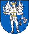
Nemšová
| Nemšová | ||
|---|---|---|
| coat of arms | map | |

|
|
|
| Basic data | ||
| State : | Slovakia | |
| Kraj : | Trenčiansky kraj | |
| Okres : | Trenčín | |
| Region : | Stredné Považie | |
| Area : | 33.445 km² | |
| Residents : | 6,414 (Dec. 31, 2019) | |
| Population density : | 192 inhabitants per km² | |
| Height : | 228 m nm | |
| Postal code : | 914 41 | |
| Telephone code : | 0 32 | |
| Geographic location : | 48 ° 58 ' N , 18 ° 7' E | |
| License plate : | TN | |
| Kód obce : | 506281 | |
| structure | ||
| Community type : | city | |
| Urban area structure: | 4 districts | |
| Administration (as of November 2018) | ||
| Mayor : | Miloš Mojto | |
| Address: | Mestský úrad Nemšová ulica J. Pálu 2 91441 Nemšová |
|
| Website: | www.nemsova.sk | |
| Statistics information on statistics.sk | ||
Nemšová (Hungarian Nemsó - until 1902 Nemsova ) is a city in Slovakia . It is located twelve kilometers northwest of Trenčín at the confluence of the Vlára in the Waag .
The place was mentioned in writing for the first time in 1242.
The municipality consists of the municipality parts:
- Kľúčové (incorporated in 1985)
- Ľuborča (incorporated in 1976)
- Nemšová (city)
- Trenčianska Závada (incorporated in 1985)
Culture
See also: List of listed objects in Nemšová
See also
Web links
Commons : Nemšová - collection of pictures, videos and audio files

