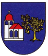
Kostolná-Záriečie
| Kostolná-Záriečie | ||
|---|---|---|
| coat of arms | map | |

|
|
|
| Basic data | ||
| State : | Slovakia | |
| Kraj : | Trenčiansky kraj | |
| Okres : | Trenčín | |
| Region : | Stredné Považie | |
| Area : | 3,666 km² | |
| Residents : | 691 (Dec. 31, 2019) | |
| Population density : | 188 inhabitants per km² | |
| Height : | 211 m nm | |
| Postal code : | 913 04 ( Chocholná-Velčice post office ) | |
| Telephone code : | 0 32 | |
| Geographic location : | 48 ° 53 ′ N , 17 ° 58 ′ E | |
| License plate : | TN | |
| Kód obce : | 506133 | |
| structure | ||
| Community type : | local community | |
| Administration (as of November 2018) | ||
| Mayor : | Peter Pilko | |
| Address: | Obecný úrad Kostolná-Záriečie č. 1 913 04 Kostolná-Záriečie |
|
| Website: | www.kostolnazariecie.sk | |
| Statistics information on statistics.sk | ||
Kostolná-záriečie is a municipality in the north- west of Slovakia with 691 inhabitants (December 31, 2019) and is part of the Trenčín District , part of the kraj Trenčiansky .
geography
The municipality is located in the south of the Považské podolie valley . The Drietomica stream , which flows into the Waag further downstream , separates the two districts from each other. The center of the village lies at an altitude of 211 m nm and is eight kilometers from Trenčín .
history
The municipality was created in 1952 by merging the independent villages Kostolná (German Kostel , Hungarian Vágegyháza - until 1907 Kosztolna ) and Dolné Záriečie (until 1927 Slovak "Zárieč"; Hungarian Alsózáros - until 1907 Zárjecs ).
The first settlements go back to the Bronze Age. After the district of Hradište , the existence of a fort is presumed to exist, but this has not yet been proven due to a lack of detailed investigation.
The place itself was mentioned in writing for the first time in 1318 as Dregma , the brook as early as 1244, i.e. shortly after the Mongol invasion . True to its name, the place was closely connected with the present-day community of Drietoma and, according to late medieval sources, was the suburb. While the upper town was later named Drietoma, the suburb was known as Kostolná Drietoma (1773) until the 18th century. In the late 16th century, the place Záriečie broke away. While the present-day place Kostolná belonged to the Diocese of Neutra , Záriečie was part of the property of the landed aristocracy, at first the Zárjecs family . Agriculture and distilleries were the main sources of income in both places.
In 1828 there were 22 houses and 219 inhabitants in Kostolná, 23 houses and 214 houses in Dolné Záriečie. On October 28, 1848, a battle between the Honvéden and an imperial army took place near Kostolná in the course of the revolution of 1848/49 .
population
Results of the 2001 census (657 inhabitants):
|
By ethnicity:
|
By denomination:
|
Buildings
- Roman Catholic church in Kostolná in baroque style from 1735
- Classically designed monastery from the 18th century, formerly the seat of the Redemptorists
Web links
- Entry on e-obce.sk (Slovak)
