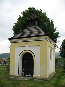
Slavnica
| Slavnica | ||
|---|---|---|
| coat of arms | map | |

|
|
|
| Basic data | ||
| State : | Slovakia | |
| Kraj : | Trenčiansky kraj | |
| Okres : | Ilava | |
| Region : | Stredné Považie | |
| Area : | 7.810 km² | |
| Residents : | 799 (Dec. 31, 2019) | |
| Population density : | 102 inhabitants per km² | |
| Height : | 236 m nm | |
| Postal code : | 018 54 | |
| Telephone code : | 0 42 | |
| Geographic location : | 49 ° 0 ' N , 18 ° 11' E | |
| License plate : | IL | |
| Kód obce : | 557421 | |
| structure | ||
| Community type : | local community | |
| Administration (as of November 2018) | ||
| Mayor : | Anna Prekopová | |
| Address: | Obecný úrad Slavnica č. 209 018 54 Slavnica |
|
| Website: | www.slavnica.sk | |
| Statistics information on statistics.sk | ||
Slavnica (Hungarian Szalonca - until 1907 Szlavnicvaszka ) is a municipality in the northwest of Slovakia with a population of 1,074 (December 31, 2019), which in Okres Ilava of, part kraj Trenčiansky lies.
geography
The community is located in the Ilavská kotlina basin , part of the larger Považské podolie valley on the right bank of the Váh . The Košariský potok flows through the place . The settlements Podhorie and Tlstá Hora are already in the White Carpathians . The center of the village lies at an altitude of 236 m nm and is seven kilometers from Ilava .
Neighboring municipalities are Bohunice in the northeast, Ilava in the east, Dubnica nad Váhom in the south, Kameničany in the west and Krivoklát in the northwest.
history
Slavnica was first mentioned in writing in 1379 as Zlaunicha and was owned by the Becsics and Sándor families . In 1598 there were 35 houses in the village, in 1784 there were 63 houses, 67 families and 339 residents. In 1828 there were 51 houses and 345 inhabitants, whose main sources of income were agriculture and fruit growing. In 1881 Slavnica was merged with the neighboring town of Vieska (then Vaszka in Hungarian ).
The place in Trenčín County belonged to the Kingdom of Hungary until 1918 and then came to Czechoslovakia or Slovakia.
population
According to the 2011 census, 842 people lived in Slavnica, 815 of them Slovaks , seven Czechs and one Magyar and one Russian . 18 residents did not provide any information on ethnicity .
744 residents committed themselves to the Roman Catholic Church, six residents to the Evangelical Church AB and one resident each to the Evangelical Methodist Church, the Orthodox Church and the Czechoslovak Hussite Church; two residents professed a different denomination. 33 residents were without a denomination and the denomination was not determined for 54 residents.
Buildings
- Baroque style cemetery chapel from the 18th century
- Wooden bell tower from the 20th century
traffic
The 2nd order road 507 runs through the municipality of Slavnica on the Nemšová - Pruské section , parallel to it the Nemšová – Lednické Rovne railway , but without passenger traffic.
The Slavnica-Dubnica nad Váhom airfield (ICAO code: LZDB) is located southeast of the town.
Individual evidence
Web links
- Entry on e-obce.sk (Slovak)

