
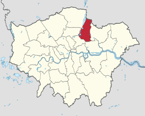
London Borough of Waltham Forest
| London Borough of Waltham Forest | |
|---|---|
  |
|
| status | London Borough |
| region | Greater London |
| Administrative headquarters | Walthamstow |
| surface | 38.82 km² |
| Residents | 276,700 |
| was standing | 2018 |
| ONS code | 00BH |
| Website | www.walthamforest.gov.uk |
The London Borough of Waltham Forest [ ˈwɔːlθəm ˈfɒɹɪst ] is a borough of London . It is in the northeast of the city.
Emergence
When the Greater London Administrative Region was established in 1965, it emerged from the Municipal Borough of Chingford , the Municipal Borough of Leyton and the Municipal Borough of Walthamstow in Essex . The name "Walthamstow" comes from the first known in 1075 under the name Wilcumestowe ("The Place of Welcome") and named in the Domesday Book of 1086 as Wilcumestou district.
The population in 2008 was made up of 62.7% white, 15.2% Asian, 15.5% black and 1.0% Chinese.
In the district there are the Walthamstow College , the William Morris Gallery and Vestry House Museum, Vestry Road, a former workhouse . The street market in the High Street, founded in 1885, is allegedly the longest in Europe at one kilometer. The Hamburg district of Wandsbek maintains a district sponsorship with the London Borough of Waltham Forest. It was established in 1949 with the former Municipal Borough of Leyton.
Districts

- Bakers Arms
- Cann Hall
- Chingford *
- Chingford Hatch
- Friday Hill
- Highams Park *
- Leyton
- Leytonstone *
- Upper Walthamstow
- Walthamstow *
* - There are still no articles of their own for the respective districts, only forwarding here.
Sports
In the district of Leyton , the stadium is Brisbane Road from Leyton Orient .
Personalities


Sorted by year
- William Cotton (1786–1866), banker and inventor
- William Morris (1834-1896), artist
- Kaikhosru Shapurji Sorabji (1892–1988), composer and pianist
- Alfred Hitchcock (1899–1980), film director
- Vera Searle (1901–1998), runner and sports official
- Eric Ashby, Baron Ashby (1904–1992) British botanist
- Thomas George Cowling (1906–1990), astronomer and mathematician
- Elsie Carrington (1919-2015), table tennis player
- Derek de Solla Price (1922–1983), historian of science
- Peter Winch (1926–1997), philosopher
- Beryl Swain (1936–2007), motorcycle racer, took part in 1962 as the first female driver in the dangerous Isle of Man TT motorcycle race
- Keith Greene (* 1938), racing car driver
- Derek Jacobi (* 1938), actor
- John Lill (born 1944), pianist
- Steve Hillage (born 1951), musician and producer
- Graham Gooch (born 1953), cricketer
- Steve Harris (* 1956), heavy metal bassist
- Paul Di'Anno (born 1958), metal singer
- Jane Ray (* 1960), illustrator
- Dave Shepherd (1929-2016), jazz clarinetist
- Teddy Sheringham (born 1966), football player
- Simon Khan (* 1972), golfer
- David Beckham (born 1975), football player
- Jodi Albert (* 1983), actress and singer
- Colin Kâzım-Richards (* 1986), football player
- Andros Townsend (born 1991), football player
- East 17 (1992–1999 and since 2006), boy group
- Benik Tunani Afobe (* 1993), football player
- Joe Willock (* 1999), soccer player
Trivia
The English boy band East 17 has named itself after the postal code for Walthamstow , East 17 or E 17 .
Individual evidence
- ↑ Mid 2018 Estimates of the population for the UK, England and Wales, Scotland and Northern Ireland
- ↑ Mills, A .: Oxford Dictionary of London Place Names , 2001
- ^ ONS mid-2007 Ethnic Group Population Estimates. (PDF, 89 KB) (No longer available online.) Greater London Authority, October 2009, archived from the original on July 19, 2011 ; accessed on May 23, 2011 (English). Info: The archive link was inserted automatically and has not yet been checked. Please check the original and archive link according to the instructions and then remove this notice.
- ↑ Printed matter 18/6706 of the Hamburg citizenship with answer from the Senate (page 2 below)
- ↑ official biography of the English boy band East 17 (engl.)
Coordinates: 51 ° 35 ′ N , 0 ° 1 ′ W