Watter (twist)
| Watter | ||
|
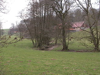
The Watter near Vahlhausen ( Landau ) |
||
| Data | ||
| Water code | EN : 4446 | |
| location | District of Waldeck-Frankenberg , Hesse ( Germany ) | |
| River system | Weser | |
| Drain over | Twiste → Diemel → Weser → North Sea | |
| source | in the Long Forest near Waldeck - Freienhagen 51 ° 16 ′ 7 ″ N , 9 ° 3 ′ 44 ″ E |
|
| Source height | approx. 435 m above sea level NHN | |
| muzzle | between Volkmarsen - Külte and Volkmarsen in the Twiste Coordinates: 51 ° 24 ′ 1 ″ N , 9 ° 5 ′ 44 ″ E 51 ° 24 ′ 1 ″ N , 9 ° 5 ′ 44 ″ E |
|
| Mouth height | approx. 183 m above sea level NHN | |
| Height difference | approx. 252 m | |
| Bottom slope | approx. 12 ‰ | |
| length | 21.9 km | |
| Catchment area | 41.25 km² | |
| Small towns | Waldeck , Bad Arolsen , Volkmarsen | |

The Watter is an approximately 21.9 km long, southern and right tributary of the Twiste in the Waldeck-Frankenberg district , northern Hesse ( Germany ).
course
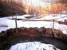
The Watter rises in the Long Forest on the north-eastern slopes of a ridge that connects the mountains Stirn ( 475 m above sea level ) in the north and Heitzelberg ( 467.4 m ) in the southeast. The source of the brook is about 1.2 km southwest of Freienhagen (northern district of Waldeck ) at about 435 m altitude. The Watter flows in predominantly northern directions.
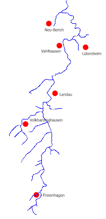
In its narrow valley, the Watter initially runs through Freienhagen, where it crosses federal road 251 . A little further north it flows a few kilometers east past Volkhardinghausen , directly west past Landau (both southeastern districts of Bad Arolsen ), where it is crossed by the federal highway 450 . After passing the Arolsender hamlet of Vahlhausen to the east , the Watter crosses under Kreisstraße 6, which connects Lütersheim (southern district of Volkmarsen ) in the southeast with Neu-Berich (eastern district of Bad Arolsen) in the northwest. After passing the Wetterkapelle to the west , it is bridged by the Warburg – Sarnau railway line and state road 3080 ( Wetterburg –Volkmarsen).
Shortly thereafter , the Watter flows between Külte (western part of Volkmarsen) in the west and Volkmarsen in the east at about 183 m into the Diemel tributary, Twiste, coming from the west .
Catchment area
The Watter catchment area , which is around 15 km (as the crow flies ), covers 41.25 km², making the Watter the second largest tributary of the Twiste after the Erpe , which is adjacent to the east . Its width varies between one and a half and just under four kilometers.
The Watter dominates its catchment area very strongly because twelve of its 15 tributaries are less than 2 km in length; the longest measures 3.8 km. Only two of these tributaries have their own tributaries. The tributaries together have a catchment area of 20.31 km², which is not even half of the mudflat catchment area. The valley of the Watter lies relatively far to the east in its catchment area, 59 percent of it lies west of the stream. On this side you will also find much longer and more productive tributaries than on the steeper east side.
The groundwater productivity in the mudflat catchment area is 5 to 15 liters per second, an average value.
There are five villages in the catchment area with a total of 2,834 inhabitants (as of 2003), which corresponds to a population density of 69.5 inhabitants per square kilometer. Most of the area is used for agriculture. 37% are used as arable land, another 17% as grassland, 40% are forested and four percent serve as partially sealed settlement areas.
Watershed
The source area of the Watter lies on the Diemel-Eder / Fulda / Weser watershed . This means that the Watter flowing in a northerly direction drains into the Weser via the Twiste and Diemel , while the Georgengraben , which rises only about 450 m away also south of Freienhagen, takes a southern detour via the Elbe , Eder and Fulda to the Weser, and while the Reiherbach , which rises about 670 m away also south of Freienhagen, takes an even longer detour over the Edersee , Eder and Fulda to the Weser.
use
Drinking water
The watter was not used for drinking water in the last few centuries . In Freienhagen, Landau and Lütersheim, however, drinking water was obtained from springs located near the Watter. This spring water was brought into the localities in Landau and Lütersheim by means of hydropower-driven pumping stations. The Landau Wasserkunst is still in operation in the summer months and can be visited: it pumps the water into a historicizing Kump between the town church of Landau and the school on the market square about 65 meters above the level of the Watter.
Such a pumping station was not necessary in Freienhagen. Two bowls here still testify to the water supply of earlier days; however, one of them has dried up. Due to severe water shortages at the end of the 1950s, a deep borehole of 326 meters was sunk in Freienhagen in 1960, through which up to 150 m³ of deep water can be pumped daily. A considerable part of this water reaches the Watter through the local sewage treatment plant, so that it does not dry out today even during long periods of heat.
All other places in the mudflat catchment area are connected to the sewage treatment plant in Volkmarsen, which transfers its purified water to the Twiste.
Hydropower
In addition to the two pumping stations already mentioned, the water from the Watter, with an average gradient of 11.3 per thousand, once also drove seven classic water mills and a system that operated craft machines such as saws with the help of water power (Schuchmann hydropower plant). In addition to the Landau pumping station, four of the mills still use water power today, three of which operate turbines instead of a water wheel, and electricity is generated instead of grinding flour. For some of the mills this is even the only source of energy, as they are not connected to the power grid due to their location far from the nearest towns.
| Official name | Upper mill | Lower mill | Siebringhäuser mill | Obermühle | Landau pumping station |
|---|---|---|---|---|---|
| Popular name | First mill | Second mill | Pfeiffer's mill | Mewes' mill | Water art |
| Location (coordinates) | 51 ° 17 ′ 41 ″ N , 9 ° 4 ′ 19 ″ E | 51 ° 17 ′ 56 " N , 9 ° 4 ′ 10" E | 51 ° 19 ′ 35 " N , 9 ° 4 ′ 24" E | 51 ° 20 ′ 6 " N , 9 ° 4 ′ 18" E | 51 ° 20 ′ 21 ″ N , 9 ° 4 ′ 50 ″ E |
| Location | Freienhagen | Freienhagen | Landau | Landau | Landau |
| Location (river kilometers) | 17.7 | 17.2 | 13.3 | 12.2 | 11.3 |
| Catchment area | 4.1 km² | 5.4 km² | 13.6 km² | 19.5 km² | 21.3 km² |
| Operation with water wheel | until about 1990 | 1717 to 1962 | until 1949 | until 1958 | 1535 until today |
| Diameter of the water wheel | 7.00 m | 6.20 m | 4.10 m | 4.80 m | |
| Width of the water wheel | 0.50 m | 0.45 m | 0.87 m | 0.80 m | |
| Type of water wheel | overshot | overshot | overshot | overshot | overshot |
| Power of the water wheel | 4.4 hp | 5.0 hp | 5.5 hp | ||
| Operation with turbine | approx. 1990 until today | 1962 to 2004 | 1950 until today | 1958 to approx. 1990 | - |
| Power of the turbine | 4.8 hp | 2.5 hp | - | ||
| Length of the upper trench | 120 m | 480 m | 300 m | 360 m | 400 m |
| Length of the trench | 60 m | 200 m | 50 m | 50 m | 20 m |
| Original usage | Flour mill | Grist mill chopper circular saw |
Drinking water pumping station | ||
| Todays use | Power generation | no? | Power generation | given up | Supply of the Landau wells |
| Official name | Middle mill | Schuchmann hydropower plant |
Under mill | Vahlhauser Mill | Lütersheim pumping station |
|---|---|---|---|---|---|
| Popular name | Groom's Mill | Post mill | |||
| Location (coordinates) | 51 ° 20 ′ 34 " N , 9 ° 4 ′ 36" E | 51 ° 20 ′ 47 " N , 9 ° 4 ′ 44" E | 51 ° 20 ′ 59 " N , 9 ° 4 ′ 55" E | 51 ° 22 ′ 20 " N , 9 ° 5 ′ 30" E | 51 ° 22 ′ 33 ″ N , 9 ° 6 ′ 0 ″ E |
| Location | Landau | Landau | Landau | Landau | Luetersheim |
| Location (river kilometers) | 10.8 | 10.3 | 9.7 | 5.7 | 4.7 |
| Catchment area | 22.0 km² | 23.6 km² | 30.2 km² | 31.8 km² | |
| Operation with water wheel | until 1977 | until 1935 | until 1953 | until 1955 | 1928 to 1974 |
| Diameter of the water wheel | 3.80 m | 3.50 m | 3.50 m | ||
| Width of the water wheel | 0.80 m | 0.70 m | 0.60 m | ||
| Type of water wheel | overshot | overshot | overshot | overshot | medium-sized |
| Power of the water wheel | 3.6 hp | 2.0 hp | |||
| Operation with turbine | 1986 until today | - | 1953 to 1965 | 1955 to 1972 | - |
| Power of the turbine | 3.4 hp | - | 6.7 hp | 6.0 hp | - |
| Length of the upper trench | 400 m | 300 m | 450 m | 500 m | |
| Length of the trench | 50 m | 60 m | 100 m | 250 m | |
| Original usage | Flour mill | Drinking water pumping station | |||
| Todays use | Power generation | given up | given up | given up | given up |
Ditches, ponds and weirs
The Watter feeds five ponds without being dammed itself. Four of them are private systems for fish farming, the fifth ("Netzer Teich") serves as an extinguishing water reservoir. There are other fish ponds at the tributaries of the Watter, some of which are dammed for these purposes.
A moat system with a total length of around 5 km once existed in Wattertal . In addition to the operating trenches of the hydropower plants, there are further parallel trenches north of Landau that are used for drinking cattle. A significant part of this trench system is no longer in operation today. Sometimes there are still relics such as ruins of weirs and silted up trenches.
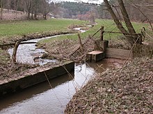
A special feature of the Watter is the shared operating ditch of the Upper and Lower Mills (near Freienhagen). It is virtually crossed by a tributary of the Watter. This is made possible by an additional weir.
Sights and monuments
The sights as well as cultural and natural monuments along or near the Watter include the already mentioned water mills, Landau Castle , the Hollenkammer and Huckershöhlen caves and the remains of Fürstenstein Castle .
literature
- Scholz, Th.Hans-Dieter: Water and windmills in the Waldeck-Frankenberg district - an inventory , published by the Kassel Regional Council, Kassel 1997
References and comments
- ↑ a b Map services of the Federal Agency for Nature Conservation ( information )
- ↑ a b c d Water map service of the Hessian Ministry for the Environment, Climate Protection, Agriculture and Consumer Protection ( information )
- ↑ In maps, the upper mill is often referred to as the Hegewalme, but this is actually just the name of an adjacent parcel.
- ↑ a b c d Data of the original water wheel. Since 2006 the Untere Mühle has had a new water wheel with a diameter of 5.50 m.
- ↑ At the Siebringhausen mill, the Watter is completely diverted into the operating ditch, the old stream bed has silted up.
- ↑ until 2004 power generation, today the water wheel is probably only decoration
- ↑ until about 1990 power generation


