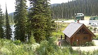
Stagleap Provincial Park
From Wikipedia, the free encyclopedia
The printable version is no longer supported and may have rendering errors. Please update your browser bookmarks and please use the default browser print function instead.
Provincial park in Central Kootenay Regional District, British Columbia, Canada
This article needs additional citations for verification. Please help improve this article by adding citations to reliable sources. Unsourced material may be challenged and removed. Find sources: "Stagleap Provincial Park" – news · newspapers · books · scholar · JSTOR (December 2009) (Learn how and when to remove this message) |
| Stagleap Provincial Park | |
|---|---|
 Panoramic view | |
| Location | British Columbia, Canada |
| Nearest city | Creston |
| Coordinates | 49°03′36″N 117°02′55″W / 49.06000°N 117.04861°W / 49.06000; -117.04861 |
| Area | 11.33 km2 (4.37 sq mi) |
| Established | August 17, 1964 (1964-08-17) |
| Governing body | BC Parks |
| Website | bcparks |
Stagleap Provincial Park is a provincial park in British Columbia, Canada. The park is approximately 1133 hectares[1] (2800 acres). It is 34 kilometers (21 miles) west of Creston.[2]
Stagleap is a protected habitat for mountain caribou, which are an endangered species.[3] For this reason, dogs and other domestic animals are prohibited from the park from November 1st through April 30th.[1]
Attractions
References
- ^ a b "Stagleap Provincial Park." BC Parks.
- ^ "'Stagleap Provincial Park." West Kootenay Visitor Center.". Archived from the original on 2012-03-23. Retrieved 2013-11-20.
- ^ "Mountain Caribou." Conservation Northwest.
External links
49°03′37″N 117°02′56″W / 49.0603°N 117.0489°W / 49.0603; -117.0489
This British Columbia protected areas related article is a stub. You can help Wikipedia by expanding it. |

