Azuara
| Azuara parish | ||
|---|---|---|
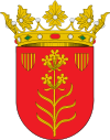
| coat of arms | Map of Spain | |

|
|
|
| Basic data | ||
| Autonomous Community : | Aragon | |
| Province : | Zaragoza | |
| Coordinates | 41 ° 15 ′ N , 0 ° 52 ′ W | |
| Height : | 603 msnm | |
| Area : | 165.8 km² | |
| Residents : | 540 (Jan. 1, 2019) | |
| Population density : | 3.26 inhabitants / km² | |
| Postal code : | 50140 | |
| Municipality number ( INE ): | 50039 | |
Azuara is a municipality in the province of Zaragoza in the Autonomous Region of Aragon in northeastern Spain . The place belongs to the Comarca Campo de Belchite and is located at 603 m altitude on the river Cámaras. The next larger towns are Belchite (16 km) and Fuendetodos (13 km). The provincial capital of Saragossa is located 60 km north of Azuara.
The place is dominated by agriculture, but 80% of its agricultural areas are not irrigated and can therefore only be used for the classic dry crops of the Mediterranean region (such as olives and wine). The population of Azuara has decreased from 830 in 1991 to 540 (as of January 1, 2019).
Azuara crater
Azuara is becoming increasingly popular among geologists and meteorite researchers, as structures from a meteorite impact have been found in the area. The impact is said to have occurred in the Middle Tertiary at the same time as two other meteorite impacts. The "Azuara Crater" has a diameter of 30 to 40 km.
Individual evidence
- ↑ Cifras oficiales de población resultantes de la revisión del Padrón municipal a 1 de enero . Population statistics from the Instituto Nacional de Estadística (population update).
- ↑ Kord Ernstson, Fernando Claudín The Azuara Impact Structure.Retrieved November 20, 2010
Web links
- Jarmo Molianen Impact structures of the world database Azuara (accessed November 20, 2010)


