Salvatierra de Esca
| Salvatierra de Esca municipality | ||
|---|---|---|
 Salvatierra de Esca
|
||
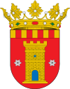
| coat of arms | Map of Spain | |

|
|
|
| Basic data | ||
| Autonomous Community : |
|
|
| Province : | Zaragoza | |
| Comarca : | Jacetania | |
| Coordinates | 42 ° 40 ′ N , 1 ° 0 ′ W | |
| Area : | 81.24 km² | |
| Residents : | 199 (Jan. 1, 2019) | |
| Population density : | 2.45 inhabitants / km² | |
| Postal code : | 50682 | |
| Municipality number ( INE ): | 50232 | |
Salvatierra de Esca is a Spanish municipality ( municipio ) in the foothills of the Pyrenees in the province of Saragossa in the autonomous community of Aragon . Salvatierra de Esca belongs to the Comarca Jacetania . The town on the Esca River had 199 inhabitants in 2019.
history
Salvatierra de Esca was founded in the 13th century to protect the border between Aragon and the Kingdom of Navarre . Remains of the monastery of Santa María de Fuenfría , which was consacrated in 876 and founded by García Íñiguez de Pamplona, remain.
Community structure
The districts are now Salvatierra de Esca and Lorbés . In addition, the former place Focheto was in the municipality.
Attractions
- Parish Church of El Salvador , late Gothic building
- Church Virgen del Pilar in the 18th century
- Virgen de la Peña Hermitage
literature
- Huesca. Tourist guide of the Altoaragón. Editorial Pirineo, Huesca 2003, ISBN 84-87997-68-6 , p. 21.
Web links
Commons : Salvatierra de Esca - collection of images, videos and audio files
Individual evidence
- ↑ Cifras oficiales de población resultantes de la revisión del Padrón municipal a 1 de enero . Population statistics from the Instituto Nacional de Estadística (population update).
- ↑ Salvatierra de Escá ( Spanish , PDF 183 kB) Instituto Aragonés de Estadística. April 24, 2013. Retrieved June 7, 2013.

