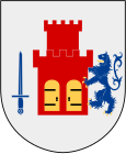
Bohuslan
| Bohuslan | |
|---|---|

|

|
| Basic data | |
| Part of the country (landsdel) : | Götaland |
| Province (län) : | Västra Götalands län |
| Surface: | 4,616 km² |
| Residents: | 292,236 (December 31, 2012) |
| Population density: | 63 inhabitants per km² |
| Highest elevation: | Björnerödspiggen 222 m ö.h. |
| Largest lake: | Bullaresjöarna |
Bohuslän [ 'buːhʉːslɛːn ] is a historical province ( Swedish landskap ) in Sweden .
geography
Bohuslän is located in western Sweden north of Gothenburg and is characterized by rocky coasts with offshore islands ( e.g. Tjörn , Orust , Marstrand ) and skerries . Gullmarsfjorden is Sweden's only fjord in Bohuslän . The largest city in Bohuslän is Uddevalla .
Bohuslän borders Norway in the north, Dalsland in the east and Västergötland in the southeast .
history
The Norwegian King Harald I made the area part of Norway around 870 and from around the 13th century the region is known under various variations of the name Bohuslän. After the dissolution of the Kalmar Union , the area was run under the Danish-Norwegian personal union and in 1658 it went to Sweden in the Peace of Roskilde .
The black death of 1349 hit Bohuslän hard. About half of the population died and a large part of the homesteads were empty. In addition, the period between the 14th and 15th centuries was quite cool, which resulted in reduced population growth. Agriculture only recovered sufficiently in the 17th century.
There was always economic boom when there was plenty of herring caught. Between 1559 and 1588, this source of income met with great interest from the Danish King Frederick II , who imposed taxes and duties on fishing. During this time as well as between 1747 and 1808, at the end of the Little Ice Age , the herring schools were large, and the abundant catches were indirectly benefiting the entire province. Many fishing settlements emerged, which led to a lasting change in the landscape, as many forests were cut down for homes, boats and fish processing plants. What remained were bare cliffs that still characterize the landscape today. In the interior of the country, on the other hand, there was increased afforestation at the beginning of the 20th century.
Economy and tourism
The region is economically dominated by its proximity to Gothenburg. For travelers, the diversity of the landscape and the numerous sights are of particular interest, which can also be explored through the popular Bohusleden summer hiking trail . Another tourist attraction are the rock carvings , hällristningar , in and around Tanumshede , which are part of the world cultural heritage .
climate
The favorable climatic location with many hours of sunshine and pleasant temperatures in summer (July / August mostly between 22 and 26 °) contributes to the attractiveness of the region.
literature
- John Coles and Lasse Bengtsson: Pictures of Past Times . Uddevalla 1990
- John Coles: Patterns in a Rocky Land, Rock Carvings in South-West Uppland . Uppsala 2000
- Ann-Sophie Hygen, Lasse Bengtsson: Rock paintings in the border area . Sävedalen 2000
- The rock painting journey - Bohuslän, Östfold , brochure of the Vitlycke museum
- Otto Dinger: Bohuslän, Structures of a Province on the Swedish West Coast (Diss. Cologne 1972, 160 p.)
Landscape symbols

- Flower: Wild honeysuckle ( lat. Lonicera periclymenum )
- Animal: Seal ( Phoca vitulina )
- Bird: Oystercatcher ( Haematopus ostralegus )
- Fish: Mackerel ( Scomber scombrus )
See also
Web links
- Official website (English, German, Swedish)
- Bohusläns Museum (English)
swell
- ↑ Folkmängd i landskapen ( Memento of the original from September 24, 2015 in the Internet Archive ) Info: The archive link was inserted automatically and has not yet been checked. Please check the original and archive link according to the instructions and then remove this notice.

