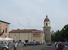
Bagnolo in piano
| Bagnolo in piano | ||
|---|---|---|

|
|
|
| Country | Italy | |
| region | Emilia-Romagna | |
| province | Reggio Emilia (RE) | |
| Local name | Bagnol in Piân | |
| Coordinates | 44 ° 46 ′ N , 10 ° 40 ′ E | |
| height | 32 m slm | |
| surface | 26 km² | |
| Residents | 9,784 (Dec. 31, 2019) | |
| Population density | 376 inhabitants / km² | |
| Post Code | 42011 | |
| prefix | 0522 | |
| ISTAT number | 035002 | |
| Popular name | Bagnolesi | |
| Patron saint | Franz von Paola | |
| Website | Bagnolo in piano | |
Bagnolo in Piano is an Italian commune ( comune ) with 9784 inhabitants (as of December 31, 2019) in the province of Reggio Emilia in Emilia-Romagna . The municipality is located about 7.5 kilometers north-northwest of Reggio nell'Emilia .
history
The toponym Bagnolo may come from the Latin flumen Baniolus and denote one of the numerous smaller rivers in the local foothills of the Po Valley . 946 the construction of the church of Santa Mustiola is proven. In 1335 the princely family of the Gonzaga took control of Bagnolo alongside the more important Reggio nell'Emilia and Novellara .
traffic
The municipality is located 5 kilometers north of the A1 autostrada from Milan via Bologna to Rome . There is a train station on the non-electrified railway line from Reggio nell'Emilia to Guastalla . The previous connection from Bagnolo in Piano to Carpi in the province of Modena was closed in 1955.
Web links
Individual evidence
- ↑ Statistiche demografiche ISTAT. Monthly population statistics of the Istituto Nazionale di Statistica , as of December 31 of 2019.


