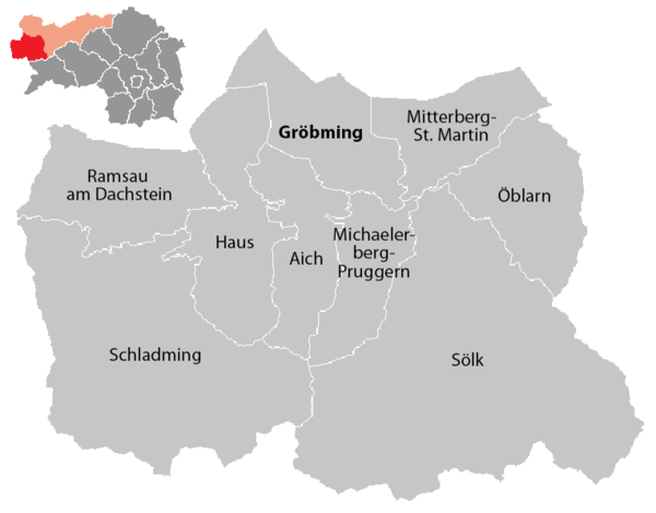
Political Expositur Gröbming
| location | |
|---|---|
| Basic data | |
| state | Styria |
| district | Liezen |
| Judicial district | Schladming |
| NUTS III region | AT-222 |
| Administrative headquarters | Grobming |
| surface | 952.86 |
| Residents | 22,820 (January 1, 2020) |
| Population density | 24 inhabitants / km² |
| License Plate |
GB
|
| Head of the Political Expositur | Christian Sulzbacher |
| website |
www.pe.groebming. steiermark.at |
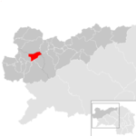
| map | |
The Political Exposure Gröbming is an administrative part of the Liezen district in Styria and the only currently existing Political Exposure in Austria. It has all the departments of a district administration , with the exception of social welfare, youth welfare, community auditing and disaster control.
It is located in the Styrian Ennstal in the northwest of the state on the border with Salzburg . In terms of landscape and spatial planning, the region is also called the Upper Ennstal or Oberland - somewhat more comprehensively . The area is congruent with the judicial district of Schladming .
history
In 1868, when the district authorities were established, the Liezen district authority was established. In 1872, the residents of the Upper Ennstal were able to set up the district administration Gröbming, which existed from June 30, 1873 to October 14, 1938 and was reassigned to the Liezen district administration by the National Socialists (as a field service in the district ).
From 1945 a permanent official day of the Liezen district administration in Gröbming was established, from which on January 1, 1962 the political exposure of the Liezen district administration in Gröbming arose. After the Political Exposure Bad Aussee was abolished in the course of the Styrian community structural reform, Gröbming is currently the only Political Exposure in Austria.
Administrative division
The Political Expositur Gröbming comprises nine communities , including one town and three market communities.
- Regions are small regions of Styria
| local community | location | Ew | km² | Ew / km² | Judicial district | region | Type
|
photo | Metadata |
|---|---|---|---|---|---|---|---|---|---|
Aich
|
|
1,297 | 56.47 | 23 | Schladming | 009 Schladming | local community
|

|
According to code: 61254 |
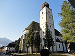
Grobming
|

|
3,085 | 66.48 | 46 | Schladming | - | market community
|
|
According to code: 61213 |
House
|
|
2,421 | 82.5 | 29 | Schladming | 009 Schladming | market community
|
|
According to code: 61217 |
Michaelerberg-Pruggern
|

|
1,157 | 47.64 | 24 | Schladming | - | local community
|

|
Acc. To code: 61260 |
Mitterberg-Sankt Martin
|
|
1.929 | 54.92 | 35 | Schladming | - | local community
|

|
According to code: 61261 |
Öblarn
|

|
2,035 | 70.17 | 29 | Schladming | - | market community
|

|
According to code: 61262 |
Ramsau am Dachstein
|

|
2,798 | 75.33 | 37 | Schladming | 009 Schladming | local community
|

|
According to code: 61236 |
Schladming
|

|
6,600 | 211.11 | 31 | Schladming | 009 Schladming | urban community
|
|
According to code: 61265 |
Sölk
|

|
1,498 | 288.24 | 5.2 | Schladming | - | local community
|

|
According to code: 61266 |
Web links
Individual evidence
- ↑ Statistics Austria - Population at the beginning of 2002–2020 by municipalities (area status 01/01/2020)
- ^ Ordinance of the Minister of the Interior of May 12, 1873. In: Wiener Zeitung , No. 125/1873, May 29, 1873, p. 978 center. (Online at ANNO ). .
- ^ A b Political districts (administrative system 1854–1868, districts, Nazi administration in general, political expositions, city districts) . In: Research on the history of the cities and markets of Austria , Volume 2: Wilhelm Rausch (Ed.), Hermann Rafetseder (Ed.): Area and name changes of the municipalities of Austria since the middle of the 19th century . Landesverlag, Linz (an der Donau) 1989, ISBN 3-900387-22-2 , p. 37.
- ↑ History of the Political Expositur Gröbming . In: pe.groebming.steiermark.at , accessed on September 13, 2016.
Coordinates: 47 ° 27 ' N , 13 ° 54' E


