Bojničky
| Bojničky | ||
|---|---|---|
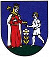
| coat of arms | map | |

|
|
|
| Basic data | ||
| State : | Slovakia | |
| Kraj : | Trnavský kraj | |
| Okres : | Hlohovec | |
| Region : | Dolné Považie | |
| Area : | 9.268 km² | |
| Residents : | 1,419 (Dec. 31, 2019) | |
| Population density : | 153 inhabitants per km² | |
| Height : | 210 m nm | |
| Postal code : | 920 55 | |
| Telephone code : | 0 33 | |
| Geographic location : | 48 ° 23 ' N , 17 ° 48' E | |
| License plate : | HC | |
| Kód obce : | 506800 | |
| structure | ||
| Community type : | local community | |
| Administration (as of November 2018) | ||
| Mayor : | Igor Bojnanský | |
| Address: | Obecný úrad Bojničky č. 90 920 55 Bojničky |
|
| Website: | www.bojnicky.sk | |
| Statistics information on statistics.sk | ||
Bojničky (until 1927 Slovak and "Bojnická"; Hungarian Bajmócska ) is a municipality in the west of Slovakia , with a population of 1,419 (as of December 31, 2019), which for Okres Hlohovec of, part Trnavský kraj belongs.
geography
The municipality is located in the Danube hill country in the lower Waag valley on the Jarčie stream , a left tributary of the Waag, six kilometers south of Hlohovec . The last offshoots of the Inowetz reach into the municipality.
history
The place was mentioned in writing for the first time in 1113 in the Zobor documents as Boenza . The main occupation of the inhabitants was and is agriculture. For a long time Bojničky belonged to the manor of the castle (now a chateau) in nearby Hlohovec.
Buildings
- Roman Catholic Elizabeth Church from the early 19th century
- Monastery of St. Cyril and Methodius completed in 2000 (Monastery of the Sisters of Mercy of St. Vincent )
Web links
Commons : Bojničky - collection of images, videos and audio files
