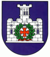
Leopoldov
| Leopoldov | ||
|---|---|---|
| coat of arms | map | |

|
|
|
| Basic data | ||
| State : | Slovakia | |
| Kraj : | Trnavský kraj | |
| Okres : | Hlohovec | |
| Region : | Dolné Považie | |
| Area : | 5.652 km² | |
| Residents : | 4,097 (Dec. 31, 2019) | |
| Population density : | 725 inhabitants per km² | |
| Height : | 143 m nm | |
| Postal code : | 920 41 | |
| Telephone code : | 0 33 | |
| Geographic location : | 48 ° 27 ' N , 17 ° 46' E | |
| License plate : | HC | |
| Kód obce : | 507253 | |
| structure | ||
| Community type : | city | |
| Administration (as of November 2018) | ||
| Mayor : | Terézia Kavuliaková | |
| Address: | Mestský úrad Leopoldov Hlohovecká cesta 2 92041 Leopoldov |
|
| Website: | www.leopoldov.sk | |
| Statistics information on statistics.sk | ||
Leopoldov (until 1948 Slovak "Mestečko"; German Leopold-Neustadtl or Leopoldstadt ; Hungarian Újvároska ) is a town in Okres Hlohovec in western Slovakia in the lower Waag Valley between the towns of Trnava and Piešťany , about 60 km northeast of the capital Bratislava .
history
The city was built from 1664 to 1669 as a fortress designed against the Turkish threat at the instigation of Leopold I (hence the name) and received city rights in 1669. The Leopoldov Fortress has served as a prison since 1855 and is particularly remembered from the period after 1948. After 1882 the village of Leopold (German also Leopoldstadt , Hungarian Lipótvár since 1873 ) was incorporated.
Culture
City name
The city used to be called in Slovak: Mestečko (literally "town", "spots"), Městěčko or Leopold Mestičko .

