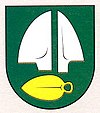
Siladice
| Siladice | ||
|---|---|---|
| coat of arms | map | |

|
|
|
| Basic data | ||
| State : | Slovakia | |
| Kraj : | Trnavský kraj | |
| Okres : | Hlohovec | |
| Region : | Dolné Považie | |
| Area : | 7.601 km² | |
| Residents : | 650 (Dec. 31, 2019) | |
| Population density : | 86 inhabitants per km² | |
| Height : | 137 m nm | |
| Postal code : | 920 52 | |
| Telephone code : | 0 33 | |
| Geographic location : | 48 ° 21 ' N , 17 ° 45' E | |
| License plate : | HC | |
| Kód obce : | 507539 | |
| structure | ||
| Community type : | local community | |
| Administration (as of November 2018) | ||
| Mayor : | Róbert Repka | |
| Address: | Obecný úrad Siladice č. 232 920 52 Siladice |
|
| Website: | www.siladice.eu | |
| Statistics information on statistics.sk | ||
Siladice (German Siladitz , Hungarian Szilád ) is a municipality in the west of Slovakia , with a population of 650 (December 31, 2019), which for Okres Hlohovec , part of kraj Trnavský belongs.
geography
The municipality is located in the Danube hill country on the lower course of the Waag , at the confluence of Dudváh into the river, 10 kilometers north of Sereď , 11 kilometers south of Leopoldov and 15 kilometers east of Trnava .
history
The place was mentioned in writing for the first time in 1113 in the Zobor documents as Saladicz . At that time Siladice belonged to the Neutra Abbey and according to the old documents it was on the left bank of the Waag instead of today's right bank. Over the centuries, the place was owned by various landlords, including the Sziládi family from 1490–1500 and Esterházy since 1641. Siladice was devastated in 1663 during a Turkish attack. The first school, then Roman Catholic, was founded in 1856. The population was and is predominantly employed in agriculture.
population
Results after the 2001 census (627 inhabitants):
|
By ethnicity:
|
By religion:
|
Buildings
- Roman Catholic Baroque Church of All Saints from 1749
