Borken brown coal area

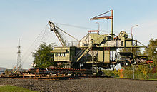
The Borkener lignite area is a (former) mining area in the West Hessian depression around Borken in Hesse . Here in the tertiary sediments abundant lignite deposits from the Eocene are stored, which are called "Older Hessian lignite" and were initially mined in underground mining , later in opencast mining . The Borkener Revier is assigned as the largest and most productive sub-district to the North Hessian lignite district .
history
In 1897 lignite was found when a well was being built in Arnsbach . The Arnsbach union was founded in order to develop the presumed larger lignite deposits . Under her leadership, lignite was mined from 1900 to 1909 in a civil engineering company in the area of what would later become the Gombeth opencast mine. The mining rights were taken over by the Deutsche Kaliwerke in 1919 and by the Prussian state in 1921 . Subsequently, Prussia founded the union Großkraftwerk Main-Weser AG , which acquired the lignite fields around Borken, began building the Borken power station in 1922 and was incorporated into PreussenElektra in October 1927 .
The mining of lignite was carried out by two companies:
- in the southern area by the BUBIAG (brown coal and briquette industrial corporation) between the places
- Stolzenbach ,
- Dillich and
- Neuenhain ;
- in the northern area by the PreussenElektra between the places
- Haarhausen
- Gombeth and
- Großenenglis .
Decline and cessation
The mining accident in Stolzenbach on June 1, 1988 contributed to the decline of mining in the Borken district, as a result of which the Stolzenbach mine was shut down and the entire coal production in the Borken district and the shutdown of the Borken power station were completed earlier than planned. The underground mining was stopped as a result of the accident, the opencast mining continued until the closure of the large Main-Weser power station on March 15, 1991 in the Gombeth mine. This ended the mining history in the region. The Hessian lignite mining museum in Borken, which opened in 1992, keeps the memory of this chapter of regional history alive.
Development of the workforce
- 1922: 50
- 1939: 900
- 1954: 1800
Funding locations

Open pit
The overburden from the early open-cast mines was deposited on two high dumps (dump Altenburg near Arnsbach and dump Dosenberg near Uttershausen ). These opencast mines were then backfilled with overburden from the subsequent opencast mines. Today nothing can be seen of them apart from river straightening and changes in the parcelling . There was then no overburden for backfilling for the later opencast mines, so that they were mostly recultivated using hydraulic engineering. The later opencast mines were also the smallest, as the large deposits with a favorable overburden / coal ratio were mined first. In addition, far fewer surface cleanups were carried out on these small opencast mines.
The Ostheim and Zimmerrode opencast mines were not in the area of the city of Borken.
| Open pit | Beginning | The End | status | Location / locality | Coordinates |
|---|---|---|---|---|---|
| Altenburg I. | 1923 | 1943 | Decommissioned, agriculturally recultivated | between Arnsbach (Borken) and Trockenerfurth , partly under today's Kippe Altenburg | 51.048174 ° N 9.249828 ° E |
| Altenburg II | 1942 | 1964 | Decommissioned, agriculturally recultivated | between Großenenglis , Gombeth and the Schwalm | |
| Altenburg III | 1946 | 1955 | Decommissioned, agriculturally recultivated, partly built on, partly absorbed in the Gombeth opencast mine | between the Borken power station , the Schwalm and the Gombeth opencast mine | |
| Altenburg IV | 1954 | 1975 | Decommissioned, flooded ( Borkener See ) | between Borken , Trockenerfurth and Nassenerfurth | 51.034686 ° N 9.266895 ° E |
| Schwalm | 1958 | 1961 | Decommissioned, agriculturally recultivated | between the Altenburg II opencast mine and the Schwalm, north of the power plant | |
| Singlis Pit | 1961 | 1972 | Decommissioned, flooded ( Singliser See ) | between Gombeth and Singlis , north of the L 3149 | 51.059691 ° N 9.305133 ° E |
| Haarhausen 1 | 1964 | 1975 | Decommissioned, agriculturally recultivated | between Nassenerfurth and Dillich , east of the L 3149 | |
| Gombeth Pit | 1970 | 1986 | Decommissioned, partially backfilled as landfill, flooded ( Gombether See ) | between Kraftwerk, Gombeth and the Singlis opencast mine, partly in the area of the Altenburg III opencast mine | 51.059631 ° N 9.285768 ° E |
| Ostheim | 1973 | 1989 | Decommissioned, flooded ( Goldbergsee ) | between Ostheim and Sipperhausen (approx. 15 km from the Borken power plant) | |
| Haarhausen 2 | 1975 | 1980 | Decommissioned, agriculturally recultivated | between Haarhausen and Nassenerfurth, west of the L 3149 | 51.07240 ° N 9.473264 ° E |
| Stockelache pit | 1976 | 1985 | Closed, flooded ( Stockelache natural bathing lake ) | between Kleinenglis and the Schwalm, east of the A 49 | 51.06454 ° N 9.242764 ° E |
| Room dig | 1978 | 1991 | Shut down, is currently being flooded | between Zimmerrode and Neuenhain , west of the L 3149 |
Civil engineering
Borken was one of the few lignite mining areas in Germany that also mined civil engineering. By far the largest civil engineering company in the Borken mining area was the Stolzenbach mine . After the mining accident in Stolzenbach on June 1, 1988, the mining of lignite in underground mining in the Borken lignite district was completely stopped.
| Civil engineering | Beginning | The End | Location / locality | Coordinates |
|---|---|---|---|---|
| Altenburg I. | 1924 | 1960 | between Arnsbach, Trockenerfurth and Borken, on both sides of the Main-Weser Railway | |
| Altenburg II | 1947 | 1971 | north and south-east of Großenenglis, adjacent to the Altenburg II opencast mine | |
| Schwalm | 1956 | 1964 | between the Altenburg II opencast mine, the Schwalm and Gombeth | |
| Altenburg IV | 1960 | 1967 | between the Altenburg IV opencast mine and Borken, south of the Altenburg I underground mine | |
| Vineyard | 1961 | 1980 | south of the Altenburg IV opencast mine, under the Borkener Stadtwald, west of the Stolzenbach underground mine | |
| Stolzenbach | 1956 | 1988 | on all sides of Stolzenbach |
Area expansion
The Borken lignite district claimed an area of 1,500 hectares within the boundaries of the city of Borken.
- Altenburg II: 114 hectares of opencast mining
- Altenburg III: 65 hectares of opencast mining
- Altenburg IV: 172 hectares of opencast mining
Post-mining landscape
→ Main article: Borkener Seenland , post-mining landscape
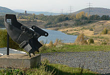
The remaining open pit holes were recultivated after the carbonization . In the process, overburden from conveying pits was backfilled into the charred; sometimes they filled with water. This created the following lakes and ponds (7 and 11–13 are not within the boundaries of the city of Borken):
- Stock pool
- Gombether lake
- Singliser See
- Borkener See
- Stolzenbacher pond
- Teufelsbach pond
- Zimmerröder lake
- Haarhäuser Lake
- Dillicher lake
- Castle pond
- Neuenhainer See
- Dorheimer Teich-West
- Dorheimer Teich-Ost
See also
literature
- Magistrate of the city of Borken (Ed.): 675 years of the city of Borken . Contributions to urban development. 1st edition. Riemann, Melsungen 1992.
- Magistrate of the City of Borken (Ed.): Borkener Jubilee Reading Book 775-2000 . Contributions to the history of the city. 1st edition. Magistrat der Stadt Borken, Borken 2000, ISBN 3-932739-08-6 .
- Hans Bickell, Horst Schönhut: North Hessian lignite mining - The Altenburg mine in Borken (Hesse) . Ed .: Magistrate of the City of Borken. Bernecker Mediengruppe, Melsungen 2002, ISBN 3-932739-11-6 .
Individual evidence
- ↑ Federal Agency for Nature Conservation (Ed.): Profile West Hessian Senke . ( HTML [accessed December 22, 2008]). HTML ( Memento of the original from July 21, 2011 in the Internet Archive ) Info: The archive link was inserted automatically and has not yet been checked. Please check the original and archive link according to the instructions and then remove this notice.
- ↑ a b Bernd Heßler: From small agricultural town to mining and power station town . In: Magistrat der Stadt Borken (Ed.): 675 years of the city of Borken . Riemann, Melsungen 1992, p. 8-9 .
- ↑ Hans Bickell, Horst Schönhut: North Hessian lignite mining - the Altenburg mine in Borken (Hesse) . Ed .: Magistrate of the City of Borken. Bernecker Mediengruppe, Melsungen 2002, p. 99 .
- ↑ Hans Bickell, Horst Schönhut: North Hessian lignite mining - the Altenburg mine in Borken (Hesse) . Ed .: Magistrate of the City of Borken. Bernecker Mediengruppe, Melsungen 2002, p. 101 .
- ↑ a b Horst Schönhut: The Borkener See . In: Magistrat der Stadt Borken (ed.): The anniversary reading book 775-2000 . Magistrate of the City of Borken, Borken 2000, ISBN 3-932739-08-6 , p. 235 .
Web links
- Borken (Hessen), Schwalm-Eder district. Historical local dictionary for Hesse (as of December 5, 2014). In: Landesgeschichtliches Informationssystem Hessen (LAGIS). Hessian State Office for Historical Cultural Studies (HLGL), accessed on January 21, 2016 .
