Granegg Castle (Waldstetten)
| Granegg Castle | ||
|---|---|---|
|
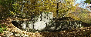
Foundation walls of the keep |
||
| Creation time : | around 1230 | |
| Castle type : | Höhenburg, spur location | |
| Conservation status: | Wall remains, trench | |
| Construction: | Humpback cuboid | |
| Place: | Waldstetten - Wißgoldingen | |
| Geographical location | 48 ° 43 '47.7 " N , 9 ° 50' 26.1" E | |
| Height: | 688 m above sea level NN | |
|
|
||
The castle Granegg is an Outbound hilltop castle on the district Wißgoldingen the community Waldstetten in Ostalbkreis .
Geographical location
The Burgstall is located on the west-facing 200 m long mountain spur of the Kalten Feld, known as Graneggle , at an altitude of 688 m above sea level. NN . The border between the district of Göppingen and the Ostalb district runs south of the castle ruins .
Due to its location, the castle dominated the pass of the Christian valley, which is almost 100 m away, at today's Reiterleskapelle .
history
The castle was built in the 13th century due to the humpback cuboid, exact construction dates are unknown. The builders and owners of the castle are also unknown. As possible lords of the Granegg castle, due to documentary mentions, lords of Stoffeln from the nearby Weilerstoffel and lords of Holtz are occasionally mentioned . The von Holtz were servants of the Rechbergers and owned estates in Tannweiler , Wißgoldingen, Winzingen and in Christental. The existence as masters is unproven for both sexes.
Whether the castle was destroyed or abandoned is unknown due to the lack of documents. It is generally assumed that the Granegg did not last very long and was abandoned by the 14th century at the latest. It is no longer recorded on the stalking map drawn by Balthasar Riecker in 1572 . The ruins were only mentioned in 1674 by the chronicler Friedrich Vogt from Schwäbisch Gmünd .
description
Contemporary views of Granegg Castle are not known. The 60 × 22 m large castle complex was separated from the cold field by a 4 m deep neck ditch , no outer bailey is detectable. On the wooded area today there are still individual remains of the wall. Above all, the remains of the foundation wall of the round keep are clearly visible with an outer diameter of 8.62 m and an inner diameter of 3.62 m with a wall thickness of 2.50 m. The Weißjura stones of the keep are said to have served as building material in the neighboring villages in the past.
Around 1885 remains of a cellar vault with cellar stairs are said to have been visible.
literature
- A. Albrecht: Graneggle and Rechbergle (OA Gmünd) , in sheets of the Swabian Alb Association , No. 2, 1931, Col. 50f.
- Konrad Albert Koch : Granegg Castle just below the Cold Field , in sheets of the Swabian Alb Association , No. 9, 1931 Sp. 241f.
- Günter Schmitt : Burgenführer Schwäbische Alb, Volume 1 - Nordost-Alb: Hiking and discovering between Aalen and Aichelberg , Biberacher Verlagsdruckerei, Biberach an der Riss 1988, ISBN 3-924489-39-4 , pp. 181-186
- Florian Henning Set: Mysterious Christian Valley. History and legend about the Granegg castle ruins and Reiterles chapel , Messelstein-Verlag GmbH, Donzdorf 1994, ISBN 3-928418-10-6
Web links
Individual evidence
- ^ Georg Stütz: Heimatbuch für Gmünd and further surroundings. Volume II: Hikes in the Homeland , Schwäbisch Gmünd 1924, p. 198


