
Cayenne
| Cayenne | |
|---|---|

|

|
| region | French Guiana |
| Department | French Guiana |
| Arrondissement | Cayenne |
| Community association | Center Littoral |
| Coordinates | 4 ° 56 ′ N , 52 ° 20 ′ W |
| height | 0-105 m |
| surface | 23.60 km 2 |
| Residents | 61,268 (January 1, 2017) |
| Population density | 2,596 inhabitants / km 2 |
| Post Code | 97300 |
| INSEE code | 97302 |
.jpg) Aerial photograph |
|
Cayenne [ kaˈjɛn ] is the capital and largest city of the French overseas department of French Guiana with 61,268 inhabitants (January 1, 2017) and an area of 23.6 km². The city is located on a peninsula of the same name in the mouth of the Río Cayenne in the Atlantic .
The three Îlets Dupont are located a few hundred meters from the northern tip of the Cayenne peninsula . 45 kilometers north-west of Cayenne are the Îles du Salut belonging to the city , which served France as a penal colony. The Cayenne Airport is located approximately 16 kilometers southwest of the city on the nearby town of Matoury .
City structure
Cayenne is divided into the following districts ( quartiers ):
- Center ville: De Gaulle, Buzaret, Amandier, Les Palmistes.
- Center ville quartiers Sud: Village Chinois, Ronjon, Palétuvuiers, Malouins, Rénovation Urbaine, ZA Galmo
- Faubourg nord: Mirza, Médan, Les Floralies, N'zila, Faubourg l'Abri, Lafaurie, Césaire, Thémire, Anatole, Brutus, Mango, Jacarandas, eau lisette
- Faubourg sud: Bonhomme, Jean François / Pascaline, Cabassou, Raban, Novaparc NR, ZA Calimbe, Uranus
- Quartiers sud-ouest: Ploermel, Mont Baduel, Mont Lucas, Petit Lucas, Hameau des encens, Stanislas, Suzini
- Périphériques Nord: Cité Pasteur, Cité Chatenay, Cité Horth, Cité Grant, Cité Coulée d'Or, Cité les pépites, Cité zéphir
- Périphériques Sud: Apounau, La Roseraie, Cité Mortin
Former canton division

Irrespective of this, until it was dissolved in 2015, it was divided into six cantons (each with their respective districts or quarters ):
- Canton Cayenne-1 Nord-Ouest (Fort Cépérou, Pointe des Amandiers, Buzaret, Îles du Salut )
- Canton Cayenne-2 Nord-Est (Chaton, Montabo, Zéphir, Bourda, Suzini)
- Canton Cayenne-3 Sud-Ouest (Village-Chinois, Leblond, La Madeleine)
- Canton Cayenne-4 Center (Center, Mirza, De Gaulle, Buzaret, Palmistes)
- Canton Cayenne-5 Sud (Bonhomme, Galmot, Anatole, Thémire, Eau-Lisette)
- Canton Cayenne-6 Sud-Est (Rebard, Coulée d'Or, Mango, Baduel, La Roseraie, Les Maringouins, Bonhomme, Mont-Lucas)
| Rochambeau Airport (Aéroport de Cayenne - Rochambeau) | ||||||||||||||||||||||||||||||||||||||||||||||||
|---|---|---|---|---|---|---|---|---|---|---|---|---|---|---|---|---|---|---|---|---|---|---|---|---|---|---|---|---|---|---|---|---|---|---|---|---|---|---|---|---|---|---|---|---|---|---|---|---|
| Climate diagram | ||||||||||||||||||||||||||||||||||||||||||||||||
| ||||||||||||||||||||||||||||||||||||||||||||||||
history
The first French settlement of the peninsula in 1604 by an expedition sent by Henry IV was abandoned after a few years due to the destruction by the Portuguese. On November 27, 1643, the city was re-established under King Charles Poncet de Brétigny, Lieutenant General. In 1652 the first slaves were introduced.
Worth seeing
- Monument to Félix Éboué
- Monument to Victor Schœlcher
- Alexandre-Franconie Museum
- Musée des Cultures Guyanaises

The town hall on Rue de Rémire 1
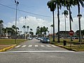
City center , view of the Place des Palmistes


Personalities
- Maurice Cognacq (1870–1949), doctor and colonial administrator
- Félix Éboué (1885–1944), French colonial politician, first black governor general
- Gaston Monnerville (1897–1991), French politician and constitutional judge
- Léon-Gontran Damas (1912–1978), Guayan French-speaking writer
- Henri Salvador (1917-2008), French singer
- Éric Edwige (* 1945), French football player
- Christiane Taubira (* 1952), French politician
- Florent Malouda (* 1980), French football player
- Ulrich Robeiri (* 1982), French fencer
- Enzo Lefort (* 1991), French fencer
- Kévin Rimane (* 1991), French football player
- Donovan Léon (* 1992), French football player
- Mehdy Metella (* 1992), French freestyle and butterfly swimmer
- Mike Maignan (* 1995), French football player
- Amaury Golitin (* 1997), French athlete
- Jean-Clair Todibo (* 1999), French football player
Web links
Individual evidence
- ^ Amazonian Museum Network. Retrieved November 10, 2019 .
- ^ Amazonian Museum Network. Retrieved November 10, 2019 .