
Duisburg-Homberg / Ruhrort / Baerl
|
|||
|---|---|---|---|
| coat of arms | map | ||

|

|
||
| structure | |||

|
|||
| Basic data | |||
| Area : | 37.1 km² | ||
| Residents : | 39,725 (December 31, 2014) | ||
| Population density : | 1,075 inhabitants / km² | ||
| Postcodes : | 47119, 47198, 47199 | ||
| Telephone code : | 0203, 02066, 02841, 02844 | ||
| Distribution of seats for the district council (2014) | |||
|
|||

Homberg / Ruhrort / Baerl is a district of Duisburg with 39,725 inhabitants and an area of 37.1 km² (as of December 31, 2014) . It consists of the districts of Alt-Homberg , Hochheide , Baerl and Ruhrort .
The smallest urban district in terms of population emerged in 1975 after the municipal territorial reform from the Baerl district of the municipality of Rheinkamp on the left bank of the Rhine, the city of Homberg on the left bank of the Rhine and the district of Duisburg-Ruhrort on the right bank of the Rhine.
Most of Duisburg's inland port Duisport is located in the city district .
Buildings

Friedrich-Ebert-Brücke with a view of the Ruhrort district

Lifting tower of the former Ruhrort – Homberg trajectory

Baerl Evangelical Village Church ,
first mentioned in 1262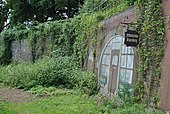
Former ferry station Essenberg


literature
- Contemporary witness exchange Duisburg ev: Duisburg-Homberg and -Hochheide , Sutton Verlag Erfurt 2015, ISBN 978-3-95400-544-4 .
Web links
- District website ( Memento of April 14, 2009 in the Internet Archive )
- District Office Homberg / Ruhrort / Baerl
- Map of the borough at OpenStreetMap
- Streets in the Alt-Homberg district (onlinestreet.de)
- Streets in the district of Hochheide (onlinestreet.de)
- Streets in the district of Baerl (onlinestreet.de)
- Streets in the Ruhrort district (onlinestreet.de)
Individual evidence
- ↑ Population statistics of the city of Duisburg from December 31, 2014 ( Memento from September 23, 2015 in the Internet Archive ) (PDF; 21 kB)
Aldenrade | Old town | Baerl | Beeck | Beeckerwerth | Bergheim | Bissingheim | Bruckhausen | Buchholz | Dellviertel | Duissern | Fahrn | Friemersheim | Großenbaum | Alt-Hamborn | Hochemmerich | High field | Hochheide | Homberg | Huckingen | Hüttenheim | Kasslerfeld | Laar | Marxloh | Meiderich | Mündelheim | Neudorf | Neuenkamp | Neumühl | Obermarxloh | Overbruch | Cream | Rheinhausen-Center | Röttgersbach | Ruhrort | Rumeln-Kaldenhausen | Ungelsheim | Old Walsum | Vierlinden | Wanheim-Angerhausen | Wanheimerort | Wedau | Wehofen
Coordinates: 51 ° 28 ' N , 6 ° 41' E