Femundsmarka National Park
| Femundsmarka National Park | ||
|---|---|---|
|
|
||
| Location: | Innlandet , Norway | |
| Next city: | Røros | |
| Surface: | 597 km² | |
| Founding: | 07/09/1971, 2003 extended | |
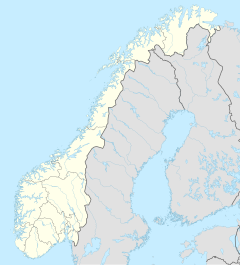
| The national parks in southern Norway (Femundsmarka has number 8) | ||
| The national park with Lake Femund in the background | ||
The Femundsmarka National Park ( Norwegian Femundsmarka-nasjonalpark ) is a 597 km² national park in Norway . It covers parts of the Femundsmarka Mountains and is located in the provinces of Innlandet and Trøndelag . In the east it borders on the historic Swedish province of Härjedalen . South of the park is Gutulia National Park .
The park was founded in 1971 with an area of 386 km² to protect the almost untouched forest and mountain region there, as well as the entire landscape with all its lakes and rivers and the biological diversity with its characteristic flora and fauna.
The park belongs to the municipalities of Engerdal (Hedmark) and Røros (Trøndelag). It also borders the nature reserves Langtjønna and Femundslia . The Grøvelsjøen nature reserve is located within the park. On the Swedish side, the nature reserves Långfjället and Rogen border the park.
Geography, landscape and geology
One of the main reasons to establish a national park in this area is the formations, which are relics of the last ice age. The landscape is otherwise characterized by mountains, lakes and rivers. The total area of the lakes and rivers makes up over 10% of the total area of Femundsmarka. The Rogen River crosses the park from east to west.
There are relatively high mountains in both the north and south, while the center of the park is not that high. The largest mountain in the park is the Storvigelen with 1,561 moh , which is in the northern part. The highest mountains in the south are Elgåhogna (1,460 moh), Store Svuku (1,415 moh) and Grøthogna (1,401 moh).
flora
The sparse vegetation in the park is due to the nutrient-poor soils and the cold, dry inland climate. In most parts of the park, therefore, meadows and pastures dominate, while in the north there are also some crooked birch forests . The tree line is around 800–900 m. There are numerous moors in the more humid parts of the park . The wolf lichen, which is quite rare in Scandinavia, also grows in Femundsmarka .
Administration and tourism
There are numerous marked hiking trails throughout the national park and there are also two overnight huts, Muggsjølia and Røhaben . There are also several huts outside the park. The many lakes and rivers also make the park a popular canoeing , kayaking and fishing area .
In addition to a road from the Norwegian village of Elga, Femundsmarka National Park can also be reached with the "MS Fæmund II" from Femundsee .
See also
Trivia
The German black metal solo project Waldgeflüster released the concept album Femundsmarka - A journey in three chapters in 2011 , which was inspired by a trekking trip through Norway.
literature
- Per Roger Lauritzen , Ole Vangen. Femundsmarka and Gutulia . Gyldendal, 2007 (Norges nasjonalparker; 2) ISBN 978-82-05-37631-1
- Møllebak Gate. Rondane og Femundsmarka: with tilgrensende fjellstrøk . Gyldendal, 1998 (Gyldendals fjellguider) ISBN 82-05-25140-1
- Den Norske turistforenings årbok 1987. Hovedtema: Femundsmarka og omliggende fjellstrøk
- Ragnar Frislid , Dagfinn Grønoset , Per Hohle . Femundsmarka and Sølentraktene . Gyldendal, 1979 ISBN 82-05-11760-8
- Gunnar Borgos, Reidar Elven mfl. Femundsmarka, Gutulia . Luther, 1972 (Norges nasjonalparker; 4) ISBN 82-531-4047-9 .
- Per cave. Til fots i Femundsmarka and Sylene . Gyldendal, 1971 ISBN 82-05-00107-3
- Erling sand. «Femundmarka» I: Den norske turistforenings årbok 1969 .


