Rondane National Park
| Rondane National Park | ||
|---|---|---|
|
|
||
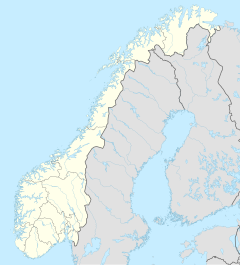
| Location: | Innlandet , Norway | |
| Next city: | Lillehammer | |
| Surface: | 963 km² | |
| Founding: | 1962, expanded in 2003 | |
| The national parks in southern Norway (Rondane has number 6) | ||
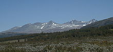
The Rondane National Park ( Norwegian Rondane nasjonalpark ) is the oldest national park in Norway . There are ten mountain peaks in it that are higher than 2,000 m. The highest mountain peak in the national park is the Rondslottet at 2,178 m. The national park is an important habitat for herds of wild reindeer . It is located near the city of Otta and was founded on December 21, 1962 and expanded in 2003 by 383 km² to an area of 963 km².
geography
Rondane is located east of Gudbrandsdalen in the municipalities of Dovre , Sel , Nord-Fron , Sør-Fron , Ringebu , Folldal and Stor-Elvdal in Fylke Innlandet . There are two other national parks nearby, the Jotunheimen National Park and the Dovrefjell-Sunndalsfjella National Park .
Rondane is a typical high mountain range with extensive plateaus and 10 peaks over 2,000 m. The highest mountains can be found in the central and northern parts. The highest peaks are the Rondslottet (Rondaner Castle) at 2,178 m, the Storronden at 2,138 m and the Høgronden at 2,118 m. The lowest point is below the tree line , which is 1,000 to 1,100 m high for Northern Europe, which is due to the mild but also very dry (500 mm precipitation per year) climate. In the south of the park there are flatter plateaus.
The landscape is clearly divided by mountains and valleys. The deepest valley separates the large Storronden-Rondslottet group from the Smiubelgen (smithy) . Between the steep slopes of this valley lies the narrow lake Rondvatnet, which also forms the center of the park. From here, all peaks over 2,000 m high can be reached on foot in less than a day.
There is not enough rainfall in Rondane to create permanent glaciers like in Jotunheimen National Park . On some protected valley slopes, however, there are solid snow fields. Dead ice holes are widespread as remnants of the ice age glaciers. Furthermore, strange little hills shape the landscape. These eskers were formed by the ground moraine in the melting glaciers.
geology
The bedrock in Rondane formed 500 to 600 million years ago as deposits on a flat sea floor. Today's fossil-free metamorphic rock was formed by mountain folds .
Most of the current landscape was shaped by the last Ice Age, nine to ten thousand years ago. Large amounts of ice were formed and it is assumed that ice melting and ice accumulation alternate cyclically. The ice melted very quickly towards the end, as deeply excavated river valleys testify. Rondane contains some small ravines (the most famous are Jutulhogget and Vesle-Ula ) cut by meltwater.
fauna and Flora
Rondane is one of the few places in Scandinavia where wild reindeer (not the domesticated Sami reindeer ) are found. The Norwegian nature conservation authority regards Rondane as "a particularly important habitat for the native reindeer". It is estimated that around 2,000 to 4,000 reindeer live in Rondane and the nearby Dovre Natural Park. To protect the reindeer population in their core area, hiking trails were relocated in the 1990s. In 2003 the park was enlarged in order to be able to protect the reindeer even better.
Other large game, including roe deer and elk , are commonly found in the outskirts of the park. Occasionally, you will also see musk ox herd in the nearby Dovre National Park . Wolverines and a small population of brown bears live in the park, while wolves are rare.
Apart from the moor birches in the lower elevations, the dry and nutrient-poor soils and rocks are covered by heather , robust grasses and lichens . The highest mountains are almost completely barren; Above 1,500 m, it is almost only the robust lichens that grow on the bare stones. One of the well-adapted flowering plants is the glacier buttercup , which thrives at an altitude of 1,700 meters.
The reindeer is heavily dependent on lichens (especially reindeer lichen ). The lichens thus serve as food for the reindeer, which then fertilizes the soil. This allows less undemanding plants to flourish, which in turn provide food for mice and lemmings .
history
prehistory
Only after the end of the glaciation of the last Ice Age could the park be populated again by plants and animals. Major climate changes allowed the reindeer to spread far across Scandinavia. But only a few hundred years later they were displaced again and could only survive in much smaller areas, including Rondane. Archaeologists found that the forest grew quickly after reforestation, even at great heights: birch trees grew at an altitude of 1,030 m 8,500 years ago.
Apparently nomadic hunters and gatherers lived on the reindeer on the plateaus . The large traps used for fishing can be seen at Gravhø and Bløyvangen and are also common in the park. These stone traps form openings or large fenced areas into which reindeer could be deceived or led.
In connection with these large traps, there are also small arched stone walls that are believed to have served as hiding places for archers waiting for prey. Various dating methods suggest that the oldest traps could be around 3,500 years old. Most finds, including houses remains, however, date from the years 500 to 700 n. Chr. It can be as safe assumed that the large traps and the stone walls from the 6th century to the depopulation by the Black Death in the 14th century were used .
Establishment of the national park
After almost ten years of planning, Rondane was designated as the first Norwegian national park, initially as a nature reserve, on December 21, 1962. The main reasons given for the establishment are "the protection of the natural environment with its native flora and fauna and the cultural heritage as well as the protection of the environment as a recreational area for future generations".
Legal efforts to protect nature in Norway began in 1954 with the passage of the Nature Conservation Act. In 1955 meetings were held in the municipalities around Rondane and a commission was set up, whose president was Norman Heitkøtter. The establishment of the then 580 km² Rondane National Park was made possible by a royal decision.
After this first national park, many more followed, all of which are maintained by the Directorate for Naturforvaltning .
extension
As a special measure for the protection of the wild reindeer, the park was expanded considerably in 2003 by 383 km² to 963 km², mainly to the northwest, but to a lesser extent to the east and south. In addition, areas of lesser protection (landscape protection and nature protection areas) were named in connection with the park. Due to the newly established Dovre National Park between Rondane and the Dovrefjell-Sunndalsfjella National Park, there is now a large, almost contiguous strip of protected mountain regions. Only a narrow strip around a street and villages separates the Dovre National Park from Rondane.
tourism
Visitors to Rondane National Park are allowed to hike and camp freely in almost all areas, except in the immediate vicinity of the mountain huts. Apart from the ban on motorized traffic, there are hardly any other restrictions. Fishing and hunting are also possible with a license.
The Norwegian Mountain Hiking Association ( DNT ) owns and operates a network of mountain huts as a service for hikers. In Rondane there is the central hut Rondvassbu at the southern end of the lake Rondvatnet. The mountain huts Grimsdalshytta, Dørålseter and Bjørnhollia are on the northern and eastern edge of the park, respectively. These four huts are managed and provide food and accommodation for the hikers. There are also unmanaged huts like Eldåbu that require a key.
The DNT also marks the hiking trails in the park with red T s, which are simply painted on stones. These marked trails connect the huts and lead to a couple of peaks near Rondvassbu. Some of the hiking trails have now been relocated to make it less disturbing for the wild reindeer.
The huts are also open in winter, but only offer self-service out of season. Ski trails are marked and sometimes groomed either by the DNT or by some hotels in the ski resorts near the park.
Rondane in literature
The landscape of Rondane has inspired many Norwegian writers. Probably the best known is Henrik Ibsen's poem Peer Gynt , written in 1867 , which is partly set in Rondane (2nd act, 4th scene: In the Rondegebirge.). With this work Ibsen wrote one of the best dramas of the 19th century and made Rondane a symbol of Norway's natural beauty.
The writer and collector of Norwegian folk tales of the mid- 19th century , Peter Christen Asbjørnsen , collected many stories about Rondane. Among them was the legend about Peer Gynt, which served as the inspiration for Ibsen's drama. A third writer, Aasmund Olavsson Vinje , also had his famous work No ser eg atter slike Fjell og Dalar performed in Rondane.
See also
literature
- Tonia Körner: Norway: Rondane (= outdoor manual. The way is the goal. Vol. 252). Conrad Stein Verlag, Welver 2009, ISBN 978-3-86686-252-4 (hiking guide).
Web links
- Further description, pictures and literature
- Map of Rondane from the Norwegian Environment Agency
- Rondvassbu hut in English or Norwegian, with pictures
- Information about the national park in English
- A dream! Lonely trails and endless white - cross-country skiers forget the world on a ski hike through the Norwegian Rondane area. In: Die Zeit from December 15, 2005, p. 81 by Rüdiger Dilloo


