Skarvan og Roltdalen National Park
| Skarvan og Roltdalen National Park | ||
|---|---|---|
|
|
||
| Location: | Trøndelag , Norway | |
| Next city: | Trondheim | |
| Surface: | 441.4 km² | |
| Founding: | 02/20/2004 | |
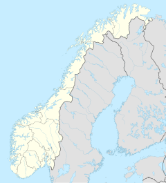
| The national parks in southern Norway (Skarvan og Roltdalen has number 14) | ||
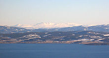
The Skarvan og Roltdalen National Park ( Norwegian : Skarvan og Roltdalen nasjonalpark ) is a Norwegian national park west of the Sylan . It belongs to the municipalities of Selbu , Tydal , Meråker and Stjørdal in Trøndelag Province . The national park was founded in 2004 to preserve and protect the large and pristine mountains and forests in the region with their biological diversity of ecosystems, species and populations and cultural heritage.
The park has an area of 441.4 km² and borders the Stråsjøen-Prestøyan nature reserve in the west .
Geography, landscape and geology

The Skarvan and Roltdalen lies between the Neadalføret and the Stjørdalsføret . The topography of the park ranges from moors and coniferous forests in the southwest running Roltdalen valley to the 1,171 m high Skarvan in the north. The highest mountain in the national park, the Fongen at 1,441 m , belongs to the high mountain range in the southeast .
The dominant rock material is various mica schists , occasionally staurolite , garnet and kyanite are also found . The Kvernfjellet , an approximately 1 km wide rocky artery, runs from Brennrya in the north along the Kvernfjellvatna lake over the Høgfjellet mountains to the Rotla river at Svartåsen in the south. It was used to mine millstones and is the largest millstone area in Norway.
The whole area shows no serious human influences and is the largest forested valley in Sør-Trøndelag.
Flora and fauna
The Skarvan og Roltdalen National Park has various natural spaces. In addition to coniferous forest , which, with its primeval forest -like character and trees that are over 200 years old, is considered to be the park's greatest botanical value, bogs and swamps, there are wide, open areas up to alpine mountains without vegetation. In this diverse natural landscape will be used within the forest moose , Crested Tit , Coal Tit , Treecreeper , three-toed woodpecker , jay and capercaillie ago.
In the wetlands, golden plover , marsh ruff , ruff , black-throated diver , scupper and Odin's chickens can be found among others . In addition to the capercaillie mentioned above, black grouse as well as mountain hares and ptarmigan are represented in healthy populations. The birds of prey in the national park include golden eagles , hawks and gyrfalcons .
Twenty of the bird species found in the park are on the red list .
History and culture
There are traces of human settlement in the national park, some of which are more than 2000 years old. In Stormoen and Søndre Liavollen, for example, there are remains of iron smelting plants in which lawn iron stones were processed. Since the mountains also had more or less productive copper deposits , with the exception of a few interruptions, the Selbu Kobberverk and another copper mine near Litle Klepptjønna ( Meråker ), from which a settlement emerged in the 18th and 19th centuries, were operated from 1713 to 1761 . The millstone pits in Kvernfjellet were used from the Middle Ages to the First World War and can be seen as deep furrows in the rock.
There are also pitfalls , tar pits , traces of former settlements (including Sami ) and associated traffic routes. A total of 99 alpine pastures and pastures can be seen in the national park, some of which date back to the 17th century. In the 1940s, 200–600 cattle, around 400 goats and around 500 sheep were kept there. The traditional alpine pasture was given up around 1960, but many alpine pastures are still used today as pastures for sheep and young cattle.
Forestry was also of great importance in the past centuries. From the 17th century to the 1950s, the felled trees were rafted on the Rotla.
For the Tydals Sami, the area of the national park has been an important grazing ground for their reindeer for centuries. From the second half of April to late autumn, around 7600 reindeer are kept there. In winter the animals are driven to Femundsmarka .
Tourism and administration
The Norwegian Trekking Association has maintained numerous trails in the park since the 1900s, which are connected to the Sylan hiking network . The hosted Schultzhytta mountain hut in the middle of the national park is also supported by the Norwegian Hiking Association. Outside the park are the Prestøyhytta , Græslihytta and Ramsjøhytta cabins .
In addition to cross-country skiing in winter, hiking, horse riding, hunting and fishing (especially for trout and char ) are popular sports in the park .
See also
Web links
- Directorate for Nature Management
- Information brochure of the Norwegian Directorate for Nature Management about the National Park (German)
Individual evidence
- ↑ a b c d e f g Information brochure of the Norwegian Directorate for Nature Management ( page no longer available , search in web archives ) Info: The link was automatically marked as defective. Please check the link according to the instructions and then remove this notice. , dirnat.no, accessed on September 20, 2010, German

