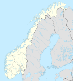
Varangerhalvøya National Park
| Varangerhalvøya National Park | ||
|---|---|---|
|
|
||
| Location: | Norway | |
| Next city: | Båtsfjord , Vadsø , Vardø | |
| Surface: | 1804 km² | |
| Founding: | 2006 | |
| The national parks in Northern Norway (The Varangerhalvøya has number 29) | ||
The Varangerhalvøya National Park ( Norwegian Varangerhalvøya nasjonalpark , North Sami Várnjárga ) is a national park in Norway . The park belongs to the municipalities of Båtsfjord , Nesseby , Vadsø and Vardø in the province of Troms og Finnmark .
The Varangerhalvøya covers an area of 1,804 km² and was founded in 2006 to preserve and protect the almost untouched landscape with its special terrain and deposits from the last Ice Age, the biodiversity of the various ecosystems and the cultural heritage of the Sami . The park also borders the Persfjorden-Syltefjorden nature reserve and the Syltefjorddalen nature reserve .
Geography, landscape and geology
The park is located in an arctic high fjell landscape on the Varanger peninsula , between the Syltefjord and the Varangerfjord .
A low ridge runs in an east-west direction, the highest mountain of which, Skipskjølen , is also the highest mountain in the national park at 633 moh . The ridge is the watershed of the region.
Today's landscape was largely shaped by the glacier movements of the last Ice Age.
Flora and fauna
In the park there are both typical Arctic and East Siberian plants, but also plants that usually grow much more south. The young deciduous forest in the national park is one of the northernmost in the world.
The calcareous soils in the north of Varangerhalvøya favor this biodiversity. The rarest plant in the park is the Crepis multicaulis which has been considered extinct in Norway since 1943 and was only rediscovered in the national park in 2008.
Since zone A of the national park (in the municipality of Nesseby) offers an ideal habitat for many water birds, including some rare and threatened species, with its lakes, bogs, swamps and wetlands, the area is of great scientific interest.
The entire peninsula is also an important habitat for the arctic fox . The logo animal of the park is the Skua .
heritage Site
Remains of Sami sanctuaries , sacrificial sites and hunting utensils for reindeer hunting were found in the national park, some of which were dated to around 4,500 years ago.
Probably the most important find is a stone reindeer trap in the shape of a circle, which was built in the 16th century.
Tourism and administration
Since the area has been a grazing area for Sami reindeer for centuries , the Sami are still allowed to do so.
The area is well suited for various outdoor activities such as hiking, cycling, canoeing and kayaking in both summer and winter. The rivers and lakes in the park are popular fishing waters, which are particularly popular during the respective fishing seasons for the individual fish species.
Web links
- Directorate for naturforvaltning: dirnat.no/varangerhalvoya
- Fylkesmannen i Finnmark: Varangerhalvøya nasjonalpark - oversikt
literature
- Soldal, Oddvar. «Forheksa landskap, - ikkje raude T-ar i Varanger» I: Fjell og vidde ; no 4, 2005
- Anna Siedlecka, David Roberts and Lars Olsen. Geologi på Varangerhalvøya: en oversikt with ekskursjonsforslag . Norges geologiske undersøkelse, 1998. ( Gråsteinen ; 3).
- Erling Sundve. Varangerhalvøya . Fritt forlag Finnmark, 1990 ISBN 82-90641-06-0

