Ormtjernkampen National Park
| Ormtjernkampen National Park | ||
|---|---|---|
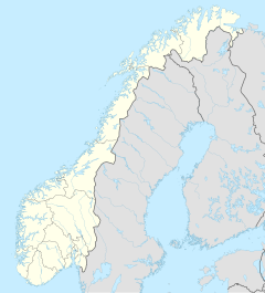
| The national parks in southern Norway (the former Ormtjernkampen has number 4) | ||
|
|
||
| Location: | Innlandet , Norway | |
| Next city: | Lillehammer | |
| Surface: | 8.5 km² | |
| Founding: | June 14, 1968 (resolved March 11, 2011) | |
The Ormtjernkampen National Park ( Norwegian Ormtjernkampen nasjonalpark ) was Norway's smallest national park until its rise into the Langsua National Park on March 11, 2011 with its 8.5 km² . He belonged to the municipality of Gausdal in the province of Innlandet . The park was founded on June 14th, 1968 in order to preserve the nature with its primeval forest character and the original fell landscape of the east country . The park bordered the Ormtjernmyra nature reserve .
Geography, landscape and geology
The area of the former Ormtjernkampen National Park is located south-southwest of Dokkvatnet and north / northwest of Ormtjørnet . The highest mountain in the former park is 1.128 moh. high Ormtjernkampen .
The national park area was mostly in the mountains between the Dokkvatnet and the Ormtjernkampen. The jungle there is one of the most pristine in Norway, as it has hardly been entered for centuries.
Flora and fauna
While coniferous forest (mainly spruce ) grows in the lower elevations of the former park , crooked birch trees predominantly grow in the higher elevations , which eventually disappear and the flora is dominated by grasses, flowers, mosses and lichens.
The mixture of living and dead trees in the forests, the alpine climate with cool summers and cold winters, and the high average annual rainfall with the resulting high humidity, offers a variety of different plants, mosses , lichens and fungi optimal growth conditions. Probably the rarest plant in the park is the bearded bellflower , of which only a few are known to occur in northern Europe.
Tourism and administration
There is a hiking trail on Ormtjernkampen . As is usually the case in the Norwegian national parks, there was no mountain hut or other paved sleeping area in Ormtjernkampen.
Since 2005 an extension of the national park has been considered. Various plans saw a total area of up to 1,365 km² for the park possible. In this scenario, the municipalities Etnedal would have 24 km² (2%), Nordre Land 47 km² (3%), Nord-Fron 104 km² (7%), Sør-Fron 133 km² (10%), Nord-Aurdal 137 km² ( 10%), Øystre Slidre 380 km² (28%) and Gausdal 540 km² (40%) kilometers were added. The percentage indicates how many percent the respective area would make up on the 1,365 km². However, this plan has not been fully implemented. The Ormtjernkampen National Park instead became part of the new Langsua National Park , which opened on March 11, 2011 with an area of 537.1 km².
literature
- Olav Gjærevoll , Leif Ryvarden mfl. Dovrefjell. Ormtjernkampen . Luther, 1975. (Norges nasjonalparker; 8). ISBN 82-531-4065-7
- Gunvald Børtnes and Ketil Kohmann. «Ormtjernkampen» I: Den norske turistforenings årbok 1969 .
- Haakon Lie. Ormtjernkampen villmark . Oslo, 1961. (Småskrifter utgitt av Østlandske naturvernforening; No. 2).

