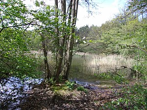
Holdenstedter ponds
|
Holdenstedter ponds
|
||
| location | North of Holdenstedt in Lower Saxony Uelzen district | |
| surface | 57.0 ha | |
| Identifier | NSG LÜ 279 | |
| WDPA ID | 378097 | |
| FFH area | 57.0 ha | |
| Geographical location | 52 ° 56 ' N , 10 ° 31' E | |
|
|
||
| Sea level | from 39 m to 62 m | |
| Setup date | 11/27/2007 | |
| administration | NLWKN | |
The Holdenstedter ponds are a nature reserve in the Lower Saxony city of Uelzen in the Uelzen district .
The nature reserve with the registration number NSG LÜ 279 is 57 hectares in size. It is completely part of the FFH area "Ilmenau with tributaries".
The nature reserve is located in the south-west of Uelzen north of the Uelzener district Holdenstedt in the valley of the Gerdau , a source river of the Ilmenau . It protects part of the lower reaches of the Gerdau between the crossing under the Hanover – Hamburg line to Holdenstedt with a backwater and the Holdenstedter ponds, two fish ponds created by damming, as well as the adjacent bank areas and part of the lowland.
The nature reserve is characterized by semi-natural deciduous forests and predominantly moist to wet grassland of varying intensity of use. In addition, near-natural still waters and unused areas can be found. In the lowlands there are wet bushes, reeds , sedges and tall herbaceous fields . At the edges of the lowland, individual coniferous forests and arable land are included in the nature reserve.
The area has been a nature reserve since December 6, 2007. The responsible lower nature conservation authority is the district of Uelzen.


