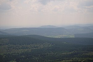
Hopper head
| Hopper head | ||
|---|---|---|
|
Hopperkopf (front) including open space near Küstelberg and telecommunications tower on the Bollerberg (rear) from the air |
||
| height | 832.3 m above sea level NHN | |
| location | near Willingen ; Waldeck-Frankenberg district , Hochsauerlandkreis ; Hessen , North Rhine-Westphalia ( Germany ) | |
| Mountains | Rothaar Mountains | |
| Dominance | 1.8 km → Clemensberg | |
| Notch height | 78.4 m ↓ to Clemensberg | |
| Coordinates | 51 ° 14 '50 " N , 8 ° 35' 55" E | |
|
|
||
The Hopperkopf , not to be confused with the nearby Hoppernkopf , at Willingen is 832.3 m above sea level. NHN high mountain of the Rothaargebirge on the border from the Waldeck-Frankenberg district in Hesse to the Hochsauerlandkreis in North Rhine-Westphalia .
Geographical location
The Hopperkopf is located in the Rothaargebirge at the junction of the Upland regions with the Diemelsee Nature Park in the north and Sauerland with the Sauerland-Rothaargebirge Nature Park in the south. Its summit, located in the municipality of Willingen in north Hesse , rises about 4 km south-southwest of Stryck and belongs to the district of northeastern Usseln (both to Willingen), 2.8 km north of Küstelberg (to Medebach ) and 2.5 km (depending on the beeline ) east-northeast of Hildfeld (to Winterberg ); the last two villages mentioned are in Westphalia .
Neighboring mountains are - with a height in meters (m) above sea level (NHN): Clemensberg (approx. 837 m ) in the west-northwest, Hegekopf ( 842.9 m ) and Mühlenkopf (approx. 815 m ) to the north, Hohe Pön ( 792, 7 m ) in the northeast, Krutenberg ( 785 m ) in the east-northeast and Hillekopf ( 804.9 m ) in the south.
The Itter rises on the northwest flank of the wooded Hopperkopf , and the small Schweimecke on its southwest flank, a northeastern tributary of the Hillebach , which rises on the neighboring Hillekopf mountain to the south .
Along the north Hessian-Westphalian border that runs over the Hopperkopf summit, there are several historical boundary stones from the years 1769, 1825 and 1866.
Natural allocation
The Hopperkopf belongs to the natural spatial main unit group Süderbergland (No. 33), in the main unit Rothaargebirge (with Hochsauerland ) (333) and in the subunit Winterberger Hochland (333.5) to the natural area Langenberg (333.58). The landscape falls east to south-east into the natural area Grafschafter Kammer (with Upländer Tor) (333.52) and to the south to southwest into the natural area Harfeld (333.56).
Mountain height
The Hopperkopfgipfel ( 832.3 m ) is according to the German basic map in Hesse around 30 m north of the border with North Rhine-Westphalia between two trigonometric points : 832 m (approx. 50 m south) and 831 m (approx. 80 m northeast) height.
Rivers and watersheds
- The Hopperkopf is located on the ridge of the Rhine-Weser watershed : The water of the Itter flows in a north-easterly direction through the Diemel to the Weser . The very short Schweimecke , which rises on the southwest flank of the Hopperkopf, reaches the Rhine through the Hillebach , which flows a little further south from the Hillekopf , westwards through the Ruhr .
- The Hopperkopf also forms the most south-westerly end of the Diemel-Eder / Fulda / Weser watershed : The water of the flowing waters that arise on the eastern flank of the mountain runs north through the Itter and Diemel into the Weser . That of the Brackenwasser brook, which rises on the southern flank of the neighboring Krutenberg to the east, creates groundwater through the brook coming from Hillekopf and the Wilde Aa ("Aar"), whose source is not far east-northeast Auf'm Knoll , as well as the Orke , Eder and Fulda a southern detour to the Weser.
Individual evidence
- ↑ a b Topographical Information Management, Cologne District Government, Department GEObasis NRW ( Notes )
- ↑ Martin Bürgener: Geographical Land Survey: The natural spatial units on sheet 111 Arolsen. Federal Institute for Regional Studies, Bad Godesberg 1963. → Online map (PDF; 4.1 MB)

