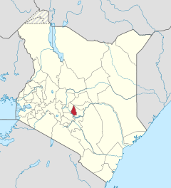
Kirinyaga County
| Kirinyaga County | |
|---|---|
 Agriculture in Kirinyaga County |
|
| Population (state) - population density |
610,411 inh. (2019) 506 inh / km² |
| surface | 1,205.4 km² |
| Coordinates | 0 ° 30 ′ S , 37 ° 17 ′ E |
| ISO 3166-2 | KE-15 |

|
|
Kirinyaga County is a county in Kenya . In Kirinyaga County in 2019 610,411 people lived on 1,205.4 km². The capital is Kerugoya and the largest city is Wanguru . Kirinyaga is bordered by Embu County to the east, Machakos County to the south, Murang'a County to the southwest, and Nyeri County to the west . The Mount Kenya , which gives its name to the country, is located in the district.
structure
| Divisions | ||
| division | Population (1999) | Capital |
|---|---|---|
| Central | 74,068 | Kerugoya |
| Gichugu | 121,738 | Kianyaga |
| Mwea | 125,962 | Wanguru |
| Ndia | 135,337 | Baricho |
| total | 457.105 | - |
The county is divided into four constituencies (Mwea, Gichuga, Ndia, and Kirinyaga).
climate
Kirinyaga is located directly below Mount Kenya and is therefore one of the wettest areas in the country. The annual temperatures fluctuate between 12 ° C and 26 ° C with an average of 20 ° C and an annual rainfall of about 1250 mm. There are two rainy seasons - a longer one from March to May and a shorter one from October to December.
population
Most of the residents belong to the Kikuyu ethnic group . The majority of the population are Christians of Roman Catholic or Protestant faith. There are some Muslims in the big cities of Kerugoya and Wanguru. Close. 70% of the population are small farmers.
In 2014 the fertility rate was 2.3 children per woman. The literacy rate was 91.5% for women and 93.7% for men between the ages of 15 and 49.
economy
As in most counties in the region, agriculture is the main economic activity in Kirinyaga County. The county is known for its rice production under the Mwea Irrigation Program and is responsible for 50% of the nation's rice production. Coffee and tea are grown in the cooler areas of Ndia, Gichugu, and Kirinyaga constituencies. Other crops in the area include corn , beans , tomatoes , green beans and other horticultural crops. Due to the scarcity of land and the relatively high population density, most of the agriculture is carried out on a small scale. In Sagana, fishing is practiced along the Sagana River .
In 2017, the county's GDP per capita was 162,666 Kenyan Shillings (around 3,248 international dollars ), making it 14th among the 47 counties in the country.
Individual evidence
- ↑ 2019 Kenya Population and Housing Census Volume I: Population by County and Sub-County. KNBS, accessed November 20, 2019 .
- ↑ Archive link ( Memento of November 3, 2011 in the Internet Archive ) District Environmental Action Plan 2006–2011 Murang'a District (pdf), p. 8; Retrieved October 25, 2010.
- ↑ a b About Kirinyaga County in Kenya. Retrieved July 1, 2019 .
- ↑ Kenya Demographic and Health Survey 2014. Retrieved June 30, 2019 .
- ↑ Mwea Irrigation Scheme. Retrieved July 1, 2019 (UK English).
- ^ Gross County Product 2019 .