Líský
| Líský | ||||
|---|---|---|---|---|
|
||||
| Basic data | ||||
| State : |
|
|||
| Region : | Středočeský kraj | |||
| District : | Kladno | |||
| Area : | 239 ha | |||
| Geographic location : | 50 ° 15 ' N , 13 ° 56' E | |||
| Height: | 375 m nm | |||
| Residents : | 110 (Jan. 1, 2019) | |||
| Postal code : | 273 76 | |||
| License plate : | S. | |||
| traffic | ||||
| Street: | Hořešovice - Líský | |||
| structure | ||||
| Status: | local community | |||
| Districts: | 1 | |||
| administration | ||||
| Mayor : | Dušan Beznoska (as of 2010) | |||
| Address: | Líský 20 273 76 Pozdeň |
|||
| Municipality number: | 571555 | |||
| Website : | www.obecni-urad.net/source/index.php?ID=2688 | |||
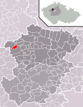
| Location of Líský in the Kladno district | ||||

|
||||
Líský (German Haselwald , formerly Liskai ) is a municipality in the Czech Republic . It is located eleven kilometers west of Slaný and belongs to the Okres Kladno .
geography
Líský is located on the eastern edge of the forest area Týnecký les on a ridge between the valleys of the Zlonický potok and Bukovský potok. The Háje (389 m) rises to the north.
Neighboring towns are Bílichov and Zichovec in the north, Hořešovičky and Hořešovice in the northeast, Plchov in the east, Pozdeň in the southeast, Hřešice in the south, Srbeč and Milý in the southwest and Bor in the west.
history
The village was first mentioned in a document in 1616.
After the abolition of patrimonial Líský formed from 1848 a district of the municipality Hřešice in the Slaný district. In 1890 the place gained its independence. Líský has been part of the Okres Kladno since 1961 . In 1980 the village was incorporated into Pozdeň . The Líský community has existed again since 1990.
Community structure
No districts are shown for the municipality of Líský.
Attractions
- chapel
Individual evidence
- ↑ Český statistický úřad - The population of the Czech municipalities as of January 1, 2019 (PDF; 7.4 MiB)

