
Lake Huron
|
Huron Lake, Lake Huron, Lac Huron |
||
|---|---|---|

|
||
| Geographical location |
Ontario (Canada), Michigan (USA) |
|
| Tributaries |
St. Marys River from Lake Superior , Lake Michigan ( Straits of Mackinac ), Saginaw River , Au Sable River , Spanish River |
|
| Drain | St. Clair River to Lake St. Clair and Lake Erie | |
| Islands | Manitoulin , Mackinac Island , Drummond Island , Cockburn Island , St. Joseph Island , Bois Blanc Island | |
| Places on the shore | Saginaw , Bay City , Alpena , Cheboygan , St. Ignace , Port Huron , Sarnia | |
| Data | ||
| Coordinates | 44 ° 48 ′ N , 82 ° 27 ′ W | |
|
||
| Altitude above sea level | 176 m | |
| surface | 59,586 km² | |
| length | 332 km | |
| width | 245 km | |
| volume | 3,540 km³ | |
| scope | 6157 km | |
| Maximum depth | 229 m | |
| Middle deep | 59 m | |
|
particularities |
The world's largest inland island , Manitoulin |
|

|
||
| Location of Lake Huron under the Great Lakes | ||


The Lake Huron (including Lake Huron , English Lake Huron ; French Lac Huron ) belongs to the group of the five Great Lakes of North America . The English pronunciation is ['hjʊɘrɘn].
The border between Canada and the United States of America runs through the Huron Sea . It borders the US state Michigan and the Canadian province Ontario . French explorers named it after the Indian tribal association of the Wyandot (also Hurons ). The lake also gave its name to the so-called Huronian glaciation , the traces of which can be clearly seen in its rock layers.
geography
Basic data
The lake is 332 km long and 245 km wide.
The lake is connected to Lake Michigan by the 8 km wide Mackinac Straits (English Straits of Mackinac ) . It is not a connection through a river or stream, but a body of water without a gradient. Therefore, Lake Huron can also be considered as one lake together with Lake Michigan.
The largest tributary of Lake Huron is the Saint Marys River , the outflow is via the St. Clair River .
In terms of area, the Huron Lake is the second largest of the Great Lakes and the third largest freshwater lake in the world with 59,586 km² after the Upper Lake . On the other hand, if you go by volume, it is only third among the Great Lakes and is even surpassed by Lake Michigan. At low tide, the lake has a volume of approx. 3,540 km³. With its 30,000 islands, the coastline of Lake Huron is the longest of the Great Lakes, at 6,157 km.
Cities on the shore
Major towns on the shores of Lake Huron are: Goderich , Sarnia , Bay City , Alpena , Rogers City , Cheboygan , Tobermory , Sauble Beach , Saugeen Shores , St. Ignace and Port Huron .
Islands and bays
In the northern part of the lake are the North Channel and Georgian Bay . They are separated from the lake's main body of water by the island of Manitoulin . With an area of 2766 km², Manitoulin is the largest inland lake island in the world.
On Georgian Bay are the places Owen Sound , Wasaga Beach , Midland , Penetanguishene , Port Severn and Parry Sound .
In the southwest part of the lake there is also the smaller Saginaw Bay .
Water levels
The water level of Lake Huron is 176 m above sea level .
Highest water level
The water level of the lake is subject to natural fluctuations. The highest water levels are found in October and November. The water level for medium high tide is 0.61 m above normal water level. From February 1986 to January 1987 the Huron and Michigan lakes were constantly in high water (at least 1.12 m above mean water level); in the summer of 1986 the two lakes reached their highest water level ever recorded with 1.80 m above mean water level.
Lowest water level
The water level in Lake Huron is usually lowest in the winter months. The water level at low tide is on average 0.30 m below normal water level. The lake reached its historic low in the winter of 1964 at 0.42 m below the mean water level.
Hydrology and formation

If you added Lake Huron and Lake Michigan together (since they are hydrologically a body of water ), they formed the largest freshwater lake on earth with 117,600 km². Seen individually, the 8 m higher Lake Obere is 22,500 km² larger than the Huron Lake. The Upper Lake flows at Sault Ste. Marie into the 120 km long Saint Marys River, which in turn flows into the North Channel of Lake Huron.
From Lake Huron, the water flows into the St. Clair River at Port Huron and Sarnia and from there over Lake St. Clair , the Detroit River , Lake Erie , Lake Ontario and the St. Lawrence River into the Atlantic Ocean .
Like each of the five Great Lakes, Lake Huron was created by melting glaciers at the end of the last ice age . Before that, the lake was a deep basin that was crossed by many rivers. Some of the former river beds are still marked on bathymetric maps today .
ecology
The water of Lake Huron has a retention time of 22 years, which means that after an average of 22 years the lake water is completely replaced once.
As with all Great Lakes, the ecology of Lake Huron has changed dramatically over the past hundred years. Originally the lake was home to a natural fish population, which was dominated by the American char . It fed on Coregonus johannae , which died out in 1952, and on bullheads and other native fish. In the 1930s, invasive species such as the sea lamprey , river herrings, and rainbow smelts began to proliferate. The American arctic char was almost wiped out in the lake by overfishing by 1950 . The sea-eyes as parasites also contributed to the decline in the char population. Non-native Pacific salmon were introduced to the lake in the 1960s, and some specimens of the American Arctic char were also released to conserve the species. However, the animals released only reproduced little.
Other invasive species in the Huron Sea are the zebra and quagga clams , the spiny water flea and the black-mouthed goby . The fish population at the bottom of the lake went to zero in 2006, and changes were also observed in zooplankton . In addition, fewer and fewer king salmon have been caught in recent years, and the same applies to herring vendace . These changes are probably also due to the influence of the new, exotic species in the lake.
history

Naming
The first Europeans to explore the area were French. They called the lake La Mer Douce , the "freshwater sea ". The lake is named Karegnondi on a map by the French cartographer Nicolas Sanson . The word comes from the language of the Hurons and has been translated as "fresh water sea", "lake of the Hurons" or just "lake". On most of the early European maps, the lake was called Lac des Hurons (Lake of the Hurons).
Storm of 1913
On November 9, 1913, a violent blizzard raged over the entire Great Lakes area. The winds from the north could intensify unhindered on the large water surface of the lakes. At the southern end of Lake Huron, in Port Huron, it came to gusts of more than 140 km / h. Due to its long north-south axis, the damage was greatest on Lake Huron. Ten ships sank here alone, and more than 20 ran aground. 235 sailors were killed.
Shipwrecks
So far, more than 1,000 shipwrecks have been found in Lake Huron.
Wreck of the first ship
Allegedly among them is the first ship with which Europeans sailed the Great Lakes, the Le Griffon , built near Buffalo in 1679 . The explorer Robert Cavelier de La Salle sailed with her across Lake Erie and then drove along the Detroit River and Lake St. Clair to Lake Huron. After crossing the Mackinac Strait, La Salle moored on Washington Island in Lake Michigan. Here he loaded the ship with furs and sent it back to Buffalo, where it never arrived.
So far, two wrecks have come into question as the remains of the Griffon , but clear identification has not yet been possible. One is located off the west coast of Manitoulin Island on the Mississagi Strait, the other is about 150 miles east of Russell Island in Georgian Bay. A storm is seen as the reason for the sinking.
Thunder Bay
In the 1160 km² National Marine Sanctuary of Thunder Bay on the west coast of the lake there are 116 historically significant wrecks. The reserve was established in 2000 by the National Oceanic and Atmospheric Administration and is the thirteenth of its kind in the United States.
In Alpena (Michigan) Laying glass bottom boats from with which tourists have the opportunity to see some of the wrecks of the Thunder Bay itself.
Saginaw Bay
185 of the more than 1,000 shipwrecks are in the Saginaw Bay area , also on the west coast of the lake. The Matoa , a 2,311 GRT propeller-driven freighter , was built in Cleveland in 1890 and scrapped in Port Austin on Saginaw Bay in 1913.
Georgian Bay, North Channel
There are 212 wrecks in Georgian Bay, the largest bay on Lake Huron. This also includes the Manola , also a freighter with 2,325 GRT. Like the Matoa , it was built in Cleveland in 1890. The operator was the Minnesota Steamship Company in Cleveland from 1890 to 1901, then the Pittsburgh Steamship Company from 1901 to 1918. On January 25, 1918, the Manola was sold to the United States Shipping Board and then in 1920 to Canada Steamship Lines, Ltd. sold. There it was renamed Mapledawn . On November 20, 1924, she ran aground near Christian Island in Georgian Bay. It was en route to Port McNichol, Ontario, but was written off as a total loss two weeks after the incident. About 75,000 bushels of barley were recovered for Midland, Ontario .

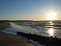
View across the lake from East Tawas State Park at the head of Saginaw Bay

Harrisville Beach on Lake Huron

The shore of the lake east of Port Dolomite, Michigan
Ipperwash Beach, Lake Huron
.jpg)


literature
- Peter Annin: The Great Lakes Water Wars. Island Press, 2006, ISBN 1-55963-087-6 .
Web links
- Lighthouse map with detailed information
- Great Lakes Environmental Atlas
- Fish species in the Great Lakes ( Memento from February 6, 2008 in the Internet Archive )
- Great Lakes Coast Guard website
- Fishing map of Lake Huron (PDF)
- Depth map of Lake Huron
Individual evidence
- ↑ Its mean depth is 59 m, the greatest depth 229 m. Great Lakes data from the United States Conservation Agency , accessed May 4, 2015.
- ↑ Seven Wonders of Canada: Manitoulin Island on the Canadian Broadcasting Corporation website , accessed May 4, 2015.
- ↑ a b US Army Corps of Engineers water level reports , accessed May 4, 2015.
- ↑ SC Riley et al .: Deepwater demersal fish community collapse in Lake Huron. In: Transactions of the American Fisheries Society. Vol 137/2008, pp. 1879-1880.
- ^ RP Barbiero et al.: Recent shifts in the crustacean zooplankton community of Lake Huron. In: Canadian Journal of Fisheries and Aquatic Sciences. Vol. 66/2009, pp. 816-828.
- ↑ Georges E. Sioui: Huron-Wendat: The Heritage of the Circle . UBC Press, 2000, ISBN 0-7748-0715-6 .
- ^ Ron Fonger: Genesee, Oakland counties adopt historic name for water group . In: The Flint Journal. May 3, 2007, accessed May 4, 2015.
- ^ Dwight Boyer: True Tales of the Great Lakes. Freshwater Press, 1971, ISBN 0-912514-48-5 , p. 212.
- ↑ a b c Jack Parker: Shipwrecks of Lake Huron: The Great Sweetwater Sea. Avery Color Studios, Au Train, Michigan 1986, pp. 50-61.
- ↑ z. B. in Boys Life magazine from September 1959.
- ^ The Ships and Legends of the Mississagi Strait ( Memento of March 2, 2012 in the Internet Archive )
- ^ JB Mansfield (ed.): History of the Great Lakes. Volume IJH Beers & Co., Chicago, 1899, pp. 78-90. Retrieved May 4, 2015.
- ↑ About Thunder Bay National Marine Sanctuary on the Thunder Bay National Marine Sanctuary page, accessed May 4, 2015.
- ↑ Historical Collections of the Great Lakes on Bowling Green State University , accessed May 4, 2015.
