List of cultural monuments in Eisenach (core city)
The list of cultural monuments in Eisenach's core city contains the individual cultural monuments within the meaning of Section 2 (1) of the Thuringian Monument Protection Act, which were published in the grounds of the zoning plan of the city of Eisenach as of September 5, 2014. For other monument ensembles see the list of cultural monuments in Eisenach , for individual monuments in the districts of Eisenach, see the list of cultural monuments in Eisenach (districts) .
Legend
- Name: gives the name, the description or the type of the cultural monument.
- Location: States the street name and, if available, the house number of the cultural monument. The list is basically sorted according to this address. The link "Map" leads to various map displays and gives the coordinates of the cultural monument.
- Dating: indicates the date; the year of completion or the period of construction. Sorting by year is possible.
- Description: Provides structural and historical details of the cultural monument, preferably the characteristics of the monument.
- ID: If available, indicates the object ID of the cultural monument assigned by the State Office for the Preservation of Monuments.
List of monuments
| image | designation | location | Dating | description | ID |
|---|---|---|---|---|---|
| Water tunnel portal |
|
||||
 More pictures |
Path obelisk, so-called Vacha stone | on the B 84 at the level of the Rennsteig (between Rüsselskopf and Ruppertskopf ) (map) |
|
||
 More pictures |
Monument, so-called Bismarckstein | B 84, turn at Vachaer Berg (map) |
|
||
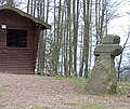 More pictures |
Stone cross wild sow | am Rennsteig (west of the Hohe Sonne) (map) |
|
||
| Stone, so-called Velsbachstein | below the Wartburg |
|
|||
 More pictures |
Heerlein's grave | (Map) |
|
||
| Gravestone Gutte Starcke | Market, grounds of the Goethe School |
|
|||
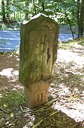 More pictures |
Cläs-Kley-Stein memorial stone | Road to the Hohe Sonne (map) |
|
||
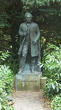 More pictures |
Söderblom monument | Hainstein (map) |
|
||
| Bust of A. Coudrey | Old graveyard |
|
|||
 More pictures |
Grave complex with a bust of Fritz Reuter |
New cemetery (map) |
|
||
 More pictures |
Cranach monument | Wartburgallee (map) |
|
||
| Memorial stone, so-called Carl-Alexander-Stein | B 84 shortly before Eisenach, near the railway underpass (map) |
|
|||
 More pictures |
Arch bridge Karolinentalbrücke |
Bundesstrasse 19 , formerly BAB 4 , Karolinental area (map) |
|
||
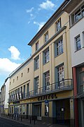 More pictures |
movie theater | Alexanderstraße 12 (map) |
Capitol |
|
|
 More pictures |
Residential and commercial building | Alexanderstraße 32, 34 (map) |
|
||
| hotel | Alexanderstrasse 50 | former Hotel City of Leipzig |
|
||
 More pictures |
school | Altstadtstrasse 30 (map) |
Oststadtschule |
|
|
 More pictures |
Children's home | Altstadtstrasse 83 (map) |
1906 donated by Hedwig von Eichel; Since then it has housed a Protestant day-care center and a technical school for day-care center staff |
|
|
 More pictures |
Residential building | Amrichen lawn 18 (map) |
|
||
 More pictures |
Professional academy | Am Wartenberg 2 (map) |
Carl Alexander School, later Eisenach University of Cooperative Education , now Gera-Eisenach Cooperative State University |
|
|
 More pictures |
Residential building | Amrastrasse 39 (map) |
|
||
 More pictures |
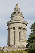
Fraternity monument | At the Göpelskuppe (map) |
|
||
 More pictures |
Hotel Berghof | At Göpelskuppe 1 (map) |
|
||
 More pictures |
Former old coin | At the coin 3 (card) |
|
||
 More pictures |
Residential building | At the coin 4 (card) |
Use as a day care center "Münze" |
|
|
 More pictures |
Castle Wartburg | On the Wartburg 1, 2, 3 (map) |
with facilities, castle hotel, castle hill, access road, guest house and garages |
|
|
 More pictures |
Residential and commercial building | Bahnhofstrasse 1 (map) |
|
||
 More pictures |
Eisenach station - reception building with equipment and prince station | Bahnhofstrasse 37 (map) |
|
||
 More pictures |
Residential and commercial building | Clemdastraße 2 (map) |
Clemdastraße 2 and Goethestraße27 form a single unit |
|
|
 More pictures |
Clement Chapel | Clemensstrasse (map) |
|
||
 More pictures |
Residential house with equipment, garden and pavilion | Clemensstrasse 8 (map) |
|
||
 More pictures |
Administration building, former Reichsbahnamt | Clemensstrasse 27 (map) |
|
||
 More pictures |
Wingolf monument | Domstrasse junction Pfarrberg (map) |
|
||
 More pictures |
Villa Seiffert | Dr.-Moritz-Mitzenheim-Strasse 1 (map) |
|
||
 More pictures |
Villa Eichel-Streiber : country house, terrace and park | Dr.-Moritz-Mitzenheim-Strasse 2 (map) |
|
||
 More pictures |
Residential building | Dr.-Moritz-Mitzenheim-Strasse 2a (map) |
|
||
 More pictures |
Housing estate | Dr.-Strauss-Strasse 7-14 (map) |
|
||
| Residential building | Dresdener Strasse 13 (map) |
|
|||
 More pictures |
Residential building | Ehrensteig 67 (map) |
formerly Clemensstift |
|
|
 More pictures |
Villa Therese | Eichrodter Weg 1 (map) |
|
||
 More pictures |
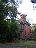
Former West Thuringian worsted yarn spinning mill, Eisenach plant | Fabrikstrasse 1 | Overall structural system (former factory owner's villa, employees' house, administration building, carding and combing), conversion / elevator tower with part of the former dye works (10 m to the 2nd row of columns) |
|
|
 More pictures |
Residential building | Fischweide 1 (map) |
Villa of the cigar factory of the industrialist Heinrich Wilhelm Fleischhauer; Removed from the list of monuments and demolished in 2015 |
|
|
 More pictures |
Residential and commercial building | Frauenberg 5, 7 (map) |
|
||
 More pictures |
Residential and commercial building | Frauenberg 9 (map) |
|
||
 More pictures |
School, formerly the Grand Ducal Saxon Forestry School in Eisenach | Frauenberg 17 (map) |
|
||
 More pictures |
Bach monument | Women's plan (card) |
|
||
 More pictures |
Bach House Eisenach | Frauenplan 21 (card) |
|
||
 More pictures |
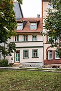
Residential building | Frauenplan 22 (card) |
|
||
 More pictures |
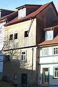
Residential building | Frauenplan 24 (card) |
|
||
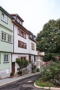 More pictures |
Residential building | Frauenplan 26 (card) |
|
||
 More pictures |
Residential building | Frauenplan 28, 30 (map) |
|
||
 More pictures |
Jewish Cemetery | Friedhofstrasse, Am Wartenberg | Part of the municipal cemetery |
|
|
 More pictures |
Rodensteiner residential and commercial building | Georgenstrasse 2 (map) |
|
||
 More pictures |
Administration building | Georgenstrasse 4 (map) |
|
||
 More pictures |
former cinema Titania | Georgenstrasse 5 (map) |
see also: cinemas in Eisenach |
|
|
 More pictures |
Residential and commercial building | Georgenstrasse 10 (map) |
|
||
 More pictures |
Residential and commercial building | Georgenstrasse 19 (map) |
|
||
 More pictures |
Residential building | Georgenstrasse 22 (map) |
|
||
 More pictures |
Residential and commercial building with equipment and well | Georgenstrasse 25 (map) |
|
||
 More pictures |
professional school | Georgenstrasse 26 (map) |
Former commercial vocational school in Eisenach |
|
|
 More pictures |
Hellgrevenhof | Georgenstrasse 43-45 (map) |
today's use as a city library |
|
|
 More pictures |
Sun residential building with furnishings and vaulted cellars | Georgenstrasse 50 (map) |
|
||
 More pictures |
Former post office with equipment | Georgenstrasse 52 (map) |
|
||
 More pictures |
Anne's Church | Georgenstrasse 62 (map) |
|
||
 More pictures |
St. Anne's Hospital | Georgenstrasse 64 (map) |
|
||
 More pictures |
Black fountain | Georgenstrasse / corner of Alexanderstrasse (map) |
|
||
 More pictures |
gym | Goethestrasse 1 (map) |
|
||
 More pictures |
Apartment building with equipment | Goethestrasse 9 (map) |
|
||
 More pictures |
Residential building | Goethestrasse 21 (map) |
|
||
 More pictures |
Duplex house | Goethestraße 24-24a (map) |
|
||
 More pictures |
Lodge house of the Masonic Lodge Carl zur Wartburg | Goethestrasse 25 (map) |
|
||
 More pictures |
Residential building | Goethestrasse 27 (map) |
|
||
 More pictures |
Residential building | Goethestrasse 29 (map) |
|
||
 More pictures |
Residential building | Goethestrasse 31 (map) |
|
||
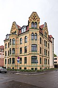 More pictures |
Residential building | Goethestrasse 39 (map) |
|
||
 More pictures |
Residential building | Goethestrasse 42 (map) |
|
||
 More pictures |
Residential and commercial building | Goldschmiedenstrasse 1 (map) |
|
||
 More pictures |
Residential building | Goldschmiedenstrasse 1a (map) |
|
||
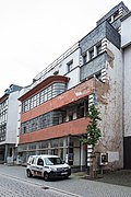 More pictures |
Steppke department store residential and commercial building | Goldschmiedenstrasse 8-10 (map) |
|
||
 More pictures |
Residential building | Goldschmiedenstrasse 13 (map) |
|
||
 More pictures |
Residential building | Goldschmiedenstrasse 24 (map) |
|
||
| Residential building | Goldschmiedenstrasse 30 (map) |
|
|||
 More pictures |
Residential building | Gothaer Strasse 80 (map) |
|
||
 More pictures |
Residential building | Gothaer Strasse 92 (map) |
|
||
 More pictures |
Front building | Grimmelgasse 2 (map) |
former Sophienbad |
|
|
 More pictures |
Fire station | Helenenstrasse 4 |
|
||
 More pictures |
Administration building | Helenenstrasse 2 | Formerly the administration building of the Eisenacher Elektrizitätswerk (EWE), now the Alexander Blume music school |
|
|
 More pictures |
Hunting lodge Hohe Sonne | High sun 1 |
|
||
 More pictures |
Residential building | Hospitalstrasse 9 (map) |
|
||
 More pictures |
Monument to St. George | Jacob's plan (map) |
|
||
 More pictures |
Former Chancellor's Palais Bechtolsheim | Jakobsplan 9 (map) |
|
||
 More pictures |
Residential and commercial building | Johannisplatz 8 (map) |
|
||
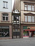 More pictures |
Residential building Narrow house in Eisenach | Johannisplatz 9 (map) |
|
||
 More pictures |
Residential building | Johannisplatz 14 (map) |
Removed from the list of monuments and demolished in 2014 |
|
|
 More pictures |
Former Gasthaus Hotel Mille | Johannisplatz 16 (map) |
Torn down to the front in 2014 and replaced by a new building |
|
|
 More pictures |
Bank / former library | Johannisplatz 18, 20 (map) |
built as a bank, in the GDR era city library, then used again as a bank |
|
|
 More pictures |
Residential and commercial building | Johannisstrasse 1 (map) |
|
||
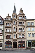 More pictures |
Residential and commercial building | Johannisstrasse 3 (map) |
|
||
 More pictures |
Residential and commercial building | Johannisstrasse 6 (map) |
|
||
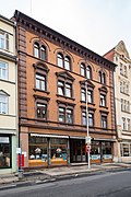 More pictures |
Residential and commercial building | Johannisstrasse 7 (map) |
|
||
 More pictures |
Residential and commercial building | Johannisstrasse 9 (map) |
|
||
 More pictures |
Former Jewish Synagogue Memorial | Karl-Marx-Strasse (map) |
reminds of the New Synagogue , which stood in this place until the end of the 1930s |
|
|
 More pictures |
pharmacy | Karl-Marx-Strasse 4 (map) |
New pharmacy |
|
|
 More pictures |
Bank building | Karl-Marx-Strasse 53 (map) |
built as a branch of the Reichsbank , seat of the SED district leadership during the GDR era , then empty |
|
|
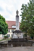 More pictures |
Memorial to fallen doctors | Karlsplatz (map) |
|
||
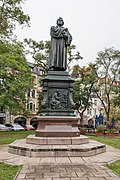 More pictures |
Luther monument | Karlsplatz (map) |
|
||
 More pictures |
City wall tower Nikolaitor | Karlsplatz (map) |
|
||
 More pictures |
Evangelical parish church of St. Nikolai with churchyard and furnishings | Karlsplatz (map) |
|
||
 More pictures |
Residential and commercial building | Karlsplatz 1 (map) |
|
||
 More pictures |
Residential and commercial building House of Health | Karlsplatz 6 (map) |
|
||
 More pictures |
Office and commercial building | Karlsplatz 10 (map) |
|
||
 More pictures |
Hotel Thuringer Hof | Karlsplatz 11 (map) |
|
||
 More pictures |
Residential and commercial building | Karlsplatz 13 (map) |
|
||
 More pictures |
Office building, formerly Hotel Karthäuserhof | Karlsplatz 20 (map) |
|
||
 More pictures |
Bank building | Karlsplatz 23 (map) |
|
||
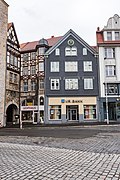 More pictures |
Residential and commercial building | Karlsplatz 24-26 (map) |
|
||
 More pictures |
Diakonia | Karlsplatz 27, 29, 31 (map) |
|
||
 More pictures |
Residential and commercial building Ratsapotheke | Karlstrasse 1 (map) |
|
||
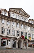 More pictures |
Residential and commercial building | Karlstrasse 3 (map) |
|
||
| More pictures | Residential and commercial building | Karlstrasse 6 (map) |
|
||
 More pictures |
Residential and commercial building | Karlstrasse 8 (map) |
|
||
 More pictures |
Residential and commercial building | Karlstrasse 10 (map) |
|
||
 More pictures |
Residential and commercial building | Karlstrasse 17 (map) |
|
||
 More pictures |
Residential and commercial building | Karlstrasse 20 (map) |
|
||
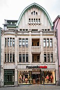 More pictures |
Residential and commercial building | Karlstrasse 26 (map) |
|
||
| Residential and commercial building | Karlstrasse 44 (map) |
|
|||
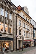 More pictures |
Residential and commercial building | Karlstrasse 46 (map) |
|
||
 More pictures |
Department store | Karlstrasse 48, 50 (map) |
former Jantzen department store |
|
|
 More pictures |
Residential and commercial building Stadtapotheke | Karlstrasse 52 (map) |
|
||
 More pictures |
Residential building | Karolinenstrasse 8 (map) |
|
||
| Residential building | Karolinenstrasse 11 (map) |
|
|||
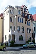 More pictures |
Residential building | Karolinenstrasse 13 (map) |
|
||
| Residential building | Karolinenstrasse 15 (map) |
|
|||
| Residential building | Karolinenstrasse 17 (map) |
|
|||
 More pictures |
Residential building |
Karolinenstrasse 19 (map) |
|
||
 More pictures |
Villa with equipment | Karolinenstrasse 33 (map) |
|
||
 More pictures |
Dance hall of the former Volkshaus Stern | Kasseler Strasse 1 (map) |
|
||
 More pictures |
Residential and commercial building | Kasseler Strasse 4 (map) |
|
||
 More pictures |
Residential house, house Spicke | Kasseler Strasse 61 |
|
||
 More pictures |
Residential building | Katharinenstrasse 74 (map) |
|
||
 More pictures |
Volkshaus and hall building | Katharinenstrasse 147 (map) |
Stiegker Volkshaus |
|
|
 More pictures |
School, Katharinenschule | Katharinenstrasse 149 (map) |
|
||
 More pictures |
Sibling Scholl School | Katharinenstrasse 150 (map) |
former Elisabeth School |
|
|
 More pictures |
Residential and commercial building | Langensalzaer Strasse 28 (map) |
|
||
 More pictures |
Former slaughterhouse in Eisenach | Langensalzaer Strasse 43 (map) |
|
||
 More pictures |
former Sparkasse | Lauchergasse 6, 8 (map) |
|
||
 More pictures |
Residential and commercial building | Löberstrasse 16 (map) |
|
||
| basement, cellar | Ludwigstrasse 1 |
|
|||
| Residential house & doctor's office | Ludwigstrasse 13 (map) |
|
|||
 More pictures |
Luther House | Lutherplatz 8 (map) |
|
||
 More pictures |
Residential and commercial building | Lutherstrasse 2 (map) |
|
||
 More pictures |
Residential building | Lutherstrasse 16 (map) |
|
||
 More pictures |
Residential building | Lutherstrasse 24 (map) |
|
||
| Residential building | Lutherstrasse 30 |
|
|||
 More pictures |
Fischbach Castle | Malittenburgweg 2 (map) |
|
||
 More pictures |
Residential and commercial building with outbuildings and equipment | Marienstraße 6 (map) |
|
||
| Residential building | Marienstraße 13, 13a |
|
|||
 More pictures |
Residential and commercial building | Marienstraße 27 (map) |
|
||
 More pictures |
Residential and commercial building | Marienstraße 29 (map) |
|
||
 More pictures |
Golden Lion Memorial | Marienstrasse 45 |
|
||
 More pictures |
town hall | Market 2 (map) |
|
||
 More pictures |
Residential and commercial building | Market 5 (map) |
|
||
 More pictures |
Parts of the Creutznacher house | Market 9 (map) |
|
||
 More pictures |
Old residence | Market 9a, 9b (map) |
|
||
 More pictures |
George School | Markt 13 (map) |
|
||
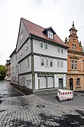 More pictures |
Residential and commercial building | Market 14 (map) |
|
||
 More pictures |
Main post office with equipment and boiler house | Markt 16 (map) |
|
||
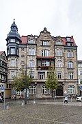 More pictures |
Administration building Rautenkranz | Markt 22 (map) |
originally Hotel Rautenkranz, then seat of the district and city administration |
|
|
 More pictures |
City palace with equipment | Markt 24 (map) |
|
||
 More pictures |
Evangelical parish church Sankt Georgen with equipment | Market (map) |
|
||
 More pictures |
Georgsbrunnen | Market (map) |
|
||
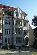 More pictures |
Apartment building | Mönchstrasse 16 (map) |
|
||
 More pictures |
Residential building | Mönchstrasse 26 (map) |
House on the bell tower |
|
|
 More pictures |
pavilion | Mühlhäuser Strasse 94 (map) |
South wing of the former district hospital, now St. Georg Klinikum Eisenach |
|
|
 More pictures |
Elisabeth High School | Nebestrasse 24 (map) |
|
||
 More pictures |
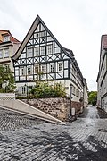
Administration building | Nonnengasse 2 (map) |
|
||
 More pictures |
Residential building | Obere Predigergasse 1 (map) |
|
||
 More pictures |
Residential building | Obere Predigergasse 13 (map) |
|
||
| Residential and commercial building | Oppenheimstrasse 78 (map) |
|
|||
 More pictures |
Old malt house | Palmental (map) |
|
||
 More pictures |
Goethe School | Pfarrberg 1 (map) |
|
||
 More pictures |
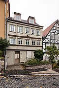
Residential building | Pfarrberg 2 (map) |
|
||
 More pictures |
Residential building | Pfarrberg 3 (map) |
|
||
 More pictures |
House and tombstone | Pfarrberg 4/6 (map) |
|
||
 More pictures |
Former preacher church | Predigerplatz 2 (map) |
|
||
 More pictures |
Former preacher monastery, now Martin-Luther-Gymnasium | Predigerplatz 4 (map) |
|
||
 More pictures |
Residential and commercial building | Querstraße 32, 34 (map) |
|
||
 |
Double-cranked toggle-lever deep-drawing press (movable cultural monument) | Racetrack 1, 2, 5; formerly AWE plant Eisenach, building A | The press was manufactured in 1928 by the Schuler company from Göppingen and served from then until 1998 in the body shop of the Eisenach vehicle factory and its successor companies. Since 2007 it has been an exhibit in the outdoor area of the museum automobile world eisenach |
|
|
 More pictures |
villa | Racecourse 5 (map) |
|
||
 More pictures |
Residential building | Racecourse 6 (map) |
|
||
 More pictures |
Residential building | Racecourse 8 (map) |
|
||
 More pictures |
Residential building | Racecourse 56 (map) |
|
||
 More pictures |
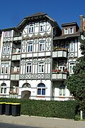
Apartment building | Racecourse 58 (map) |
|
||
 More pictures |
Residential building | Rittergasse 3 (map) |
|
||
 More pictures |
Gym, Werner Seelenbinder Hall | Röseplatz 3 (map) |
|
||
 More pictures |
Former manor | Rothenhof 7 (map) |
|
||
 More pictures |
Former monastery brewery | Schlossberg 2 (map) |
|
||
 More pictures |
Kreuzkirche | Schlossberg 4a (map) |
|
||
 More pictures |
Burial chapel | Schlossberg 4a (map) |
|
||
 More pictures |
Old graveyard | Schlossberg 4a (map) |
with tombstones |
|
|
 More pictures |
Back building | Schmelzerstraße 3 (map) |
|
||
 More pictures |
Farm buildings | Schmelzerstraße 12/14 (map) |
|
||
 More pictures |
Residential building | Schmelzerstraße 14 (map) |
|
||
 More pictures |
School with equipment and extension to the east |
Schmelzerstraße 19 (map) |
|
||
 More pictures |
New tram depot | Sommerstrasse 4 (map) |
Second depot for the Eisenach tram , converted into a city car park in 1998 |
|
|
 More pictures |
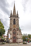
Catholic parish church of St. Elisabeth with churchyard and furnishings | Sophienstrasse (map) |
|
||
 More pictures |
Catholic community center, formerly a school | Sophienstrasse 8 (map) |
|
||
 More pictures |
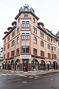
Residential and commercial building | Sophienstrasse 40a (map) |
|
||
 More pictures |
Wartburg Stadium sports facility | Sportpark 3 (map) |
|
||
 More pictures |
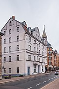
Residential and commercial building | Theaterplatz 2 (map) |
|
||
 More pictures |
District Court | Theaterplatz 5 (map) |
|
||
 More pictures |
school | Theaterplatz 6 (map) |
|
||
 More pictures |
State Theater Eisenach | Theaterplatz 7 (map) |
|
||
 More pictures |
Trenkelhof Chamber Estate | Trenkelhofer Strasse 1 (map) |
|
||
 More pictures |
Residential building | Uferstrasse 21 (map) |
|
||
 More pictures |
Commercial building & garage | Uferstrasse 23 (map) |
|
||
 More pictures |
Power station | Uferstrasse 34 (map) |
former power station for the Eisenach tram |
|
|
 More pictures |
Residential building | Uferstrasse 42 (map) |
|
||
 More pictures |
Residential building | Uferstrasse 50 (map) |
|
||
 More pictures |
Residential and commercial building | Waldhausstrasse 8, 10 (map) |
|
||
 More pictures |
Hotel Kaiserhof |
Wartburgallee 2 (map) |
|
||
 |
Residential and commercial building | Wartburgallee 10 (map) |
|
||
 More pictures |
Residential and commercial building | Wartburgallee 12 (map) |
|
||
 More pictures |
Eisenach brewery with techn. Furnishing | Wartburgallee 25a (map) |
former stock brewery |
|
|
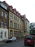 |
Residential building | Werneburgstrasse 7 (map) |
|
||
 More pictures |
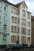
Residential building | Werneburgstrasse 9 (map) |
|
||
 More pictures |
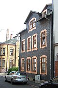
Administration building |
Werneburgstrasse 11 (map) |
Built in the early 1920s as the headquarters of the local health insurance fund , then a polyclinic , today an office and commercial building. |
|
|
 More pictures |
Residential building | Wydenbrugkstrasse 2 (map) |
|
swell
Web links
Commons : Kulturdenkmale in Eisenach - Collection of pictures, videos and audio files
Individual evidence
- ^ House is being demolished , Thüringische Landeszeitung , February 26, 2015
- ↑ a b Birgit Schellbach: The front of the Gasthaus Mille must stand still , Thüringer Allgemeine, September 13, 2013
- ^ Technical monument in Eisenach , accessed on February 1, 2013.