List of landscape protection areas in Swabia (Bavaria)
The list of landscape protection areas in Swabia (Bavaria) includes the following lists of landscape protection areas in Swabian districts and cities from the article namespace:
Counties and municipalities
- List of landscape protection areas in the Aichach-Friedberg district
- List of landscape protection areas in the Augsburg district
- List of landscape protection areas in Augsburg
- List of landscape protection areas in the district of Dillingen an der Donau
- List of landscape protection areas in the Donau-Ries district
- List of landscape protection areas in the district of Günzburg
- List of landscape protection areas in Kaufbeuren
- List of landscape protection areas in Kempten (Allgäu)
- List of landscape protection areas in the district of Lindau (Lake Constance)
- List of landscape protection areas in Memmingen
- List of landscape protection areas in the Neu-Ulm district
- List of landscape protection areas in the Oberallgäu district
- List of landscape protection areas in the Ostallgäu district
- List of landscape protection areas in the Unterallgäu district
The selection corresponds to the administrative region of Swabia (Bavaria) . There are 115 landscape protection areas in the administrative district (as of October 2018).
Notes on the information in the table
- Area name : Official designation of the protected area
- Image / Commons : Image and link to other images from the protected area
- LSG-ID : Official number of the protected area
- WDPA-ID : Link to the World Database on Protected Areas database of the protected area
- Wikidata : Link to the Wikidata entry for the protected area
- Designation : Date of designation as a protected area
- Municipality (s) : Municipalities in which the protected area is located
- Location : geographical location
- Area : total area of the protected area in hectares
- Area share : Proportionate areas of the protected area in counties / municipalities, given in% of the total area
- Comment : Special features and comments
Except for the Position column , all columns can be sorted.
| Territory name | Image / Commons | LSG ID | WDPA ID | Wikidata | Expulsion | Parish (noun) | location | Area ha | Area share | comment |
|---|---|---|---|---|---|---|---|---|---|---|
| Asperwald | LSG-00235.01 | 395711 | Q59611791 | 1972 | position | 11.4 | District of Neuburg-Schrobenhausen (37.1%), District of Aichach-Friedberg (62.9%) | |||
| Friedberger Lechleite |
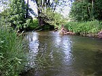 |
LSG-00440.01 | 395948 | Q59611796 | 1989 | position | 365.35 | Aichach-Friedberg district (100%) | ||
| Lechauwald near Todtenweis and Rehling |
 |
LSG-00401.01 | 395909 | Q59611792 | 1987 | position | 368.63 | Aichach-Friedberg district (99.8%) | ||
| Protection of the alluvial forest on the Ach in the community of Grimolzhausen | LSG-00185.01 | 395655 | Q59611787 | 1970 | position | 11.23 | Aichach-Friedberg district (100%) | |||
| Protection of an alluvial forest in the Grimolzhausen community | LSG-00179.01 | 395651 | Q59611786 | 1969 | position | 5.81 | Aichach-Friedberg district (100%) | |||
| Silberbrünnel | LSG-00218.01 | 395696 | Q59611790 | 1971 | position | 27.2 | Aichach-Friedberg district (100%) | |||
| Weilachtal |
 |
LSG-00439.01 | 395947 | Q59611911 | 1989 | position | 1900.19 | Aichach-Friedberg district (99.9%) |
|
|
| Augsburg - Western forests |
 |
LSG-00417.01 | 395925 | Q59608104 | 1988 | position | 69892.76 | Augsburg (2.2%), Augsburg district (61.1%), Dillingen an der Donau district (10.0%), Günzburg district (15.7%), Unterallgäu district (10.1%), Donau- Ries (0.9%) | ||
| Kobelwald |
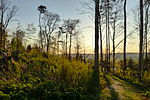 |
LSG-00296.01 | 395775 | Q19963766 | 1979 | position | 19.73 | District of Augsburg (100%) | ||
| Kreuzberg near Thierhaupten |
 |
LSG-00462.01 | 395970 | Q59612256 | 1992 | position | 2.75 | District of Augsburg (100%) |
|
|
| Cow lake area at the Hochablaßwehr |
 |
LSG-00009.02 | 395454 | Q59612435 | 1951 | position | 161.1 | Augsburg (99.3%) | ||
| Lechauen north of Augsburg | LSG-00009.01 | 395453 | Q59612434 | 1951 | position | 113.84 | Augsburg (99.9%) | |||
| LSG Gögginger wood |
 |
LSG-00017.01 | 395460 | Q20180422 | 1952 | position | 39.79 | Augsburg (99.8%) | ||
| LSG Wertachauen between Inningen and Göggingen |
 |
LSG-00021.01 | 395464 | Q59612436 | 1953 | position | 223.65 | Augsburg (99.8%) | ||
| LSG Wittelsbacherpark |
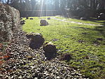 |
LSG-00316.01 | 395803 | Q59612437 | 1980 | position | 20.8 | Augsburg (100%) | ||
| LSG Wolfzahnau |
 |
LSG-00525.01 | 396058 | Q1519229 | 1998 | position | 74.14 | Augsburg (100%) |
|
|
| Old mountain | LSG-00159.01 | 395629 | Q59611383 | 1968 | position | 1.67 | District of Dillingen an der Donau (100%) | |||
| Bertenau | LSG-00128.01 | 395602 | Q59611381 | 1966 | position | 368.38 | District of Dillingen an der Donau (100%) | |||
| Dillinger Au | LSG-00166.01 | 395636 | Q59611387 | 1969 | position | 180.18 | District of Dillingen an der Donau (100%) | |||
| Danube floodplains between Blindheim and Tapfheim |
 |
LSG-00471.01 | 395979 | Q59610693 | 1993 | position | 1095.37 | District of Dillingen an der Donau (73.2%), District of Donau-Ries (26.7%) | ||
| Donauauen between Offingen and Peterswörth |
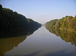 |
LSG-00581.01 | 396131 | Q59610413 | 2004 | position | 647.7 | District of Dillingen an der Donau (72.9%), District of Günzburg (27.1%) | ||
| Egaulauf between Schabringen and Donaualtheim | LSG-00020.01 | 395463 | Q59611377 | 1952 | position | 9.69 | District of Dillingen an der Donau (100%) | |||
| Gschwellhau |
 |
LSG-00373.01 | 395882 | Q59611395 | 1985 | position | 169.47 | District of Dillingen an der Donau (99.9%) | known locally as 'Garlic Grove' | |
| LSG Donau-Auen between Günzburg and Gundelfingen |
 |
LSG-00493.01 | 396001 | Q59610407 | 1995 | position | 1782.02 | District of Dillingen an der Donau (62.8%), District of Günzburg (37.1%) | ||
| Upper Kesseltal |
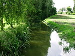 |
LSG-00140.01 | 395613 | Q59610653 | 1967 | position | 1062.64 | District of Dillingen an der Donau (71.8%), District of Donau-Ries (28.2%) | ||
| Pfannental | LSG-00112.01 | 395540 | Q59611378 | 1963 | position | 740.86 | District of Dillingen an der Donau (100%) | |||
| Protection of the Danube floodplains in the cities of Lauingen and Dillingen an der Donau | LSG-00252.01 | 395730 | Q59611388 | 1973 | position | 312.81 | District of Dillingen an der Donau (100%) | |||
| Protection of the large pots, small pots and pits | LSG-00260.01 | 395738 | Q59611392 | 1973 | position | 3.99 | District of Dillingen an der Donau (100%) | |||
| Protection of the reed (Wittislinger Moor) |
 |
LSG-00195.01 | 395675 | Q59611390 | 1970 | position | 43.23 | District of Dillingen an der Donau (100%) | Part of the FFH area Wittislinger Ried No. 7328-305 with WDPA 555521893, see. List of FFH areas in the district of Dillingen an der Donau | |
| Protection of parts of the landscape of the Danube floodplains and the reservoir of the Faimingen barrage | LSG-00232.01 | 395708 | Q59611391 | 1972 | position | 889.6 | District of Dillingen an der Donau (100%) | |||
| Schwaighholz | LSG-00161.01 | 395631 | Q59611386 | 1968 | position | 41.16 | District of Dillingen an der Donau (100%) | |||
| Zoo | LSG-00129.01 | 395603 | Q59611382 | 1966 | position | 153.11 | District of Dillingen an der Donau (100%) |
|
||
| Altwasser near Donauwörth |
 |
LSG-00315.01 | 395802 | Q59610671 | 1980 | position | 6.08 | District of Donau-Ries (100%) | Exceptional location as a residual natural area in the middle of the industrial area south of Donauwörth, bordered to the east and embraced by Airbus Helicopters, north of railway facilities, west and south of industrial companies, including a large slaughterhouse. | |
| Backwater at lifeguards |
 |
LSG-00312.01 | 395799 | Q59610665 | 1980 | position | 10.86 | District of Donau-Ries (100%) | ||
| At Langweidlegraben east of Heissesheim |
 |
LSG-00314.01 | 395801 | Q59610669 | 1980 | position | 52.73 | District of Donau-Ries (100%) |
|
|
| Firnhabermoos (Mertinger Hell) |
 |
LSG-00211.01 | 395691 | Q59610661 | 1971 | position | 182.24 | District of Donau-Ries (100%) | ||
| In the Osterried southeast of Auchsesheim |
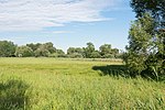 |
LSG-00324.01 | 395812 | Q59610673 | 1981 | position | 34.38 | District of Donau-Ries (100%) | ||
| Karthäusertal |
 |
LSG-00409.01 | 395917 | Q59610687 | 1987 | position | 884.21 | District of Donau-Ries (100%) | Part of the area is the juniper heather on the Ganzenberg | |
| Lechheide-Sachsenwald south of Oberpeiching |
 |
LSG-00366.01 | 395875 | Q59610684 | 1985 | position | 22.91 | District of Donau-Ries (100%) | ||
| Marienhöhe and Stoffelsberg |
 |
LSG-00451.01 | 395959 | Q59610690 | 1990 | position | 26.62 | District of Donau-Ries (100%) | ||
| Northern edge of the Ries |
 |
LSG-00254.01 | 395732 | Q59610833 | 1973 | position | 8425 | District of Donau-Ries (100%) | ||
| Riedgraben with leaves |
 |
LSG-00313.01 | 395800 | Q59610667 | 1980 | position | 17.89 | District of Donau-Ries (100%) | ||
| Riegelberg near Holheim |
 |
LSG-00325.01 | 395813 | Q59610675 | 1981 | position | 62 | District of Donau-Ries (99.9%) | ||
| Schmähingen North |
 |
LSG-00353.01 | 395861 | Q59610678 | 1984 | position | 10.36 | District of Donau-Ries (100%) | ||
| Schmähingen West |
 |
LSG-00353.02 | 395862 | Q59610680 | 1984 | position | 28.09 | District of Donau-Ries (100%) | ||
| Schmutterwäldchen near Bäumenheim |
 |
LSG-00360.01 | 395869 | Q59610683 | 1984 | position | 13.19 | District of Donau-Ries (100%) | ||
| Protection of the area between Katzenstein and Sonderhof |
 |
LSG-00188.01 | 395658 | Q59610655 | 1970 | position | 210.58 | District of Donau-Ries (100%) | ||
| Protection of parts of the landscape in the area of the city of Harburg and the community of Großsorheim |
 |
LSG-00253.01 | 395731 | Q59610659 | 1973 | position | 146.99 | District of Donau-Ries (100%) | ||
| Protection of parts of the landscape in the city of Donauwörth and in the communities of Altisheim, Graisbach, Marxheim and Schäfstall |
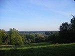 |
LSG-00233.01 | 395709 | Q59610663 | 1972 | position | 973.72 | District of Donau-Ries (100%) | ||
| Protection of parts of the landscape in the city of Oettingen and the municipality of Hainsfarth |
 |
LSG-00250.01 | 395728 | Q59610657 | 1972 | position | 74.4 | District of Donau-Ries (100%) | ||
| Protection zone in the Altmühltal nature park |
 |
LSG-00565.01 | 396115 | Q23787649 | 1995 | position | 163135.05 | Ingolstadt (0.1%), District of Eichstätt (36.3%), District of Neuburg-Schrobenhausen (4.0%), District of Kelheim (8.7%), District of Neumarkt in der Oberpfalz (8.2%), District Regensburg (1.5%), Roth district (6.4%), Weißenburg-Gunzenhausen district (22.8%), Donau-Ries district (11.8%) |
|
|
| Bibertal | LSG-00199.01 | 395680 | Q59609628 | 1971 | position | 32.13 | District of Günzburg (79.8%), District of Neu-Ulm (20.2%) | |||
| Bremental |
 |
LSG-00465.01 | 395973 | Q59610405 | 1992 | position | 208.88 | District of Günzburg (100%) | ||
| Danube valley between Weißingen and Günzburg |
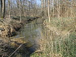 |
LSG-00511.01 | 396022 | Q59610411 | 1997 | position | 1173.72 | District of Günzburg (99.9%) | ||
| Günzriedweiher with surroundings | LSG-00298.01 | 395777 | Q59610403 | 1979 | position | 50.78 | District of Günzburg (100%) | |||
| Leipheimer and Günzburger Moos |
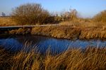 |
LSG-00288.01 | 395766 | Q59610401 | 1977 | position | 339.65 | District of Günzburg (100%) | ||
| Upper Günztal | LSG-00415.01 | 395923 | Q59609633 | 1988 | position | 175.23 | District of Günzburg (88.4%), District of Neu-Ulm (11.5%) | |||
| Southern Mindelaue | LSG-00496.01 | 396004 | Q59610409 | 1996 | position | 46.13 | District of Günzburg (100%) |
|
||
| LSG IIler |
 |
LSG-00519.01 | 396040 | Q59612118 | 1998 | position | 301.92 | Kempten (99.9%) | ||
| LSG Rottachtobel | LSG-00518.01 | 396039 | Q59612081 | 1998 | position | 71.66 | Kempten (100%) | |||
| LSG Schwabelsberger Weiher |
 |
LSG-00490.01 | 395998 | Q59612044 | 1995 | position | 18.86 | Kempten (100%) |
|
|
| Bavarian shores of Lake Constance |
 |
LSG-00388.01 | 395896 | Q59610123 | 1986 | position | 952.16 | District of Lindau (Lake Constance) (25.1%) | ||
| Hagspielmoor and its surroundings | LSG-00177.01 | 395649 | Q59610119 | 1969 | position | 41.43 | District of Lindau (Lake Constance) (100%) | |||
| Hoyerberg |
 |
LSG-00443.01 | 395951 | Q59610128 | 1989 | position | 15.26 | District of Lindau (Lake Constance) (100%) | ||
| Waldsee near Lindenberg in the Allgäu and the surrounding area |
 |
LSG-00424.01 | 395932 | Q59610124 | 1988 | position | 239.09 | District of Lindau (Lake Constance) (100%) | ||
| Weißensberger Weiher | LSG-00450.01 | 395958 | Q59610130 | 1990 | position | 25.7 | District of Lindau (Lake Constance) (100%) |
|
||
| Protection of parts of the landscape south and east of the Iller | LSG-00259.01 | 395737 | Q59608100 | 1973 | position | 142.87 | Memmingen (83.7%), Unterallgäu district (16.3%) |
|
||
| Danube floodplains |
 |
LSG-00116.01 | 395544 | Q59609624 | 1963 | position | 878.99 | District of Neu-Ulm (99.8%) | ||
| Illerauwald from Neu-Ulm to Kellmünz |
 |
LSG-00513.01 | 395999 | Q59608111 | 1997 | position | 1964.12 | District of Neu-Ulm (99.9%) | ||
| Jura slope and forest section of the large forest | LSG-00255.01 | 395733 | Q59609631 | 1973 | position | 150.29 | District of Neu-Ulm (100%) | |||
| Kirchholz | LSG-00251.01 | 395729 | Q59609627 | 1972 | position | 12.13 | District of Neu-Ulm (100%) | |||
| Pfuhler, Finninger and Bauernried |
|
LSG-00528.01 | 396061 | Q59609634 | 1998 | position | 1884.34 | District of Neu-Ulm (100%) |
|
|
| Betzigau moss |
 |
LSG-00414.01 | 395922 | Q59608916 | 1988 | position | 205.1 | Kempten (12.8%), Oberallgäu district (87.2%) | ||
| District ordinance on the protection of the Grüntensee in the districts of Oberallgäu and Ostallgäu |
 |
LSG-00127.01 | 395601 | Q59608301 | 1966 | position | 764.73 | District of Ostallgäu (35.2%), District of Oberallgäu (64.8%) | Grüntensee reservoir on the Wertach | |
| Eschach pond |
 |
LSG-00379.01 | 395887 | Q59609061 | 1985 | position | 59.75 | District of Oberallgäu (100%) | ||
| Great Alpsee |
 |
LSG-00359.01 | 395868 | Q59608919 | 1984 | position | 822.54 | District of Oberallgäu (100%) | ||
| Group of horns |
 |
LSG-00467.01 | 395975 | Q59609108 | 1992 | position | 6823.03 | District of Oberallgäu (100%) | ||
| Illerschleife above Martinszell and lower Rottachtal |
 |
LSG-00132.01 | 395606 | Q59608923 | 1967 | position | 432.51 | District of Oberallgäu (100%) | ||
| Small Alpsee near Immenstadt |
 |
LSG-00464.01 | 395972 | Q59608925 | 1992 | position | 37.94 | District of Oberallgäu (100%) | ||
| Nagelfluhkette |
 |
LSG-00468.01 | 395976 | Q59608927 | 1992 | position | 5687.92 | District of Oberallgäu (100%) | ||
| Niedersonthofener See |
 |
LSG-00183.01 | 395654 | Q59608930 | 1970 | position | 687.64 | District of Oberallgäu (100%) | ||
| Rauhenzeller moss |
 |
LSG-00408.01 | 395916 | Q59608931 | 1987 | position | 304.31 | District of Oberallgäu (100%) | ||
| Protection of the Grünten area, the Great Forest, the German Alpine Road and the Wertach Valley |
 |
LSG-00249.01 | 395727 | Q59608933 | 1972 | position | 7614.76 | District of Oberallgäu (99.9%) | Grünten , a ridge in the Allgäu Alps | |
| Protection of the Bruckmoos in the north of Hochgreut in the Wildpoldsried, Betzigau and Kraftisried districts | LSG-00080.01 | 395502 | Q59608297 | 1956 | position | 131.05 | District of Ostallgäu (10.7%), District of Oberallgäu (89.2%) | |||
| Protection of parts of the landscape of the Tiefenberger Moos | LSG-00221.01 | 395699 | Q59608936 | 1971 | position | 386.31 | District of Oberallgäu (100%) | |||
| Protection of parts of the landscape in the area of the Allgäu high alpine chain including the Oberstdorf valleys and the Hinterstein valley in the Oberallgäu district |
 |
LSG-00248.01 | 395726 | Q59608939 | 1972 | position | 19630.49 | District of Oberallgäu (99.9%) | ||
| Protection of parts of the landscape in the Dietmannsried market | LSG-00282.01 | 395760 | Q59608940 | 1976 | position | 31.49 | District of Oberallgäu (100%) | |||
| Protection of parts of the landscape in the Altusried and Dietmannsried markets |
 |
LSG-00284.01 | 395762 | Q59608943 | 1977 | position | 1464.72 | District of Oberallgäu (99.9%) | ||
| Schwarzenberger Weiher with winter moss and mountain moss |
 |
LSG-00421.01 | 395929 | Q59608944 | 1988 | position | 238.43 | District of Oberallgäu (100%) | ||
| Stoffelberg |
 |
LSG-00444.01 | 395952 | Q59608946 | 1989 | position | 524.98 | District of Oberallgäu (100%) | ||
| Sulzberger See |
 |
LSG-00356.01 | 395865 | Q59608948 | 1984 | position | 131.09 | District of Oberallgäu (100%) | ||
| Waltenhofen Moor |
 |
LSG-00355.01 | 395864 | Q59608950 | 1984 | position | 66.68 | District of Oberallgäu (100%) | ||
| Werdensteiner Moos |
 |
LSG-00285.01 | 395763 | Q59608952 | 1977 | position | 136.62 | District of Oberallgäu (100%) |
|
|
| Attlesee - Kögelweiher |
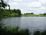 |
LSG-00160.01 | 395630 | Q59608304 | 1968 | position | 437.91 | District Ostallgäu (100%) | ||
| Auerberg |
 |
LSG-00318.01 | 395805 | Q59608621 | 1980 | position | 330.6 | District Ostallgäu (100%) | ||
| Bachtel and Bear Lake |
 |
LSG-00413.01 | 395921 | Q59608312 | 1988 | position | 299.75 | Kaufbeuren (46.2%), Ostallgäu district (53.7%) | Bachtelsee and Bärensee reservoirs on the Wertach river south of Kaufbeuren | |
| Berger moss |
 |
LSG-00395.01 | 395903 | Q59608311 | 1986 | position | 48.3 | District Ostallgäu (100%) | ||
| Lazy Lake |
 |
LSG-00186.01 | 395656 | Q59608305 | 1970 | position | 20.94 | District Ostallgäu (100%) | ||
| Forggensee and neighboring lakes |
 |
LSG-00446.01 | 395954 | Q59608315 | 1990 | position | 5806.4 | District Ostallgäu (100%) | Reservoir Forggensee am Lech | |
| Area around the Elbsee, Gde. Aitrang |
 |
LSG-00067.01 | 395492 | Q59608295 | 1955 | position | 1609.04 | District Ostallgäu (100%) | Elbsee | |
| Landscape protection at the Schwaltenweiher |
 |
LSG-00108.01 | 395536 | Q59608299 | 1962 | position | 91.4 | District Ostallgäu (100%) | Schwaltenweiher | |
| Protection of the ruins Hohenfreyberg - Eisenberg in the district of Füssen |
 |
LSG-00107.01 | 395535 | Q59608298 | 1962 | position | 191.31 | District Ostallgäu (100%) | Hohenfreyberg and Eisenberg castle ruins and the surrounding area | |
| Protection of parts of the landscape of Kurfürstenallee in Marktoberdorf |
 |
LSG-00030.01 | 395469 | Q59608355 | 1954 | position | 48.9 | District Ostallgäu (100%) | ||
| Protection of parts of the landscape in the area of the city of Füssen and the communities Weissensee, Eisenberg and Pfronten in the district of Füssen |
 |
LSG-00115.01 | 395543 | Q59608300 | 1963 | position | 1469.5 | District Ostallgäu (100%) | ||
| Protection of parts of the landscape in the area of the Faulenbacher valley, the Lech valley, the Schwansee valley and the Alpine lake area in the Füssen district |
 |
LSG-00078.01 | 395500 | Q59608296 | 1956 | position | 1320.12 | District Ostallgäu (100%) | ||
| Seeger lake |
 |
LSG-00142.01 | 395615 | Q59608303 | 1967 | position | 152.54 | District Ostallgäu (100%) | ||
| Sulzschneider Moore | LSG-00319.01 | 395806 | Q59608308 | 1980 | position | 778.83 | District Ostallgäu (100%) | |||
| Troll and Luimoos pond |
 |
LSG-00320.01 | 395807 | Q59608309 | 1980 | position | 112.32 | District Ostallgäu (100%) | Troll pond | |
| Wertach Gorge |
 |
LSG-00472.01 | 395980 | Q59608316 | 1993 | position | 954.54 | District of Ostallgäu (85.1%), District of Oberallgäu (14.9%) |
|
|
| Hochfirst |
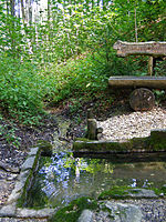 |
LSG-00426.01 | 395934 | Q59608106 | 1988 | position | 605.28 | District of Unterallgäu (100%) | ||
| Illerauen north of Buxheim |
 |
LSG-00491.01 | 395999 | Q59614164 | 1995 | position | 590.72 | District of Unterallgäu (100%) | ||
| Mühlbachtal |
 |
LSG-00454.01 | 395962 | Q59608107 | 1991 | position | 684.11 | District of Unterallgäu (71%), District of Oberallgäu (29.0%) | ||
| Protection of parts of the landscape on both sides of the Iller in the districts of Legau, Maria Steinbach, Grönenbach and Kronburg |
 |
LSG-00262.01 | 395740 | Q59608102 | 1973 | position | 888.49 | District of Unterallgäu (99.9%) | ||
| Lower Iller near Kardorf |
 |
LSG-00352.01 | 395860 | Q59608103 | 1983 | position | 65.52 | District of Unterallgäu (99.9%) | ||
| Wertachauen in the district of Unterallgäu |
 |
LSG-00460.01 | 395968 | Q59608109 | 1992 | position | 692.07 | District of Unterallgäu (100%) |
See also
- List of nature reserves in Swabia (Bavaria)
- List of FFH areas in Swabia (Bavaria)
- List of EU bird sanctuaries in Swabia (Bavaria)
- List of geotopes in Swabia (Bavaria)
Individual evidence
- ↑ Green List, Landscape Protection Areas , accessed on December 1, 2015.
Web links
Commons : Landscape protection areas in Swabia (Bavaria) - Collection of images, videos and audio files