List of streets, squares and bridges in Hamburg-Hohenfelde
The list of streets, squares and bridges in Hamburg-Hohenfelde is an overview of the streets, squares and bridges currently available in the Hamburg district of Hohenfelde . It is part of the list of traffic areas in Hamburg .
overview
In Hohenfelde (district numbers 416 to 417) there are 10,034 inhabitants (as of December 31, 2019) on 3.8 km². Hohenfelde is in the postcode area 22087 and 22089.
There are 49 designated traffic areas in Hohenfelde, including two squares and seven bridges.
Overview of the streets
The following table gives an overview of all named traffic areas - streets, squares and bridges - in the district as well as some related information. In detail these are:
- Name / location : current name of the street, square or bridge. Via the link ( location ), the street, the square or the bridge can be displayed on various map services. The geoposition indicates approximately the middle. In the case of longer streets that lead through two or more parts of the city, it is therefore possible that the coordinate is in a different part of the city.
- Street code: official street code, consisting of a letter (first letter of the street, the square or the bridge) and a three-digit number.
-
Length / dimensions in meters:
Note: The length information contained in the overview are overview values rounded up or down according to mathematical rules , which were determined in the Digital Atlas North with the local scale. They are more for comparison purposes and, if official values are known, are exchanged and marked separately.
For squares, the dimensions are shown in the form a × b for rectangular systems or a × b × c for triangular systems with a as the longest edge.
The addition ( in the district ) indicates how long the street is within the district if it runs through several districts. - Name origin : origin or reference of the name.
- Date of designation : Year of the official designation or the first mention of a name, in case of uncertainty also the specification of a period.
- Notes : Further information on nearby institutions, the history of the street, historical names, monuments, etc.
- Image : Photo of the street or an adjacent object.
| Name / location | Road key |
Length / dimensions (in meters) |
Origin of name | Date of designation | Remarks | image |
|---|---|---|---|---|---|---|
|
Ackermannstrasse
( Location ) |
A024 | 215 | after Konrad Ernst Ackermann (1712–1771), drama director in Hamburg | 1899 |

|
|
| Alfredstrasse
( Location ) |
A075 |
265 (in the district) |
after Alfred Wilhelm Harder (1866–1884), son of the merchant and landowner Hermann Harder, who died early | 1866 | southern part in Borgfelde ; on both sides of the Angerstrasse partially dismantled to a footpath |

|
| Alfredstrasse Bridge
( Location ) |
25th | based on Alfredstrasse | 1901 | According to the "Street and Area Directory of the Free and Hanseatic City of Hamburg" only in Borgfelde , according to the German basic map mainly in Hohenfelde |

|
|
| Angerstrasse
( Location ) |
A433 | 700 | after a gallows field ("Schindanger") that used to be here in front of the city gates | 1873 | Marienhospital, several vocational schools |

|
| Armgartstrasse
( Location ) |
A459 | 290 | after Armgart, miller of the cow mill in the 15th century | 1872 |

|
|
|
Barcastrasse
( Location ) |
B052 |
195 (in the district) |
after Johann Theodor Friedrich Barca, previous owner of the site | 1862 | western part in St. Georg |

|
| Bozenhardweg
( Location ) |
B522 | 140 | after the actor Albert Bozenhard (1860–1939) | 1958 |

|
|
| Bay Street
( Location ) |
B668 | 105 | to the Hohenfelder Alster Bay | 1872 |

|
|
|
Comeniusplatz
( Location ) |
C044 | 70 | after the pedagogue Johann Amos Comenius (1592–1670) | 1912 | these days a street, not a square |

|
|
Eilenau
( Location ) |
E090 |
500 (in the district) |
Field name: Eilbek floodplain | 1874 | eastern part in Eilbek |

|
| Ekhofstrasse
( Location ) |
E119 | 210 | after the actor Conrad Ekhof (1720–1778) | 1899 |

|
|
| Elisenstrasse
( Location ) |
E146 | 150 | presumably after the late wife of the landowner HF Stuckenberg | 1866 |

|
|
| Ernst-Kabel-Rose
( Location ) |
E226 | 105 | after Ernst Kabel (1879–1955), chairman of the Born Hamburger eV association | 1957 |

|
|
|
Freiligrathstrasse
( Location ) |
F215 | 270 | after the poet Ferdinand Freiligrath (1810–1876) | 1889 |

|
|
|
Graumannsweg
( Location ) |
G209 | 450 | after the previous owner of the site, JH Graumann (1797–1866) | 1858 |

|
|
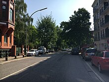
| Güntherstrasse
( Location ) |
G332 | 510 | after the previous owner and Hamburg Senator Johann Arnold Günther (1755–1805) | 1863 |
|
|
|
Hilde-Sicks-Weg
( Location ) |
H875 | 175 | Hilde Sicks (1920–2007), actress and radio play speaker | 2017 | Footpath |

|
| Hohenfelder Allee
( Location ) |
H551 | 375 | according to their location in the district | around 1887 |

|
|
| Hohenfeld Bridge
( Location ) |
- | 10 | to the Hohenfelder Bay in the Alster | 1874 |

|
|
| Hohenfelder Strasse
( Location ) |
H552 | 230 | according to their location on the "Hohenfelde" which until the development and construction owned by the Hospital of the Holy Spirit was | 1882 |

|
|
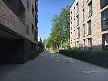
| Hohenfeld terrace
( Location ) |
H867 | 140 | according to the location in the district | 2015 | Footpath between Mühlendamm and Ifflandstrasse |
|
|
Ifflandstrasse
( Location ) |
I003 | 610 | after the actor August Wilhelm Iffland (1759-1814) | 1899 |

|
|
|
Cow mill
( Location ) |
K494 | 210 | after a watermill formerly located here on the dammed up Eilbeklauf , which was owned by the city for centuries and was demolished in 1874 | 1822: At the Kuhmühle, 1898: Kuhmühle |

|
|
| Kuhmühlenbrücke
( Location ) |
- | 20th | see cow mill | 1904 | northern part in Uhlenhorst |

|
|
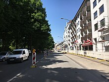
Landwehr
( Location ) |
L024 | 410 | after the medieval Landwehr that once ran here (simple fortifications in front of the actual city wall) | 1890 | Street area of the northern part in Hohenfelde, the eastern side of the street in Eilbek , southern part in Borgfelde and Hamm ; Part of the federal highway 5 |
|
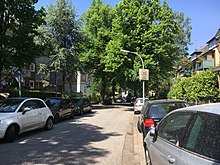
| Lenaustraße
( Location ) |
L124 | 90 | after the poet Nikolaus Lenau (1802–1850) | 1899 |
|
|
| Lessingstrasse
( Location ) |
L145 | 335 | after the poet Gotthold Ephraim Lessing (1729–1781) | 1863 |

|
|
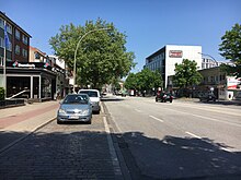
| Luebecker Strasse
( Location ) |
L274 | 1030 | Section of the medieval army route to Lübeck between Lübecker Tor and the "Lübschen Baum" | 1858 | eastern section part of federal highway 75 |
|
|
Mill dam
( Location ) |
M317 | 455 | after a windmill located there until 1888, possibly also the cow mill further north | 1858 |

|
|
| Mundsburg Bridge
( Location ) |
- | 20th | after an estate belonging to the wine merchant Johann Hinrich Mundt, known locally as "Mundtsburg" in the 18th century, see also Mundsburg underground station | 1904 | northern part in Uhlenhorst |

|
| Mundsburg dam
( Location ) |
M347 |
270 (in the district) |
see Mundsburg Bridge | 1872 | northern part in Uhlenhorst |

|
|
Neubertstrasse
( Location ) |
N044 | 350 | after the previous owner and gardener Carl Ernst Emil Louis Neubert (1832-1916) | 1874 |

|
|
|
Papenhuder Strasse
( Location ) |
P024 |
220 (in the district) |
Field name, former name of part of what is now the Uhlenhorst district | 1872 | northern part in Uhlenhorst |

|
|
Ramazan Avci Square
( Location ) |
R457 | 65 × 20 | after Ramazan Avcı , who was murdered here by neo-Nazis in 1985 | 2012 |

|
|
| Rice mill
( Location ) |
R137 | 200 | after a steam mill formerly located here | 1888 |

|
|
| Richardallee
( Location ) |
R179 | 105 | presumably after a previous owner of the site | 1957 |

|
|
|
Schottweg
( Location ) |
S878 | 240 | after the lawyer and senator Gerhard Schott (1641–1702), co-founder of the Opera on the Gänsemarkt | 1979 |

|
|
| Schroderstrasse
( Location ) |
S293 | 180 | after the previous landowner | 1858 |

|
|
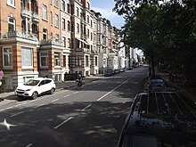
| Schwanenwik
( Location ) |
S339 |
440 (in the district) |
Wik = bay, after a place preferred by the Alster swans for ages | 1872 | northern part in Uhlenhorst |
|
| Schwanenwikbrücke
( Location ) |
- | 30th | see Schwanenwik | 1904 | northern part in Uhlenhorst |

|
| Schweimlerstrasse
( Location ) |
S354 | 150 | after the master carpenter Wilhelm Schweimler (1853–1942), long-time chairman of the Hohenfeld citizens' association | 1955 | Street area in Hohenfelde, southeast side in St. Georg |

|
| Sextuple gate
( Location ) |
S368 | 670 | in memory of a toll that was previously levied here | 1884 | Street area in Hohenfelde, parts of the southwest side in St. Georg |

|
| Steinhauerdamm
( Location ) |
S641 | 210 | after the camp sites that used to be here, where natural stones ( boulders ) were prepared by stone cutters for road construction | 1890 | Part of the federal highway 75 |

|
|
Uhlandstrasse
( Location ) |
U009 | 550 | after the poet Ludwig Uhland (1787–1862) | 1863 |

|
|
|
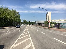
Wallstrasse
( Location ) |
W042 | 270 | according to its location in front of the former ramparts ("New Works)" to protect the suburb of St. Georg | 1861: Kleine Wallstrasse, 1899: Wallstrasse |
|
|
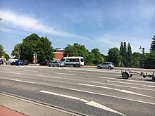
| Wallstrasse Bridge
( Location ) |
- | 40 | based on the Wallstrasse that runs over the railroad tracks here | 1905 | southern part in Borgfelde ; Part of the federal highway 75 |
|
| Wandsbeker Stieg
( Location ) |
W063 | 480 | former footpath to Wandsbek | 1858 |

|
|
| Wartenau
( Location ) |
W076 | 300 | after an earlier watchtower ( waiting ) at the "Lübschen Baum" | 1874 | Street area completely in Hohenfelde, northeast side of the street in Eilbek ; Part of the federal highway 5 |

|
| Wartenau Bridge
( Location ) |
- | 25th | after the road Wartenau that the Eilbekkanal to here Uhlenhorst crosses | 1904 | northern part in Uhlenhorst |

|
Individual evidence
- ↑ Digital Atlas North
- ↑ Senate resolution of May 6, 2015, published in Official Gazette No. 37 of May 15, 2015
Literature and Sources
- Statistics Office North: Street and area directory of the Free and Hanseatic City of Hamburg
- Horst Beckershaus: The Hamburg street names - where they come from and what they mean , 6th edition, CEP European Publishing House, Hamburg 2011, ISBN 978-3-86393-009-7

