List of streets and squares in Ruhland
The list of streets and squares in Ruhland including the Arnsdorf district is an overview of the currently existing named streets and squares. It is part of the list of streets and squares in the Ruhland district . Officially named bridges are and have not existed until now.
Another list contains allotment gardens, residential courtyards and cemeteries, as well as paths that are closed to motorized traffic.
overview
Ruhland is a small town with 3,665 inhabitants, 788 of them in the district of Arnsdorf (as of 2015) and the seat of the official administration. The district area is 37.22 km².
Ruhland is assigned to the postal code area 01945.
The list includes 85 streets and paths including the village meadow and 7 squares. 14 streets are named after people, 10 streets after neighboring or distant destinations, 18 streets according to landscape conditions (e.g. Bergstraße, Am Bach), 11 streets and one lane according to trades and businesses (Anglerweg, Brauhausgasse, Brauhausplatz, Färbergasse, Fischerstraße , Glashüttenstraße, Jägerstraße, Hospitalstraße, Kirchplatz, Kirchweg, Milchstraße, Mühlenstraße, waterworks), 13 streets, two squares and one lane after adjacent objects or local destinations (bathing establishment, Bahnhofstraße, Brauhausgasse, Brauhausplatz, Forsthaus, Friedhofsweg, Güterbahnhofstraße, Herschenzmühle, Hospitalstraße, Mühlenstraße, Scheunenweg, Schützenhausplatz, Stadtmühle, Stadtmühlenweg, Wallstraße), 3 streets and a square after trees (Birkenweg, Kiefernweg, Lindenplatz, Pflaumenweg).
Overview of streets and squares
- Name / location : current name of the street or square. Via the link Location , the street or the square can be displayed on various map services. The geoposition indicates the approximate center of the street length. The addition ' in the district ' indicates the district.
- Traffic routes not listed in the official street directory are marked with * .
- Former or no longer valid street names are in italics in the name column . All objects described are set in italics in the description . There is a separate list of names for important former streets or historical street names.
-
Length / dimensions in meters:
The length information contained in the overview are rounded overview values that were determined in Google Earth with the local scale, usually without taking into account lateral branches. They are used for comparison purposes and, if official values are known, are exchanged and marked separately.
For squares, the dimensions are given in the form a × b for rectangular systems and for (approximately) triangular systems as a × b × c with a as the longest side.
If the street continues into neighboring districts, an addition ' in the district ' indicates how long the street section within the district of this article is. - Name origin: origin or reference of the name.
- Notes: further information on adjacent monuments or institutions, the history of the street and historical names.
- Image: Photo of the street, square, path, etc. or an adjacent object.
| Name / location | Length / dimensions (in meters) |
Origin of name | Date of designation |
Remarks | image |
|---|---|---|---|---|---|
|
Old Hermsdorfer Strasse
( Situation ) (in "New Concern") |
390 | Old (after the construction of the railway / before the construction of the Kamenzer) road to Hermsdorf | After the construction of the railway and the construction of Kamenzer Straße , the road to Hermsdorf ran here |
 more pictures |
|
|
Alte Poststrasse *
( Location ) (extra-urban road) |
n / A | literally | from Ruhland past the forester's house to Ortrand | [[File: Ruhland, old "Poststrasse" (to the edge of town), west view between Forsthaus and Sieggraben.jpg | 140px | Alte Poststrasse] more pictures |
|
|
Old Forest Road *
( Location ) (extra-urban road) |
n / A | literally | from Ruhland over the Sieggrabenfurt to the 1945 destroyed bridge towards Lauchhammer | [[File: Ruhland, "Alte Waldstraße" northwest of the Autobahn.jpg | 140px | Alte Waldstraße] more pictures |
|
| At the Anger
( Location ) (in the "Neue Sorge" residential park) |
190 | literally | from Am Wiesengrund to west-southwest, with a bend to the south; touches Am Fliess and Am Lug |
 more pictures |
|
| At the river
( Location ) |
115 | literally | from Gutshof to the north, in front of Fischerstrasse a footbridge over the Schwarzwasser |
 more pictures |
|
| At the Dreistein
( Location ) (in the "Große Wiesen" industrial park) |
460 | after the Dreisteingraben and the old field name "Bei den Drei Steinen" | 1994 | begins and ends with the south or south-south-east branch from Am Dürrbachgraben ; industrial Estate
|
 more pictures |
| At the Dürrbachgraben
( Location ) (in the "Große Wiesen" industrial park) |
705 | after the Dürrbachgraben | 1994 | from Bernsdorfer Straße to the north-northeast to the bathing establishment ; Commercial area, part of the L 581 since 2016
|
 more pictures |
| At the flow
( Location ) (in the "Neue Sorge" residential park) |
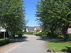
265 | literally | from Am Anger to the south in an arc to the south-southwest, crosses |
 more pictures |
|
| On the lug
( Location ) (in the "Neue Sorge" residential park) |
140 | after Lug = (damp) meadow | from Am Wiesengrund to west northwest, crosses Am Fließ , crosses Am Lug |
 more pictures |
|
| At the black water
( Location ) (in Arnsdorf) |
545 | literally | from the main street west to Ludwig-Jahn-Straße |

|
|
| On the meadow ground
( Location ) (in the "Neue Sorge" residential park) |
320 | literally | opens up the “Neue Sorge” residential park; from Theodor-Schmidt-Straße to the south-south-east (there with a branch to the southwest), then further south (with a branch to the east-northeast) with a branch path to the field path on Dürrbachgraben (connection to the playground in the residential area ) |
 more pictures |
|
| Anglerweg
( Situation ) (in "New Concern") |
390 | after angler | from Bernsdorfer Straße to the north-northeast with a junction to the "Insel" and a bend to the west to the bathing establishment ; opens up the "Alte Badeanstalt" (fishing pond, open space, walking path ) |
 more pictures |
|
|
August-Bebel-Strasse
( Location ) (in Schönburgsau) |
700 | after August Bebel (1840–1913), leader of the labor movement and co-founder of the SPD | 1945 | from the Grenzstrasse to the east to Fichtestrasse , then to east-northeast, crosses Jägerstrasse , Neugrabenweg , Heinrich-Heine-Strasse and ends at Geschwister-Scholl-Weg (the end belongs to Heinrich-Heine-Strasse by post ); before 1945 Ostmarkstrasse |
 more pictures |
|
Bathing establishment
( Situation ) (in "New Concern") |
1200 | after bathing establishment | from the Elsterbogen railway underpass to the north, partly parallel to the railway line to Schwarzbach; until 2016 part of the L 581 to Schwarzbach; after the new railway bridges have been built and the L 57 has been lowered, no passage to Bernsdorfer Straße |
 more pictures |
|
| Train station (street)
( Location ) |
200 + 200 |
Road to the train station | from Bahnhofstrasse / end of Güterbahnhofstrasse to west-southwest, opens up parking lot and blind track, a parallel street opens up the station; so far without postal significance
|
 more pictures |
|
| Bahnhofstrasse
( Location ) |
500 | Street from the market to the train station | from the market / end of Dresdener Straße to east-southeast to the end of Güterbahnhofstraße , with a bend to the north to Elsterbogen / Nordstraße ; touches Kirchgasse , Kirchplatz , Brauhausplatz , Hospitalstraße and Marienstraße and crosses Ernst-Thälmann-Straße , opens up the train station
|
 more pictures |
|
| Mountain road
( Location ) |
74 | literally (there was a little hill here) | from Hospitalstrasse to the east to Feldstrasse |
 more pictures |
|
| Berlin street
( Location ) |
505 | Road to Berlin ; Part of the L 55 | from the market north to Elsterbogen ; touches Kirchgasse and the Pflaumenweg captured by post , a junction opens up Hinter dem Markt ; leads at the "Zollhaus" over the Schwarze Elster to the B 169 and to Schwarzheide , Schipkauer Straße ; Part of the L 55
|
 more pictures |
|
| Bernsdorfer Strasse
( Situation ) (in "New Concern") |
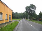
570 | Road to Bernsdorf ; Part of the L 57 | from the Elsterbogen railway underpass to the southeast, via Guteborn and Grünewald to Bernsdorf
|
 more pictures |
|
| Birch path
( Location ) (in Schönburgsau) |
515 | for the birches that line the path | from Neugrabenweg to west-southwest, originally over the motorway to Alte Poststraße ; Southern border of the development of the district / residential area Schönburgsau and the end of Fichtestrasse , Rosa-Luxemburg-Strasse and Jägerstrasse |
 more pictures |
|
| Brauhausgasse
( Location ) |
34 | after the brewery | from Brauhausplatz to Marienstrasse / end of Karl-Liebknecht-Strasse |
 more pictures |
|
|
Brauhausplatz
( Location ) |
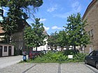
73 × 12 | after the brewery | Access from Bahnhofstrasse , Mittelstrasse , Wallstrasse and Brauhausgasse
|
 more pictures more pictures |
|
|
Dorfaue
( Location ) (in Arnsdorf) |
1010 | literally; here also like village green | west parallel to the main street from Guteborner Straße to the south (the street length results from 2 parallel strings and 2 branches) |

|
|
| Dresdener Strasse
( Location ) |
1100 | Road to Dresden | from the market south to Kamenzer Strasse , past the cemetery; crosses Mittelstraße , Wallstraße , Marienstraße , Rudolf-Breitscheid-Straße and Ernst-Thälmann-Straße / Karl-Marx-Straße , touches Bahnhofstraße , Goethestraße , Kreuzstraße , Glashüttenstraße and Herschenzmühle ; Part of the L 55
|
 more pictures |
|
|
Dr.-Otto-Werkmeister-Strasse
( Location ) |
575 | according to the Ruhland doctor Dr. Otto Werkmeister | 2017 | from the junction Rudolf-Breitscheid-Straße / Hartwigstraße to west-southwest past the day-care center “Spurensucher”, then bends to the south and then several times to the west and south; opens up a small building area and a retirement home Resolution of the city council of November 20, 2017; the name Lebensweg (from day care center to senior citizens' home), which was proposed first and preferred by the main committee, was discarded |

|
|
Elsterbogen
( Location ) |
505 | Arched road to the bridge over the Black Elster | from the railway underpass Bernsdorfer Straße (L 57) / Bahnhofstraße / Nordstraße to the north-west, crosses Feldstraße and joins Berliner Straße ; opens up a small commercial and special area; Bypass road, part of the L 55 |
 more pictures |
|
|
Ernst-Thalmann-Strasse
( Location ) |
735 | after Ernst Thälmann (1886–1944), leader of the labor movement, chairman of the KPD | 1945 | from Dresdener Strasse / beginning of Karl-Marx-Strasse past the cemetery and Scheunenweg to the east with a curtsy to the north-northeast and north, touches Karl-Liebknecht-Strasse , crosses Rudolf-Breitscheid-Strasse and Bahnhofstrasse , ends at Feldstrasse ; before 1945 Kurt-Meyer-Strasse - it is not certain which of the possible namesake was meant at the time |
 more pictures |
|
Färbergasse
( Location ) |
45 | dyeing according to the old craft | from the market to the west to Gartenstrasse |
 more pictures |
|
| Feldstrasse
( Location ) |
345 | literally | from Bahnhofstrasse to the north, bend to the east to the end of Ernst-Thälmann-Strasse , then crosses Elsterbogen to the northeast and Nordstrasse to the east ; the length specification includes the post belonging to the end of Nordstraße |
 more pictures |
|
| Fichtestrasse
( Location ) (in Schönburgsau) |
335 | possibly after the Berlin workers' sports club "Fichte" | 1945 | from August-Bebel-Straße to the south to Birkenweg ; before 1945 Sudetenstrasse |
 more pictures |
| Fischerstrasse
( Location ) |
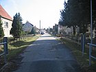
698 | Fishermen , getting food for the first settlers | from the market to the west, touches Gartenstrasse , Wallstrasse , Stadtmühle and Lange Strasse ; originally beyond the current autobahn with a Moltke monument at the end, before 1945 Moltke- Allee
|
 more pictures |
|
| Forester's house
( Location ) (extra-urban road) |
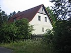
n / A | literally | Part of the road in front of the forester's house, branching off from Alte Poststraße , on the Ruhland - Waidmannsruh - Bärhaus cycle path |
 more pictures |
|
|
Frauendorfer way
( Location ) (extra-urban road) |
n / A | from Arnsdorf to Frauendorf (old local connection road) | from Dorfaue from Arnsdorf to Frauendorf (old local connection road, developed bike path) | ||
| Friedhofsweg
( Location ) (in Arnsdorf) |
280 | to the cemetery | from Dorfaue / Frauendorfer Weg north to the cemetery | ||
|
Friedrich-Engels-Strasse
( Location ) |
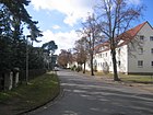
255 | after Friedrich Engels (1820–1895), philosopher and communist revolutionary | 1945 | from Karl-Marx-Straße / Glashüttenstraße past Straße des Aufaufbau to the west to the foot and cycle bridge over the Ruhlander Schwarzwasser to Geschwister-Scholl-Weg and Heinrich-Heine-Straße |
 more pictures |
|
gardenstreet
( Location ) |
130 | after the garden | from Fischerstrasse south to Wallstrasse , touches Mittelstrasse and Färbergasse |
 more pictures |
|
| Glashüttenstrasse
( Location ) |
175 | to the Ruhlander glassworks | from Dresdener Strasse west to Karl-Marx-Strasse ; touches the place of the young pioneers
|
 more pictures |
|
| Goethestrasse
( Location ) |
305 | after Johann Wolfgang von Goethe (1749-1832), German poet and natural scientist | from Dresdener Strasse to the west to Ortrander Strasse / Hartwigstrasse , touches Lange Strasse
|
 more pictures |
|
| Border road
( Location ) (in Schönburgsau) |
565 | the street is the western limit of the development | from the Ortrander road to southwest, touches the ends of Park Road and August-Bebel-road and is in a forest road parallel to the highway on which the Birkenweg / waterworks leads
|
 more pictures |
|
| Guteborner Strasse
( Location ) (in Arnsdorf) |
815 | from Dorfaue to Guteborn (old local connection road) | from the Dorfaue via the main road and forest road to Guteborn (old local connection road, developed bike path) | ||
| Güterbahnhofstrasse
( Location ) |
210 | Street at and parallel to the freight yard | from Bahnhofstraße to the southwest to Rudolf-Breitscheid-Straße and on railway premises of no postal significance further to Ernst-Thälmann-Straße
|
 more pictures |
|
| grange
( Location ) |
115 | literally | from Lindenplatz west to Lange Straße
|
 more pictures |
|
|
Hainweg
( Location ) (in Schönburgsau) |
700 | to Hain (small forest) | 2005 | from Ortrander Straße to the north with a bend to the east, opens up a small residential area behind the Matzmühle west of the Haingraben |
 more pictures |
| Hartwigstrasse
( Location ) |
540 | after Eduard Hartwig, "meritorious Rathmann until 1901" | (<) 1926 | from Goethestraße / Ortrander Straße to the south to Glashüttenstraße , crosses Rudolf-Breitscheid-Straße (captures the end) and Karl-Marx-Straße , touches Kreuzstraße |
 more pictures |
| Main road
( Location ) (in Arnsdorf) |
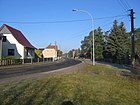
1600 | literally | Part of the L 55, runs parallel to the Ruhlander Schwarzwasser from south to north through the entire district |
|
|
| Heinrich-Heine-Strasse
( Location ) (in Schönburgsau) |
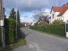
700 | after Heinrich Heine (1797–1856), German poet, writer and journalist | 1945 | from Ortrander Strasse to the south, crosses August-Bebel-Strasse and ends at Geschwister-Scholl-Weg ; the extended August-Bebel-Straße and branches to Geschwister-Scholl-Weg belong to Heinrich-Heine-Straße by post ; a junction leads as a footpath and bike path over the Ruhlander Schwarzwasser to Friedrich-Engels-Straße ; before 1945 Schönburgs-Au like the district |
 more pictures |
| Hermsdorfer Strasse
( Situation ) (in "New Concern") |
435 | Road to Hermsdorf | from the southwest end of Theodor-Schmidt-Strasse to the south-southeast, meets the Kamenzer Strasse and leads to Hermsdorf and Lipsa |
 more pictures |
|
| Herschenzmühle
( Location ) |
960 | after an owner of the mill | from Dresdener Straße between the railway underpasses to the southwest, opens up the residential area Herschenzmühle and the area between the railway lines |

|
|
| Behind the market *
( Location ) |
40 × 25 | literally | The square behind the buildings in the corner between Berliner Straße and Markt has no postal address; a public parking lot behind the printing works leads into the courtyards of the buildings; as an extension of the access from Berliner Straße there is a footpath (“Janks Gäßchen”) to Stadtmühlenweg through gardens and over the Schwarzwasser to Stadtmühle . |
 more pictures |
|
| Hospitalstrasse
( Location ) |
117 | here was the hospital | from Bahnhofstraße to the north, touches Bergstraße and Kirchplatz (connecting street)
|
 more pictures |
|
|
Jaegerstrasse
( Location ) (in Schönburgsau) |
445 | after the hunter | from Parkstraße via August-Bebel-Straße to the south to Birkenweg |
 more pictures |
|
|
Jenstech way *
( Location ) (extra-urban road) |
2370 | after the old field name Im Jenstech , from Gänsesteg (Jenschstech, Jensteich, Jensteig) | from (slightly north) Arnsdorf, crossing the extended Hermsdorfer Straße, to the L 57 a little south of the junction with Schwarzer Weg |

|
|
|
Kamenzer Strasse
( Situation ) (on "New concern") |
415 | to Kamenz | from the railway underpass Dresdener Straße / crossing Alte Hermsdorfer Straße to east-southeast, meets Hermsdorfer Straße and leads to Hermsdorf and Lipsa; Part of the K 6603 |
 more pictures |
|
|
Karl-Liebknecht-Strasse
( Location ) |
360 | after Karl Liebknecht (1871–1919), leader of the labor movement | 1945 | before 1945 Wilhelmstrasse |
 more pictures |
|
Karl-Marx-Strasse
( Location ) |
590 | after Karl Marx (1818-1883), philosopher and economist, theoretician of the labor movement | 1945 | from Dresdener Strasse to the west to the intersection with Hartwigstrasse , then turn south over the junction of Friedrich-Engels-Strasse and Glashüttenstrasse and ends at an industrial area (steel construction); touches the place of the young pioneers ; before 1945 General- Litzmann- Allee |
 more pictures |
| Pine path
( Location ) (in Arnsdorf) |
165 | after the jaw | from the main road east to Kiefernweg | ||
| Kirchgasse
( Location ) |
150 | literally | from the market / end of Berliner Straße to Kirchplatz , on the west side of which forks to the south to Bahnhofstraße and to the north ending at a small apartment block behind the rectory garden |
 more pictures |
|
|
church Square
( Location ) |
64 × 42 | literally | Postally, this includes the street in front of the rectory in the north, the connection in the east to Bahnhofstraße , its extension to the north and the connecting street to Hospitalstraße with a length of 50 m; the street in the west and the connection in the west to Bahnhofstrasse belong to Kirchgasse by post
|
 more pictures more pictures |
|
|
Kirchweg *
( Location ) (extra-urban road) |
n / A | Way to the Ruhlander church | Path from Arnsdorf to Ruhland, branching off of the current Ludwig-Jahn-Straße over the Schwarzwasser to the current Herschenzmühle , also on the Mordweg , the current L 55 |

|
|
| Kreuzstrasse
( Location ) |
180 | after a 450-year-old atonement cross at the beginning | 1926 | from Dresdener Strasse to west-southwest to Hartwigstrasse , touches Vorwerk |
 more pictures |
|
Long way *
( Location ) (Schönburgsau, Ausserortsstraße) |
n / A | literally | from the Schützenhaus over the Filzenwiese and the Buschgraben; the built-up beginning now belongs to Ortrander Straße |

|
|
| Long street
( Location ) |
278 | literally | from Fischerstrasse north to Goethestrasse , touches Gutshof |
 more pictures |
|
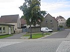
| Lindenplatz
( Location ) |
30 × 20 × 20 | literally | Access from Marienstraße , Wallstraße and Gutshof |
 more pictures |
|
| Ludwig-Jahn-Strasse
( Location ) (in Arnsdorf) |
550 | after Friedrich Ludwig Jahn (1778–1852), educator, initiator of the German gymnastics movement | from the Dorfaue to the east and then with 2 branches to the north to Am Schwarzwasser |

|
|
|
Marienstrasse
( Location ) |
420 | after Mary (mother of Jesus) | from Lindenplatz to the south and then east-south-east via Dresdener Strasse and Brauhausgasse / end of Karl-Liebknecht-Strasse to north-north-east to Bahnhofstrasse
|
 more pictures |
|
|
market
( Location ) |
54 × 54 | after the market | Access from Berliner Strasse , Dresdener Strasse , Fischerstrasse , Bahnhofstrasse ; Access from Färbergasse
|
 more pictures more pictures |
|
|
Milky Way
( Location ) (extra-urban road) |
4800 | for milk, dairy cattle facility at the end of the street | formerly also common LPG road from Ruhland Schwarzbacher Weg to Biehlen | ||
| Mittelstrasse
( Location ) |
220 | literally | from Brauhausplatz to west-northwest via Dresdener Straße to Gartenstraße |
 more pictures |
|
| Mühlenstrasse
( Location ) (in Arnsdorf) |
527 | after the mill on the black water | from the Dorfaue to the east over the main road to the K 6603 |

|
|
|
New street
( Location ) (in Arnsdorf) |
295 | literally | from the main road to the east over forest road to the outskirts and a forest path | ||
| Neugrabenweg
( Location ) (in Schönburgsau) |
905 | after the new dig , an important drainage ditch before 1900 | from Ortrander Straße to the south, crosses August-Bebel-Straße , touches Parkstraße , Birkenweg and Geschwister-Scholl-Weg and continues as an asphalt path through the railway crossing structure to Arnsdorf or the forester's house |
 more pictures |
|
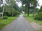
| Neulandweg
( Situation ) (in "New Concern") |
313 | after the old field name Alte Neuländer : Neuland = area made arable for arable farming | from Theodor-Schmidt-Strasse / corner of Bernsdorfer Strasse to the south-south-east to the field path on Dürrbachgraben |
 more pictures |
|
| North street
( Location ) |
270 | literally | from Bahnhofstrasse and the Elsterbogen railway underpass to the north, crossing the end of Feldstrasse ; after the new construction of the railway bridges and the lowering of the L 57, no more passage to Bahnhofstraße , access only via Feldstraße ; the length specification includes a side branch that belongs to Nordstrasse by post, but is also the blind end of Feldstrasse |
 more pictures |
|
|
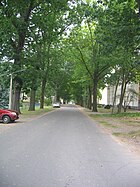
Ortrander street
( Location ) (in Schönburgsau) |
785 | Outskirts , neighboring town; this is where the old post road to Ortrand began | from Goethestrasse / corner Hartwigstrasse over the Ruhlander Schwarzwasser near the Matzmühle to west-southwest; this includes a junction at the Schützenhaus, which used to lead as a long path over the current motorway into the bush meadows; Parschkenweg began with Ortrander Strasse and then branched off to Alte Poststrasse to Ortrand, the originally straight connection to the former Parschkenweg was interrupted by the motorway
|
 more pictures |
|
|
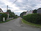
Parkstrasse
( Location ) (in Schönburgsau) |
505 | after the former city park (laid out as Prinzess-Luisen-Weg , see Geschwister-Scholl-Weg ), which borders the Schönburgsau settlement | from Neugrabenweg to west-southwest to Grenzstraße, touches Jägerstraße and Rosa-Luxemburg-Straße |
 more pictures |
|
|
Parschkenweg *
( Location ) (extra-urban road) |
n / A | after the old field name Im Parschken , the name comes from the Sorbian breza = birch | Extension of the current Ortrander Straße |

|
|
| Parcel road
( Location ) (in Schönburgsau) |
128 | by plot (plot) | 1945 | from Fichtestrasse to the east to Rosa-Luxemburg-Strasse ; 1922 to 1945 Wilhelm Gustloff- Strasse , 1945 to 1974 (incorporation Arnsdorf) Ludwig-Jahn- Strasse |
 more pictures |
| Plum Path *
( Location ) |
n / A | literally | from the customs house to the town mill ; by post to Berliner Straße
|

|
|
| Young Pioneers Square *
( Location ) |
130 × 125 × 53 | after the young pioneers | public children's playground in the residential area
|
 more pictures |
|
|
Cross street
( Situation ) (in "New Concern") |
290 | literally; Linden double row in the middle third | from Bernsdorfer Strasse at the railway underpass to the southwest with a bend to Theodor-Schmidt-Strasse ; in 1931 the Bernsdorfer Strasse ran along here
|
 additional pictures street and catholic church |
|
|
Ring road
( Situation ) (in "New Concern") |
230 | literally | from the Anglerweg to east-southeast with a bend to Bernsdorfer Straße |
 more pictures |
|
|
Rosa-Luxemburg-Strasse
( Location ) (in Schönburgsau) |
420 | after Rosa Luxemburg (1871-1919), spokeswoman for the left in the SPD and co-founder of the KPD | 1945 | from Parkstraße via August-Bebel-Straße to the south to Birkenweg ; before 1945 Saarlandstrasse |
 more pictures |
|
Rudolf-Breitscheid-Strasse
( Location ) |
550 | after Rudolf Breitscheid (1874–1944), left-liberal and later social democratic politician | 1945 | from Güterbahnhofstrasse via Ernst-Thälmann-Strasse , Karl-Liebknecht-Strasse , Hartwigstrasse to the west, touches Vorwerk ; the western end belongs to Hartwigstrasse by post ; before 1945 Suchystraße and Schäfereiweg
|
 more pictures |
|
Scissor path *
( Location ) (extra-urban road) |
~ 1600 | after the old field name The archipelago , (like a plow sharpened ) narrow strips | from Ruhland through the railway crossing structure to Arnsdorf (extended Neugrabenweg, interrupted by the railway line to Ortrand) | ||
| Barn path
( Location ) |
90 | literally | on the east wall of the cemetery, now a private road |

|
|
| Schwarzbacher way
( Location ) (extra-urban road) |
1000 | literally | from the Elsterbogen railway underpass between the railway lines to the green waste dump, formerly the road from Ruhland to Schwarzbach, after another 200 m crossed the current course of the railway line and then continued like the current L 581; back then there was no bathing establishment . |

|
|
|
Black way *
( Location ) (extra-urban road) |
n / A | also Leichenweg (from the time when Guteborn and the more eastern municipalities did not have their own cemetery) | previously also Leichenweg, transport route to Guteborn, extension of the current meadow road over the Blumengraben |

|
|
| Schützenhausplatz *
( Location ) |
120 × 50 | literally | also fairground; Before World War I belonged to the gymnastics club "Gut Heil", which played there with its large field handball team. |
 more pictures more pictures |
|
| Town mill
( Location ) |
370 | literally | from Fischerstraße to the north to Pflaumenweg , touches the Stadtmühlenweg |
 more pictures |
|
| Stadtmühlenweg
( Location ) |
205 | literally | from the city mill to the east with a bend to the north, a garden opens up; at the beginning of the branch to "Janks Gäßchen" at Hinter dem Markt |
 more pictures |
|
| Road of construction
( Location ) |
335 | literally from the construction after WWII | from Friedrich-Engels-Strasse to the south with a bend to the west and back again to Friedrich-Engels-Strasse and foot and cycle bridge over the Ruhlander Schwarzwasser to Geschwister-Scholl-Weg and Heinrich-Heine-Strasse ; the length specification includes the access to the garages and the ring closure to Friedrich-Engels-Straße | ||
| Theodor-Schmidt-Strasse
( Situation ) (in "New Concern") |
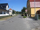
1010 | after Karl Ernst Theodor Schmidt from Drense (Prenzlau district) , 1894–1916 archdeacon (at the same time chapel preacher in Guteborn); "Founder of the colony on the old Guteborner Strasse" (Neue Sorge) | 1926 | from Bernsdorfer Strasse to south-southwest to Hermsdorfer Strasse , at times parallel to the railway line, opens up the original residential area “Neue Sorge”; the street length and house numbering include a cross street |
 more pictures |
|
Vorwerk
( Location ) |
140 | after the Vorwerk | 1926 | from Rudolf-Breitscheid-Strasse to the south to Kreuzstrasse ; still the earlier (since 1926) name Vorwerkstrasse |
 more pictures |
|
Forest rest
( Location ) (extra-urban road, to Arnsdorf) |
350 | literally | Piece of Hermsdorfer Straße (K6603) south of the Guteborner Straße intersection (old covering shop ) |

|
|
|
Forest road
( Location ) (in Arnsdorf) |
180 | literally | from the main street to the east with a bend to the north via Guteborner Straße and Neue Straße to Kiefernweg | ||
| Wallstrasse
( Location ) |
242 | after the wall (city fortifications) | from Brauhausplatz via Dresdener Straße to west-northwest to Lindenplatz / end of Marienstraße with a bend to the north to Fischerstraße |
 more pictures |
|
| Waterworks
( Location ) (in Schönburgsau) |
425 | after the waterworks , which it served as an access until it was demolished | By post, the Birkenweg 60 m west of Fichtestrasse to the motorway with a bend to the south to the former site of the waterworks |
 more pictures |
|
| Meadow road
( Situation ) (in "New Concern") |
510 | literally | from the intersection of Alte Hermsdorfer Straße / Hermsdorfer Straße to the southeast; this is where the Black Path or Leichenweg began to Guteborn |
 more pictures
|
Important old street names
- General- Litzmann- Allee - now Karl-Marx-Straße (renamed 1945)
- Moltke- Allee - now Fischerstraße (renamed 1945)
- Suchystraße - today's Rudolf-Breitscheid-Straße between Karl-Liebknecht-Straße and Ernst-Thälmann-Straße , initially a path, then expanded as a private road;
- after Georg Suchy - builder and architect, b. January 18, 1862 in Königswartha, founder of the family seat in Ruhland
Other publicly used areas and paths
This list includes
- Bike and footpaths
- Geschwister-Scholl-Weg , Hainsteg, Janks Gäßchen, Pflaumenweg
- Allotment gardens
- "Sommerfreude", "Sonnenschein", Am Stadtmühlenweg, Am Pflaumenweg (urban + priv.), Hinter der Ortrander Straße (on leased private land, since 2017 from the housing cooperative Schwarzheide eG); On the Schwarzwasser (east bank Fr.-Engels-Str. To Stahlbau)
- Hiking trails
- (Zengler-ABM)
- Arnsdorf cemeteries, Ruhland
- Others
- Freizeitzentrum Arnsdorf Picture is missing
- Customs House Garden
- Schützenhausgarten
- Sports grounds Arnsdorf, Ruhland -> also sports facilities (+ gym)
- Playgrounds WG Neue Sorge, Young Pioneers' Square
- Old swimming pool open space, fishing pond and circular path
- Dirt roads (selection)
- (as abbreviations and farm roads sometimes used for diversions)
- Residential courtyards
- 3 courtyards behind the Ortrander Str .; others at Friedrich-Engels-Strasse, Karl-Marx-Strasse and Strasse des Aufbaus
| Object type | Surname | Access / location | Length / dimensions (in meters) |
Remarks | image |
|---|---|---|---|---|---|
| Type? |
At the "Neue Sorge" fishing pond |
Anglerweg
( Location ) (in the residential area "Neue Sorge") |
50 × 15 | "Old bathing establishment", fishing pond, walking path |
 more pictures |
| Beer garden | Arnsdorf leisure center |
Dorfaue , between house no. 9 and Friedhofsweg 1
( Location ) (in Arnsdorf) |
115 × 55 |
more pictures |
|
| Beer garden | Mileta's beer garden |
Goethestrasse
( Location ) |
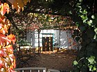
7 × 7 | Goethestrasse 18, corner of Lange Strasse, in front of the restaurant |
 more pictures |
| Beer garden | Mileta's court |
Goethestrasse
( Location ) |
22 × 9 | further access to Marienstraße ; thus passage Goethestrasse - Marienstrasse and bowling alley | |
| Coffee garden | Rectory garden |
church Square
( Location ) |
55 × 25 | Coffee garden, internal and public events of the Protestant parish; also included in city festivals |
 more pictures |
| Beer garden | Schützenhausgarten Schönburgsau |
Ortrander street
( Location ) (in Schönburgsau) |
42 × 28 | Coffee and beer garden , also club events (shooting festival, official singers meeting) and included in city festivals |
 more pictures |
| Beer garden | Customs House Garden |
Berlin street
( Location ) |
30 × 60 | formerly a coffee and beer garden , now alcohol-free, managed by “ Verein t im Zollhaus” ; also for club events |

|
| graveyard | Arnsdorf cemetery |
Friedhofsweg
( Location ) (in Arnsdorf) |
115 × 55 |
 more pictures |
|
| graveyard | graveyard |
Ernst-Thalmann-Strasse
( Location ) |
250 × 205 × 200 | Dimensions including the Soviet cemetery of honor |
 more pictures |
| trail | Elsterdamm at the "Zollhaus" |
Berlin street
( Location ) |
500 | Linden double row to the embankment |

|
| trail | Geschwister-Scholl-Weg , city park |
Ortrander street
( Location ) |
1200 + 600 | further entrances from Neugrabenweg , Heine-Straße , Friedrich-Engels-Straße and Hainsteg ; Recreational forest; the 2nd length specification relates to the route on the east bank to (track on the railway line) |
 more pictures |
| trail | "Janks Gäßchen" * |
Stadtmühle / Stadtmühlenweg
( Location ) |
200 | further access from Hinter dem Markt via Berliner Straße |
 more pictures more pictures |
| trail | Consumption path * in Schönburgsau |
Ortrander street
( Location ) |
215 | further access to Parkstrasse; the forest path is roughly the extension of Jägerstrasse (where the consumer sales point used to be) to Ortander Strasse / Grenzstrasse |

|
| trail | Hainsteg |
Ortrander Strasse / Geschwister-Scholl-Weg
( Location ) |
375 | further access from Fischerstrasse |
 more pictures |
| trail | Pflaumenweg * (by post to Berliner Straße ) |
Berlin street
( Location ) |
385 | further access from Stadtmühle ; Leased gardens along the way |

|
| Dirt road | Hainwiesenweg * |
Fischerstrasse
( Location ) (at Schonburgsau) |
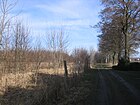
900 | Path through the "Hainwiesen" parallel to the A 13 motorway further accesses: from the Hainweg (across the field); from Ortrander Straße: central branch at the Schützenhaus, and via residential courtyards (and allotments) at house no. 5 and 9 |
 more pictures |
| Dirt road | Railway embankment parallel path east * |
Cross street
( Location ) (at the residential area "Neue Sorge") |
800 | Dirt road parallel to Theodor-Schmidt-Straße on the railway embankment further entrances from Theodor-Schmidt-Strasse (central branch), Hermsdorfer Strasse , Alte Hermsdorfer Strasse |

|
| Dirt road | Railway embankment parallel path west * |
Dresdener Strasse
( Location ) |
1160 | Waldweg extended Dresdener Straße on the embankment further entrances from Geschwister-Scholl-Weg (Ostabzweig), extended Neugrabenweg (connection to the regional cycle path network) |
|
| Dirt road | Dürrbachgraben field path * | L 57 (Bernsdorfer Strasse)
( Location ) (at the residential area "Neue Sorge") |
1000 | Dirt road parallel to Theodor-Schmidt-Straße on Dürrbachgraben further entrances from Neulandweg , Am Fließ (footpath), Theodor-Schmidt-Strasse (central branch), Wiesenstrasse |
 more pictures |
| Garden area | Gardens at the Pflaumenweg |
Pflaumenweg over Berliner Strasse
( Location ) |
200 × 75 | further access from Stadtmühle ; Leased gardens |

|
| Garden area | Gardens at the Schwarzwasser |
Geschwister-Scholl-Weg east branch via Friedrich-Engels-Straße - Ulmenweg *
( Location ) |
400 × 50 | further access from the Bahndamm-Parallelweg (West) * (road north of the railway line) near Herschenzmühle; Leased gardens on urban land |

|
| Garden area | Gardens on Stadtmühlenweg |
Town mill
( Location ) |
150 × 120 | Leased gardens |
 more pictures |
| Garden area | Gardens behind Ortrander Strasse 6–9 | Ortrander street
( Location ) |
320 × 40 | Leased gardens on private land |

|
| Garden area | Gardens south of the "Sunshine" facility | extended Neugrabenweg
( Location ) |
160 × 80 + 100 × 60 |
second access from the east bank branch of the Geschwister-Scholl-Weg; Leased gardens on private land |

|
| Garden area | "Summer joy" allotment garden |
Hartwigstrasse
( Location ) |
100 × 100 + 300 × 55 |
further entrances from Friedrich-Engels-Strasse ; VKSK division; Check dimensions ; Lease contracts in the north-eastern part 2020 canceled for residential development |

|
| Garden area | "Sunshine" allotment garden |
Neugrabenweg
( Location ) |
275 × 60 | second access from the east bank branch of the Geschwister-Scholl-Weg ; VKSK division |

|
| playground | Young Pioneers Square |
Hartwigstrasse
( Location ) |
130 × 125 × 53 | further access to Glashüttenstrasse ; public children's playground |
 more pictures |
| playground | Playground at the "Neue Sorge" residential park |
Am Fliess (branch path)
( Location ) |
100 × 40 | further access to Dürrbachgraben-Feldweg via Neulandweg or junction in the middle of Theodor-Schmidt-Straße ; public children's playground |
 more pictures |
| sports ground | Arnsdorf sports field |
Ludwig-Jahn-Strasse
( Location ) |
100 × 80 | ||
| sports ground | sports ground |
Ortrander street
( Location ) |
275 × 60 | created in 1947, expanded in 1952 and 20XX; a soccer field existed from 1920 to 1942 on the meadow at the "Zollhaus" |
 more pictures |
| Residential courtyard | Friedrich-Engels-Strasse 1 - 10 |
Friedrich-Engels-Strasse
( Location ) |
220 × 25 | adjoins residential courtyard Karl-Marx-Straße 9/10/11; further access to Karl-Marx-Straße |

|
| Residential courtyard | Karl-Marx-Strasse 9/10/11 |
Karl-Marx-Strasse
( Location ) |
27 × 25 + 50 × 15 | adjoins residential courtyard Friedrich-Engels-Strasse 1 - 10; further access to Friedrich-Engels-Straße |

|
| Residential courtyard | Residential courtyard Ortrander Strasse 6/7 |
Ortrander street
( Location ) |
77 × 53 |

|
|
| Residential courtyard | Residential courtyard Ortrander Straße 8/9 |
Ortrander street
( Location ) |
83 × 50 |

|
|
| Residential courtyard | Residential courtyard Ortrander Straße 13/14 |
Ortrander street
( Location ) |
140 × 20 | further access Neugrabenweg |

|
Web links
swell
- List in the Official Journal for the Ruhland Office: OJ 04.2019 (April 12, 2019) from p. 5, accessed on April 14, 2019
- from the official archive: Grubann-Druck (Ruhland): Directory of all house owners in the city of Ruhland issued in 1936, with handwritten additions from the Ruhland road construction archive
- from the official archive: List of street names in Schönburgs-Au compiled by Grubann-Druck in 1936, with additions from the Ruhland road construction archive
Individual evidence
- ↑ Population in the state of Brandenburg from 1991 to 2015 according to independent cities, districts and municipalities , Table 7; based on the 2011 census
- ↑ a b c d e f g C. Nicolaus: Ruhlands Flurnamen . (1931)
- ↑ a b c d chronicle of the city Ruhland 1317-1997 , Ruhland 1995-1997, in the context of ABM emerged
- ↑ a b Andrea Budich: Bake smaller rolls when renovating in: Lausitzer Rundschau , Senftenberg edition, July 6, 2004, accessed on February 2, 2018
- ↑ a b c d Horst Bormann: Ruhland 90 - 75 - 70 years ago; a late harvest from the "Elster Chronicle" (22nd episode) by Horst Bormann in the Ruhland official gazette, edition 9/1996, pp. 20-21
- ↑ a b History of the "Germania Ruhland" association , on the association's homepage
- ↑ Oberpf. Dahlmann: From the yearbook of the community Ruhland f. 1906 , p. 4 (list of archdeacons and subdeacons who were also chapel preachers in Guteborn )
- ^ Official archive, collections on the city of Ruhland
- ^ Andrea Budich: Zollhaus rebirth with live music in May. In: Lausitzer Rundschau. Senftenberg edition, January 14, 2016, accessed October 30, 2016
