
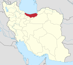
Māzandarān
| مازندران Māzandarān
|
|
|---|---|
  |
|
| Basic data | |
| Country | Iran |
| Capital | Sari |
| surface | 23,842 km² |
| Residents | 3,283,582 (2016 census) |
| density | 138 inhabitants per km² |
| ISO 3166-2 | IR-21 |
 |
|
Coordinates: 36 ° 48 ' N , 53 ° 31' E


Māzandarān , also Masanderan ( Persian مازندران, Masanderan مازرون or مازندرون), is an Iranian province. It emerged from the ancient province of Tabaristan . The capital is Sāri .
3,283,582 people live in the province (2016 census). The province is 23,701 square kilometers. The population density is 138 inhabitants per square kilometer.
language
In Masandaran the Masanderan language (Māzanderānī) is spoken. It has the oldest written tradition among the living Iranian languages .
history
Māzandarān was part of Tabaristan in ancient times . Here local dynasties were able to establish themselves again and again with a certain independence from the surrounding states. The best known example are the Ziyarids , who ruled between 928 and 1090. Māzandarān is often mentioned in the Shāhnāme of Firdausi as a demonic landscape inhabited by divas , which, however, could mean today's India .
geography
The border to the province of Tehran runs over the Damawand , the highest peak of the mighty Elburs Mountains ( Pers. Alborz ) at 5671 m . The capital Tehran is another 50 km south . Māzandarān is shielded from the dry desert-like inland by the Elburs Mountains. There is a moderate, relatively humid climate on the mountain slopes. Foothills of the Hyrcanic forest grow here . This temperate rainforest is followed by the Elburs forest steppe with a rather dry climate.
Agriculture
The medlar is cultivated by the Caspian Sea in Māzandarān. In addition, Mazandaran's rice is grown in the lowlands and large potato fields can be seen in the Damavand Mountains near the town of Firūzkuh . Mazandaran is also known for oranges and figs .
Administrative division
Māzandarān is divided into 15 districts:
- Amol
- Bābol
- Bābolsar
- Behschahr
- Juybār
- Mahmud Ābād
- Nekā
- Just
- Nouschahr
- Qaem-Shahr
- Ramsar
- Sari
- Savad cow
- Tonekābon
- Chalus
Colleges
- Bābol University of Medical Sciences
- Shomāl University
- Māzandarān University of Medical Sciences
- University of Māzandarān
- Behshahr University of Science and Technology
- Islamic Āzād University of Nekā
- Islamic Āzād University of Sāri
- Islamic Āzād University of Tonekābon
- Islamic Āzād University of Bābol
- Islamic Āzād University of Āmol
- Imam Khomeini University for Naval Sciences
Sons and daughters

- Reza Shah Pahlavi (1878–1944), Shah of Persia
- Nima Youschidsch (1897–1960), Persian poet
- Khosrow Sinai (1941-2020), Iranian film director
- Gholam Hossein Banan (1911–1986), Iranian musician and singer
- Abdollah Movahed (* 1940), Iranian wrestler
- Imam-Ali Habibi (* 1931), Iranian wrestler
- Reza Yazdani (* 1984), Iranian wrestler
- Reza Allamehzadeh (* 1943), Dutch filmmaker, film critic and writer of Iranian origin
- Towhidi Tabari (* 1964), Iranian calligrapher and painter
- Schamseddin Hosseini (* 1967), Iranian politician, Islamic clergyman
- Scheys Rezai (* 1984), Iranian football player
- Mohammad Ali Sadjadi (* 1957), Persian artist
- at-Tabarī (839–923), historian and scholar
- ʿAlī ibn Sahl Rabban at-Tabarī (around 805 – around 870), Iranian doctor and scholar
See also
literature
- Yukako Goto: The southern Caspian provinces of Iran under the Safavids in the 16th and 17th centuries . Berlin, Klaus Schwarz Verlag 2011. ISBN 978-3-87997-382-8
Web links
Individual evidence
- ↑ City Population: Iran - Cities and Provinces .
- ↑ Jürgen Ehlers (ed. And trans.): Abū'l-Qāsem Ferdausi: Rostam - The legends from the Šāhnāme . Philipp Reclam jun., Stuttgart 2002, p. 368
Alborz | Ardabil | Bushehr | Khuzestan | Fars | Qom | Gilan | Golestan | Hamadan | Hormozgan | Ilam | Isfahan | Kerman | Kermanshah | Kohgiluye and Boyer Ahmad | Kurdistan | Lorestan | Markazi | Māzandarān | North Khorasan | East Azerbaijan | Qazvin | Razavi-Khorasan | Semnan | Sistan and Balochistan | South Khorasan | Tehran | Tschahār Mahāl and Bakhtiyāri | West Azerbaijan | Yazd | Zanjan
Former provinces: Khorasan
Abbas Abad | Amol | Babol | Babolsar | Behshahr | Galugah | Juybar | Mahmudabad | Miyandorud | Neka | Nouschahr | Only | Qaem Shahr | Ramsar | Saree | Savad cow | Tonekabon | Chalus