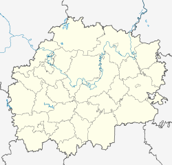
Miloslavskoye (Ryazan)
| Urban-type settlement
Miloslawskoje
Милославское
|
||||||||||||||||||||||||||||||||||
|
||||||||||||||||||||||||||||||||||
|
||||||||||||||||||||||||||||||||||
Miloslawskoje ( Russian Милосла́вское ) is an urban-type settlement in Ryazan Oblast in Russia with 4,478 inhabitants (as of October 14, 2010).
geography
The place is about 120 km as the crow flies south-southwest of the Ryazan Oblast administrative center, about 10 km from the border with Lipetsk Oblast on the river Mokraja Polotebnja, which flows over the Polotebnja to Ranowa .
Miloslawskoje is the administrative center of the Rajons Miloslavsky and seat and only town of the municipality Miloslawskoje gorodskoje posselenije.
history
The place was first mentioned in 1350. Origin and name are associated with the Tatar prince Salachmir (Solochmir), who entered the service of the Ryazan prince Oleg Ivanovich and called himself Ivan Miloslawich after converting to Christianity. After a decline in the following centuries, the place only regained some importance in the 19th century. From 1831 he was also called Alexejewskoje . When the railway line Moscow - Ranenburg of the Ryazan-Uralsk Railway passed by at the end of the 19th century, a station was built there, which again bore the name Miloslawskoje .
On July 12, 1929, the Miloslawskoje station settlement became the administrative seat of a newly created rajon named after it. In 1965 it was united with the village and the surrounding villages Babarykino, Gorjuschkino and Pokrovo-Schischkino and received the status of an urban-type settlement.
Population development
| year | Residents |
|---|---|
| 1939 | 790 |
| 1959 | 1455 |
| 1970 | 4193 |
| 1979 | 4639 |
| 1989 | 4995 |
| 2002 | 4813 |
| 2010 | 4478 |
Note: census data
traffic
Miloslawskoje has a station at kilometer 281 of the railway line opened on this section in 1898 and electrified since 1966 Moscow ( Paveletsky station ) - Pavelets - Ranenburg - Bogoyawlensk .
A regional road leads into the settlement, which branches off the federal trunk road R22 Kaspi Kaschira (near Moscow) - Astrakhan almost 40 km north of the neighboring district center of Skopin .
Web links
Individual evidence
- ↑ a b Itogi Vserossijskoj perepisi naselenija 2010 goda. Tom 1. Čislennostʹ i razmeščenie naselenija (Results of the All-Russian Census 2010. Volume 1. Number and distribution of the population). Tables 5 , pp. 12-209; 11 , pp. 312–979 (download from the website of the Federal Service for State Statistics of the Russian Federation)

