Kassimov
| city
Kassimov
Kasimov
|
||||||||||||||||||||||||||||||||||||||||
|
||||||||||||||||||||||||||||||||||||||||
|
||||||||||||||||||||||||||||||||||||||||
| List of cities in Russia | ||||||||||||||||||||||||||||||||||||||||
Kassimow ( Russian Касимов ) is a city in the Ryazan Oblast ( Russia ) with 33,491 inhabitants (as of October 14, 2010).
geography
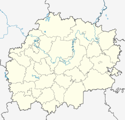
The city is located in the eastern part of the Meshchora Lowlands, about 150 km northeast of the Oblast capital Ryazan and 260 kilometers southeast of Moscow on the left bank of the Oka , a right tributary of the Volga .
Kassimow is administratively directly subordinate to the Oblast and at the same time the administrative center of the Rajon of the same name .
history
The city was founded in 1152 by Yuri Dolgoruki as Gorodets-Meshchorsky as a border fortress of the principality of Vladimir-Suzdal .
In 1376 the city was destroyed by troops of the Golden Horde , but subsequently rebuilt nearby as Nowy Nisowy Gorod ( New Low Town ).
In 1471, the city was renamed Kassimow after the Grand Duke of Moscow Vasily II had given it as a fief to the Tatar prince Qasıym (Russian spelling Касим / Kassim ), who had transferred to Moscow from the Golden Horde in 1446 . Until 1681 Kassimow remained under several Tatar dynasties the center of the autonomous khanate Kassimow ( Tatar Касыйм ханлыгы / Qasıym xanlığı). Under Peter I, the city lost its independence and then belonged to the Pereslavl-Ryazan Province. In 1778 the modern town charter was granted as the administrative center of a district ( Ujesds ) of the Ryazan governorate . In the first half of the 19th century, an industry based on local fishing began to develop in the city. The 1897 census showed that about a sixth of the population was still Tatar's mother tongue. In 1929, Kassimov became an administrative center of the Kassimov district in the Moscow region, and in 1937 the district became part of the Ryazan region.
Population development
| year | Residents |
|---|---|
| 1897 | 13,547 |
| 1926 | 13,000 |
| 1939 | 22,198 |
| 1959 | 27,855 |
| 1970 | 33,066 |
| 1979 | 34,216 |
| 1989 | 37,521 |
| 2002 | 35,816 |
| 2010 | 33,491 |
| 2019 | 29,700 |
Note: census data (1926 rounded)
Culture and sights
Due to its history, Kassimow is the furthest city in central Russia with historical Islamic buildings. In the city there is a mosque from the 18th century, built on foundations from the 15th century, with a minaret from the 15th to the 16th century, rebuilt in 1740. The mausoleums of Şahğäli Xan (Shahghali Khan, Shah Ali Khan) from 1555 with minarets and Äfğan Möxämmäd (Afgan Muhammed Sultan) from 1658 are also located here.
Even Russian Orthodox churches have been preserved: the Assumption Cathedral ( Вознесенский собор / Voznesensky Sobor) from the 19th century and the Church of the Epiphany ( Богоявленская церковь / Bogoyavlensky Tserkov), the Nikolai Church ( Никольская церковь / Nikolskaya Zerkow) and the Holy Trinity Church ( Троицкая церковь / Troitskaja zerkow) from the 18th century.
Kassimow has a local museum.
Economy and Infrastructure
In Kassimow there is a factory for fishing nets , built on the basis of a rope factory from 1853, which produces up to a third of the nets required for sea fishing in Russia, companies for non-ferrous metal processing, equipment manufacturing, refrigeration technology and a ship repair yard.
The town is the terminus of a 69 km long railway line , which at the station Uschinski of the route Moscow -Rjasan- Ruzayevka - Sysran branches. The station is located eight kilometers southwest of the city on the opposite, right bank of the Oka, which is crossed by a road bridge west of the city. An earlier bridge near the city center was demolished in the 1990s.
Kassimow is the terminus of the regional roads R105 from Lyubertsy near Moscow via Spas-Klepiki , R124 from Shazk and R125 from Nizhny Novgorod via Murom .
sons and daughters of the town
- Anna Hansen (1869–1942), translator of Scandinavian writers
- Frol Koslow (1908–1965), Soviet politician
- Yevgeny Markin (1938–1979), poet (born in the nearby village of Kletino)
- Alexander Makarov (* 1951), athlete
See also
Individual evidence
- ↑ a b Itogi Vserossijskoj perepisi naselenija 2010 goda. Tom 1. Čislennostʹ i razmeščenie naselenija (Results of the All-Russian Census 2010. Volume 1. Number and distribution of the population). Tables 5 , pp. 12-209; 11 , pp. 312–979 (download from the website of the Federal Service for State Statistics of the Russian Federation)
Web links
- City Council website (Russian)
- Kassimow on mojgorod.ru (Russian)


