Jermisch
| Urban-type settlement
Jermisch
Ермишь
|
||||||||||||||||||||||||||||||||||
|
||||||||||||||||||||||||||||||||||
|
||||||||||||||||||||||||||||||||||
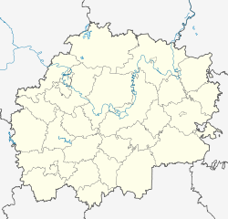
Jermisch ( Russian Ермишь ) is an urban-type settlement in the Ryazan Oblast in Russia with 4345 inhabitants (as of October 14, 2010).
geography
The place is a good 160 km as the crow flies east of the administrative center of Ryazan, not far from the border with Nizhny Novgorod Oblast and the Republic of Mordovia . It is located on the right Mokscha tributary Jermisch , which is dammed up there to form the small Jermischinski prud reservoir .
Yermish is the administrative center of Yermishinsky Rajons and the seat of the municipality of Yermishinskoye gorodskoje posselenije, which also includes the villages of Nekrasovka (7 km east) and Swestur (9 km north-west) and the settlements of Gar (5 km north-west) and Gorelyschewo (14 km north-west).
history
The place was founded at the beginning of the 17th century under the name Anossowo ; The founding year is 1628. In 1755 an ironworks was opened there, which was in operation until 1882. The place was later named after the name of the river, alternatively until the 20th century also as Archangelskoje, after the local Archangel Church (Russian Archangelskaya zerkow ). At the end of the 18th century it became the seat of a Volost in Ujesd Temnikow in the Tambov governorate .
On July 12, 1929, Jermisch became the administrative seat of a newly created Rajons named after him. In 1960 the place received the status of an urban-type settlement.
Population development
| year | Residents |
|---|---|
| 1897 | 2452 |
| 1939 | 3321 |
| 1959 | 3069 |
| 1970 | 4217 |
| 1979 | 4488 |
| 1989 | 5061 |
| 2002 | 4715 |
| 2010 | 4345 |
Note: census data
traffic
The regional road 61K-033 leads to Jermisch, which branches off the 61K-030 Sassowo - Kadom a good 20 km southwest of Woschod and continues to the oblast border as 61K-036, from where it connects to Vosnesenskoye in the Nizhny Novgorod Oblast and Tengushevo in Mordovia consists.
In Sassowo, 50 km to the south-west, on the Moscow - Ryazan - Rusajewka - Syzran route, there is the nearest train station.
Web links
Individual evidence
- ↑ a b Itogi Vserossijskoj perepisi naselenija 2010 goda. Tom 1. Čislennostʹ i razmeščenie naselenija (Results of the All-Russian Census 2010. Volume 1. Number and distribution of the population). Tables 5 , pp. 12-209; 11 , pp. 312–979 (download from the website of the Federal Service for State Statistics of the Russian Federation)


