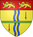
Vimont
| Vimont | ||
|---|---|---|

|
|
|
| region | Normandy | |
| Department | Calvados | |
| Arrondissement | Caen | |
| Canton | Troarn | |
| Community association | Val ès Dunes | |
| Coordinates | 49 ° 7 ′ N , 0 ° 12 ′ W | |
| height | 2–29 m | |
| surface | 8.96 km 2 | |
| Residents | 746 (January 1, 2017) | |
| Population density | 83 inhabitants / km 2 | |
| Post Code | 14370 | |
| INSEE code | 14761 | |
| Website | www.vimont.fr | |
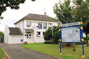
 Vimont Town Hall |
||
Vimont is a French municipality with 746 inhabitants (as of January 1 2017) in the department of Calvados in the region of Normandy ; it belongs to the arrondissement of Caen and the canton of Troarn .
geography
Vimont is about 13 kilometers east-southeast of Caen . Vimont is surrounded by the neighboring communities of Banneville-la-Campagne in the north and north-west, Saint-Pair in the north, Janville in the north-east, Argences in the east, Moult in the south and south-east, Bellengreville in the west and south-west, Frénouville in the west and Émiéville in the west and Northwest.
The former route nationale 13 (today's D613) runs through the municipality .
history
In 1826 the place Saint-Pierre-Oursin was incorporated.
Population development
| year | 1962 | 1968 | 1975 | 1982 | 1990 | 1999 | 2006 | 2012 |
|---|---|---|---|---|---|---|---|---|
| Residents | 190 | 218 | 276 | 413 | 470 | 483 | 520 | 739 |
Source: INSEE
Attractions
- Vimont Castle from the 18th century, monument historique since 1978
- Saint-Pierre-Orsin Castle, today's Kurhaus
Individual evidence
Web links
Commons : Vimont (Calvados) - Collection of images, videos and audio files


