
Cintheaux
| Cintheaux | ||
|---|---|---|
|
||
| region | Normandy | |
| Department | Calvados | |
| Arrondissement | Caen | |
| Canton | Thury-Harcourt | |
| Community association | Cingal-Suisse Normande | |
| Coordinates | 49 ° 3 ′ N , 0 ° 18 ′ W | |
| height | 69-122 m | |
| surface | 7.58 km 2 | |
| Residents | 190 (January 1, 2017) | |
| Population density | 25 inhabitants / km 2 | |
| Post Code | 14680 | |
| INSEE code | 14160 | |
 Street in Cintheaux |
||

Cintheaux is a French municipality with 190 inhabitants (as of January 1 2017) in the department of Calvados in the region of Normandy . It belongs to the arrondissement of Caen and the canton of Thury-Harcourt . The inhabitants are known as Cintheauxiens .
geography
Cintheaux is located around 16 km south-southeast of Caen . The Cintheaux is surrounded by the municipalities of Le Castelet in the north and northeast, Saint-Sylvain in the east, Cauvicourt in the southeast, Gouvix in the south, Bretteville-sur-Laize in the southwest and west and Fontenay-le-Marmion in the northwest.
Population development
| year | 1793 | 1836 | 1876 | 1926 | 1946 | 1968 | 1999 | 2016 |
| Residents | 224 | 245 | 233 | 175 | 132 | 172 | 180 | 192 |
| Source: Cassini, EHESS and INSEE | ||||||||
Attractions
- Saint-Germain church from the 12th century, monument historique
- Former school, Monument historique
- Canadian War Cemetery

Saint Germain Church

View of the military cemetery
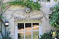
Relief on the former school


literature
- Le Patrimoine des Communes du Calvados. Volume 1, Flohic Editions, Paris 2001, ISBN 2-84234-111-2 , pp. 321-322.
Web links
Commons : Cintheaux - collection of images, videos and audio files