Rapilly
| Rapilly | ||
|---|---|---|
|
|
||
| region | Normandy | |
| Department | Calvados | |
| Arrondissement | Caen | |
| Canton | Falaise | |
| Community association | Pays de Falaise | |
| Coordinates | 48 ° 51 ′ N , 0 ° 20 ′ W | |
| height | 54–222 m | |
| surface | 4.19 km 2 | |
| Residents | 47 (January 1, 2017) | |
| Population density | 11 inhabitants / km 2 | |
| Post Code | 14690 | |
| INSEE code | 14531 | |
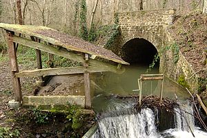
 Lavoir of the parish |
||
Rapilly ( ) is a French commune with a population of 47 (as at 1st January 2017) in the department of Calvados in the region of Normandy . It belongs to the arrondissement of Caen and the canton of Falaise .
geography
Rapilly is about eleven kilometers west-southwest of Falaise and 40 kilometers south of Caen . The municipality is surrounded by Le Détroit in the north-west and north, Les Loges-Saulces in the north-east and east, Ménil-Vin in the south-east, Les Isles-Bardel in the south and south-west and Le Mesnil-Villement and west. The Orne runs directly southwest of the municipality .
Population development
| year | 1793 | 1836 | 1876 | 1926 | 1946 | 1968 | 1990 | 2016 |
| Residents | 174 | 201 | 176 | 95 | 84 | 55 | 46 | 47 |
| Source: Cassini, EHESS and INSEE | ||||||||
Attractions
- Saint-Quentin church from the 12th / 13th centuries Century, classified as a cultural asset
- Castle from the 18th century, cultural
- several houses and farms from the 19th century, which are also designated as cultural assets
Web links
Commons : Rapilly - collection of images, videos and audio files
Individual evidence
- ↑ Rapilly - Cassini
- ↑ Rapilly - INSEE
- ↑ Saint-Quentin Church in the Base Mérimée of the French Ministry of Culture (French)
- ^ Castle in the Base Mérimée of the French Ministry of Culture (French)
- ↑ Houses and farms in Rapilly in the Base Mérimée of the French Ministry of Culture (French)
