Ménil-Vin
| Ménil-Vin | ||
|---|---|---|
|
|
||
| region | Normandy | |
| Department | Orne | |
| Arrondissement | Argentan | |
| Canton | Athis-de-l'Orne | |
| Community association | Val d'Orne | |
| Coordinates | 48 ° 51 ′ N , 0 ° 19 ′ W | |
| height | 72-192 m | |
| surface | 3.62 km 2 | |
| Residents | 53 (January 1, 2017) | |
| Population density | 15 inhabitants / km 2 | |
| Post Code | 61210 | |
| INSEE code | 61273 | |
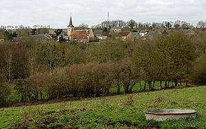
 Place view |
||
Ménil-Vin is a French municipality with 53 inhabitants (at January 1, 2017) in the department of Orne in the region of Normandy .
geography
Ménil-Vin is located 21 kilometers northeast of the city of Flers . The place is located directly north of the Baize . This forms the natural border between the Orne and Calvados departments in the region , with the communities in the north usually belonging to the Calvados department. Ménil-Vin is an exception. In addition to the Baize, two other small rivers flow through the municipality. The municipality includes the three hamlets of La Vigne , Canteloup and Le Moulin .
The neighboring municipalities of Ménil-Vin are Les Loges-Saulces in the north, Bazoches-au-Houlme and Ménil-Hermei in the south, Les Isles-Bardel in the west and Rapilly in the northwest.
History and culture
A fulling mill from the Middle Ages indicates that sheep farming and weaving were important industries for the community at the time. In 1873 the community was connected to the railway network. A hill was tunneled under the hamlet of Canteloup and the Boulaire brook was spanned with a bridge. The rails were dismantled in 1918 for defense reasons during the First World War , and the bridge was destroyed in 1959.
The church
According to a legend, the village church was initially supposed to be built on a small hill. Allegedly, however, the stones that had already been set were removed, whereupon it was decided to build the church at its current location. It bears the name Saint-Pierre . The oldest surviving elements date from the 10th or 11th century. The bell tower consists of different stones and has a slate roof . There is a sundial on the north side.
Assignment to the Orne department
The formation of the départements in 1790 sparked resistance in the town of Falaise , part of the Calvados département , which saw its influence in the communes of the Orne département endangered by the demarcation of the border. They claimed the Orne as a border. In fact, however, the Baize became the border and Ménil-Vin was assigned to the canton of Bazoches-au-Houlme in the Orne department. Because the congregation didn't appeal, they stayed there. In 1820, Falaise again requested the assignment of 33 communities to the Calvados department. At that time the municipalities resisted, but in 1832 some municipalities agreed to do so, probably including Ménil-Vin. However, this was rejected.
Population development
| year | 1962 | 1968 | 1975 | 1982 | 1990 | 1999 | 2009 | 2017 |
| Residents | 67 | 61 | 61 | 71 | 65 | 64 | 63 | 53 |
Individual evidence
- ^ Mairie Ménil-Vin , annuaire-mairie.fr
- ↑ a b Ménil-Vin , valdorne.fr

