Saint-Pierre-du-Regard
| Saint-Pierre-du-Regard | ||
|---|---|---|
|
|
||
| region | Normandy | |
| Department | Orne | |
| Arrondissement | Argentan | |
| Canton | Flers-2 | |
| Community association | Flers Agglo | |
| Coordinates | 48 ° 51 ′ N , 0 ° 33 ′ W | |
| height | 69-218 m | |
| surface | 9.3 km 2 | |
| Residents | 1,422 (January 1, 2017) | |
| Population density | 153 inhabitants / km 2 | |
| Post Code | 61790 | |
| INSEE code | 61447 | |
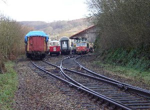
 Formerly the Pont-Érambourg station |
||
Saint-Pierre-du-Regard is a French commune with 1,422 inhabitants (at January 1, 2017) in the department of Orne in the region of Normandy .
geography
The place Saint-Pierre-du-Regard is on the northern edge of the Orne department. The municipality is traversed by the Noireau and the Vère, which flows into the Noireau in the far northeast of the municipality. The core town goes directly into that of the neighboring town of Condé-sur-Noireau , with the Noireau forming the border; this also represents the border to the Calvados department . Like large parts of the region, the surrounding area is characterized by the landscape of bocage and slightly hilly terrain. In addition to the core town, there are numerous hamlets in the area.
The neighboring municipalities of Saint-Pierre-du-Regard are Condé-sur-Noireau in the west and north, Saint-Denis-de-Méré in the northeast, Sainte-Honorine-la-Chardonne in the east, Athis-de-l'Orne in the southeast and Montilly-sur-Noireau in the southwest.
Infrastructure
The D20, which runs directly through the village, connects to Athis-de-l'Orne in a south-westerly direction, while it connects to the D512 to Vire in a westerly direction via Condé-sur-Noireau . From the neighboring town of Condé, the D562 or D962 in north-south direction also offer a national route to the cities of Caen in the north and Flers in the south.
history
Traditionally, the hinterland was the main settlement point for local agriculture, whereas the area near the Condé and especially the Vère was more industrial. This division has been preserved to this day. In 1944, the community suffered massive bombing during Operation Overlord , which was part of World War II .
The station, which was built shortly before as a stop on the route from Caen to Flers, was officially recognized as such on December 11, 1880. Both passenger and freight trains stopped there until passenger service was stopped in May 1970. In December 1979, operations for freight traffic were also given up. It was later converted into a museum with old locomotives and wagons.
Population development
| year | 1962 | 1968 | 1975 | 1982 | 1990 | 1999 | 2011 |
| Residents | 1,386 | 1,565 | 1,538 | 1,515 | 1,497 | 1,274 | 1,346 |
During the French Revolution , the population was 1,047 in 1793. In the following time there was a strong increase up to the historic high of 2,210 inhabitants in 1886. This was followed by a phase of population decline to 1,099 shortly after the Second World War. After that, the number recovered slightly and, with fluctuations, remained at a level of around 1,300 inhabitants.
Personalities
- Émile Rimailho (1864–1954), French artilleryman and engineer, died in Pont-Érambourg
- Raymond Martin (* 1949), French cyclist, born in Pont-Érambourg
Web links
Individual evidence
- ^ Mairie de Saint-Pierre-du-Regard , annuaire-mairie.fr
- ↑ a b Saint-Pierre-du-Regard ( Memento of May 21, 2009 in the Internet Archive ), athis-bocage.com
- ↑ SITE DES ANCIENS TRAINS , alain.mionnet.pagesperso-orange.fr
- ↑ Saint-Pierre-du-Regard , cassini.ehess.fr
