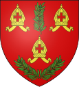
Argences
| Argences | ||
|---|---|---|

|
|
|
| region | Normandy | |
| Department | Calvados | |
| Arrondissement | Caen | |
| Canton | Troarn | |
| Community association | Val ès Dunes | |
| Coordinates | 49 ° 8 ′ N , 0 ° 10 ′ W | |
| height | 2-74 m | |
| surface | 9.76 km 2 | |
| Residents | 3,718 (January 1, 2017) | |
| Population density | 381 inhabitants / km 2 | |
| Post Code | 14370 | |
| INSEE code | 14020 | |
| Website | www.argences.com | |
 Leclerc square with church |
||
Argences is a French municipality with 3718 inhabitants (as of January 1 2017) in the department of Calvados in the region of Normandy ; it belongs to the arrondissement of Caen and the canton of Troarn . The inhabitants are called Argençais .
geography
Argences is about 15 kilometers east-southeast of Caen . Argences is surrounded by the neighboring municipalities of Janville and Saint-Pierre-du-Jonquet in the north, Saint-Ouen-du-Mesnil-Oger in the northeast, Canteloup in the east, Moult in the south and southeast and Vimont in the west and northwest.
The station is on the Mantes-la-Jolie – Cherbourg line
history
989 gave Richard I of Normandy the Abbey Fécamp country this area. This gave birth to the Barony of Argences.
Population development
| year | 1962 | 1968 | 1975 | 1982 | 1990 | 1999 | 2006 | 2011 |
|---|---|---|---|---|---|---|---|---|
| Residents | 1,584 | 1,802 | 2,215 | 3,000 | 3,048 | 3,241 | 3,484 | 3,564 |
Source: INSEE
Attractions
- Saint-Jean church, destroyed after a bombardment in 1944 (remains of the apse wall)
- Fresnes Castle, Monument historique since 1993
- Porte Mill
- Wash house
Community partnerships
There is a partnership with the German municipality of Hettstadt in Bavaria .
Personalities
- François Fayt (* 1946), composer


