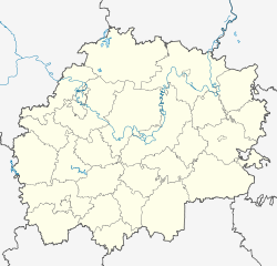
Korablino
| city
Korablino
Кораблино
|
||||||||||||||||||||||||||||||||||||||
|
||||||||||||||||||||||||||||||||||||||
|
||||||||||||||||||||||||||||||||||||||
| List of cities in Russia | ||||||||||||||||||||||||||||||||||||||
Korablino ( Russian Кораблино ) is a city in the Ryazan Oblast ( Russia ) with 12,658 inhabitants (as of October 14, 2010).
geography
The city is located in the north of the Oka-Don plain about 90 km south of the Oblast capital Ryazan not far from the Pronja River , a right tributary of the Oka River, which flows into the Volga .
Korablino is the administrative center of the Rajons of the same name .
history
The place was first mentioned in 1676 as a village. According to one version, the place name was derived from the Russian word korabl for ship , because the wood of the surrounding oak forests is said to have been used to build ships on the Don. According to other sources, the place was initially called Korabjino after its owners, the Korobjin boyar family , while the current form did not come into use until the end of the 18th century.
After the opening of the then Rjasan- Koslower Railway in 1866, the place into a significant Hay and -handelszentrum the developed provinces .
A factory for silk fabrics was opened in the 1950s. In addition, since the place is on the eastern edge of the Moscow lignite basin, several coal shafts were sunk , but they were soon closed again due to poor profitability. On May 19, 1958 the status of an urban-type settlement and on April 1, 1965 the city charter was granted.
Population development
| year | Residents |
|---|---|
| 1939 | 2,098 |
| 1959 | 5,265 |
| 1970 | 13.131 |
| 1979 | 14,789 |
| 1989 | 15,349 |
| 2002 | 14,690 |
| 2010 | 12,658 |
Note: census data
Culture and sights
The Church of the Protection and Intercession of Mary ( Покровская церковь / Pokrowskaja zerkow) from the 19th century is located in Korablino . The city has a local museum.
In the Rajon is the listed Jerlinski Dendrological Park, which was laid out in the middle of the 19th century and has over 150 species of trees and shrubs.
Economy and Infrastructure
In Korablino there is a factory for silk fabrics ( cortex ) as well as companies in the construction and food industries.
The town lies on the 1871 consistently opened railway line Moscow -Rjasan- Voronezh or - Tambov - Saratov (distance 287 kilometers).
The regional road R127 runs through Korablino , which connects the R126 Ryazan – Dankow – Jefremow , which runs a few kilometers to the east, with the M6 Moscow – Tambov – Volgograd – Astrakhan near Skopin (almost 40 kilometers west) road.
Individual evidence
- ↑ a b Itogi Vserossijskoj perepisi naselenija 2010 goda. Tom 1. Čislennostʹ i razmeščenie naselenija (Results of the All-Russian Census 2010. Volume 1. Number and distribution of the population). Tables 5 , pp. 12-209; 11 , pp. 312–979 (download from the website of the Federal Service for State Statistics of the Russian Federation)
Web links
- Korablino on mojgorod.ru (Russian)


