Naxburg (castle)
| Naxburg | ||
|---|---|---|
|
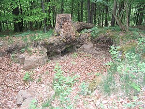
Depression on the summit |
||
| Alternative name (s): | Nackesberg, Naxberg | |
| Creation time : | around 1290 | |
| Castle type : | Hilltop castle | |
| Conservation status: | Burgstall, small remains of the wall | |
| Standing position : | Nobles | |
| Place: | Freiensteinau | |
| Geographical location | 50 ° 27 '0 " N , 9 ° 23' 31" E | |
| Height: | 554 m above sea level NN | |
|
|
||
The Naxburg is an Outbound hilltop castle in Vogelsberg on the territory of the municipality Freiensteinau in Hesse .
Geographical location
The Naxburg is located on an originally called Naxberg 554 m above sea level. NN high hill. After the castle was destroyed and decayed, its name was transferred to the mountain.
history
The "Nackesberg" (also Naxburg) was built around 1290 by Berthold II von Lißberg, and Simon von Schlitz called von Blankenwald to monitor the trade route from Frankfurt to Erfurt .
The Fulda Abbey claimed ownership of the mountain and the castle. The builders did not give in to this, however, and entrusted them to the Count Palatine near Rhine with the courts of Freiensteinau and Moos as a fief . During the following clashes, the castle was probably destroyed by the Fulda Abbey and by 1338 was already in ruins. Later the ruins came into the possession of the noble family von Eisenbach and through them, in 1428, into the possession of the barons von Riedesel . However, the castle was not rebuilt.
The ruins were removed over the years by the farmers from Ober-Moos and Gunzenau , now districts of Freiensteinau, and used for residential construction.
The discovery of a stirrup , an arrowhead and shards of Franconian clay prompted von Riedesel in 1884 to initiate excavations on the mountain in order to look for other finds. No further finds were made.
The Naxburg today
Today only a depression with two to three stair-step-like basalt stones in an impassable deciduous forest can be seen of the Naxburg . The location and course of the former ramparts can only be guessed at.
Literature and Sources
- Culture and sports association Gunzenau eV in connection with the Lauterbach eV photo club (publisher): Gunzenau - The story of a Vogelsberg village. 1998, ISBN 3-89313-040-3 .
- Hessian Land Surveying Office: Topographic map 1: 50000: Hoher Vogelsberg, ISBN 3-89446-340-6 .
- History Association Freiensteinau eV www.blaueseck.de
- Rudolf Knappe: Medieval castles in Hesse: 800 castles, castle ruins and castle sites. 3. Edition. Wartberg-Verlag, Gudensberg-Gleichen 2000, ISBN 3-86134-228-6 , p. 228.
Web links
- Naxburg, Vogelsbergkreis. Historical local dictionary for Hessen. In: Landesgeschichtliches Informationssystem Hessen (LAGIS).


