
Novoye Chaplino
| Village
Novoye Tschaplino
Новое Чаплино
|
||||||||||||||||||||||||||||
|
||||||||||||||||||||||||||||
|
||||||||||||||||||||||||||||


Novoje Tschaplino ( Russian Новое Чаплино ) is a village (selo) in the Chukchi Autonomous Okrug ( Russia ) with 419 inhabitants (as of October 14, 2010).
geography
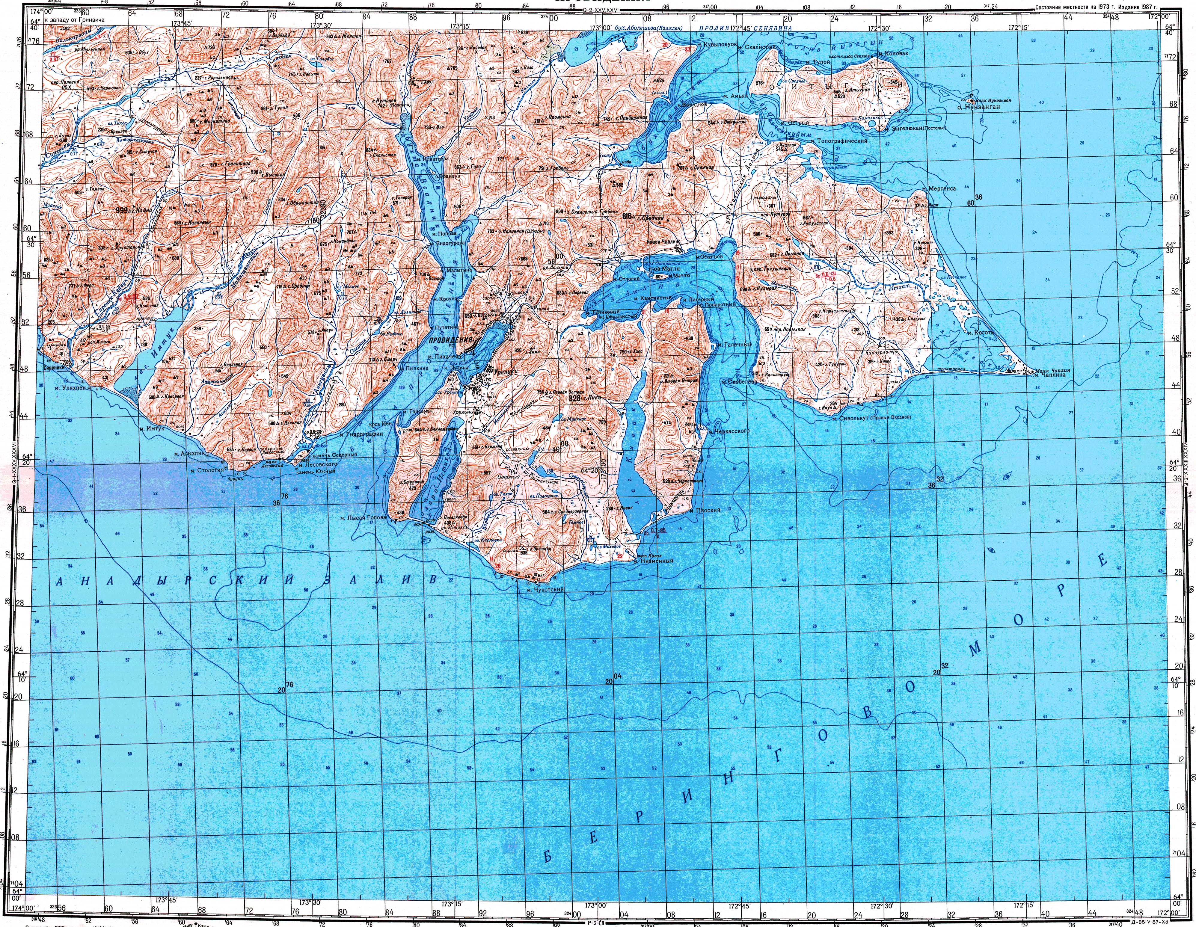
The village is located about 460 km as the crow flies east of the administrative center of the Anadyr Autonomous Okrug in the eastern part of the Chukchi Peninsula on the northern bank of the Tkatschen Bay of the Bering Sea , east of the Matlju Peninsula jutting out into the bay. Immediately north of the village is the 816 m high mountain Gora Srednjaja.
Novoje Chaplino belongs to the district of Prowidenija; it is from the eponymous administrative seat, the settlement Prowidenija , 20 km to the northeast.
history
Novoje Tschaplino ("New Tschaplino") was founded in 1958 to support the residents of the village of Tschaplino (Yupik Ungasik ) , located a good 30 km on Cape Tschaplin (Mys Tschaplina) , and other smaller coastal settlements in the area (Kiwak, Plower ), who mostly belong to the Yupik ethnic group , Chechnya) to relocate there. The resettlement was completed by 1959 and the former village , now known as Staroje Tschaplino ("Old Tschaplino"), was given up. The Russian name of cape and villages is derived from the family name Pyotr Tschaplins, a participant in Vitus Bering's First Kamchatka Expedition 1728–1730.
Until the formation of the city circle provideniya 2015 was Novoye Tschaplino seat and only town a rural community of the same name (selskoje posselenije) within the Rajons Prowidenski.
traffic
Novoje Tschaplino is located on an unpaved runway that, coming from Prowidenija, which has an airport, continues to the east adjoining peninsula with Cape Chaplin. The village can also be reached by water.
Web links
- Novoje Tschaplino on the city council website (Russian)
Individual evidence
- ↑ a b Čislennostʹ naselenija gorodskich naselennych dotov, selʹskich naselennych dotov po Čukotskomu avtonomnomu okrugu. (Population of urban settlements, rural settlements in the Chukchi Autonomous Okrug.) Download from the website of the Chukchi Autonomous Okrug of the Federal Service of State Statistics of the Russian Federation
- ↑ Topographic map from 1987, accessed January 24, 2019.
- ↑ GP Avetissow: Tschaplin, Pyotr Avraamowitsch (1699–29.08.1765) . In: Imena na Karte Rossijskoi Arktiki , Nauka, Sankt Petersburg 2003, ISBN 5-02-025003-1 (Russian).
| Cities | |||||||
| Urban-type settlements |
Beringowski SG | Egwekinot S | Mys Schmidta | Providenia S | Ugolnye Kopi SG |
||||||
| More parish seats |
|
||||||
|
Other inhabited places in urban districts |