
Oliveira do Hospital
| Oliveira do Hospital | ||||||
|---|---|---|---|---|---|---|
|
||||||
| Basic data | ||||||
| Region : | Centro | |||||
| Sub-region : | Region of Coimbra | |||||
| District : | Coimbra | |||||
| Concelho : | Oliveira do Hospital | |||||
| Coordinates : | 40 ° 22 ′ N , 7 ° 52 ′ W | |||||
| Residents: | 4705 (as of June 30, 2011) | |||||
| Surface: | 9.26 km² (as of January 1, 2010) | |||||
| Population density : | 508 inhabitants per km² | |||||
| politics | ||||||
| Address of the municipal administration: | Junta de Freguesia de Oliveira do Hospital Avenida Dr. Francisco Sá Carneiro, n.º7C 3400-059 Oliveira do Hospital |
|||||
| Oliveira do Hospital district | ||||||
|
||||||
| Residents: | 20,855 (as of June 30, 2011) | |||||
| Surface: | 234.52 km² (as of January 1, 2010) | |||||
| Population density : | 89 inhabitants per km² | |||||
| Number of municipalities : | 16 | |||||
| administration | ||||||
| Administration address: | Câmara Municipal de Oliveira do Hospital Largo Conselheiro Cabral Metello 3400-062 Oliveira do Hospital |
|||||
| President of the Câmara Municipal: | José Carlos Alexandrino Mendes ( PS ) | |||||
| Website: | www.cm-oliveiradohospital.pt | |||||


Oliveira do Hospital is a municipality and city (Cidade) in Portugal .
history
Finds (such as the Anta da Arcainha ) prove a settlement by humans since prehistory . The circle ( concelho ) Oliveira do Hospital was founded around the time of the Second Crusade (1147–1149). The place name, which had previously developed etymologically from Ulvária (a type of algae occurring in local waters) to Oliveira , got its name addition do Hospital to distinguish it from other places named Oliveira . Queen D. Teresa originally chose the name to dedicate the Order of St. John / Hospitaller (see Sovereign Order of Malta ), to which she gave the village in 1120. In 1514 King Manuel I renewed the town charter ( Foral ). In 1993 Oliveira do Hospital was raised from vila (small town) to city (cidade) status.
Attractions
There are numerous architectural monuments in the Oliveira do Hospital district, in particular a number of sacred buildings , mansions and fountains. Mention should be made of the Mozarabic Church of São Pedro de Lourosa in Lourosa and the Baroque church in São Gião . There are Roman ruins in the village of Bobadela .
- Oliveira do Hospital

The main church of Oliveira do Hospital

In the main church ( Igreja Matriz )

Landscape at Oliveira do Hospital

Rock formation at Oliveira do Hospital
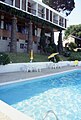
In the Pousada Santa Barbara


The village of Aldeia das Dez is one of the traditional slate villages on the route Aldeias do Xisto in the Oliveira do Hospital district. Various local and regional hiking trails criss-cross the area, and river baths offer water sports and swimming opportunities.
administration
Oliveira do Hospital is the administrative seat of a district of the same name. The neighboring areas are (starting clockwise in the north): Nelas , Seia , Arganil , Tábua and Carregal do Sal .
With the regional reform in September 2013 , several municipalities were merged into new municipalities, so that the number of municipalities decreased from 21 to 16.

The following parishes ( freguesias ) are in the Oliveira do Hospital district:

| local community | Population (2011) |
Area km² |
Density of population / km² |
LAU code |
|---|---|---|---|---|
| Aldeia the Dec | 531 | 18.69 | 28 | 061101 |
| Alvoco das Várzeas | 320 | 11.62 | 28 | 061102 |
| Avô | 595 | 7.17 | 83 | 061103 |
| Bobadela | 759 | 5.68 | 134 | 061104 |
| Ervedal e Vila Franca da Beira | 1,394 | 28.78 | 48 | 061122 |
| Lagares da Beira | 1,398 | 13.19 | 106 | 061106 |
| Lagos da Beira e Lajeosa | 1,335 | 13.51 | 99 | 061123 |
| Lourosa | 555 | 13.94 | 40 | 061109 |
| Meruge | 555 | 7.25 | 77 | 061110 |
| Nogueira do Cravo | 2,309 | 14.98 | 154 | 061111 |
| Oliveira do Hospital e São Paio de Gramaços | 5,708 | 13.67 | 418 | 061124 |
| Penalva de Alva e São Sebastião da Feira | 1,123 | 14.50 | 77 | 061125 |
| Santa Ovaia e Vila Pouca da Beira | 952 | 7.43 | 128 | 061126 |
| São Gião | 425 | 14.55 | 29 | 061115 |
| Seixo da Beira | 1,600 | 33.73 | 47 | 061118 |
| Travanca de Lagos | 1,296 | 15.83 | 82 | 061119 |
| Oliveira do Hospital district | 20,855 | 234.52 | 89 | 0611 |
Discovered in 1966, Anta von Bobadela is located about 3.0 km northwest of Oliveira do Hospital.
Population development
| Population in Oliveira do Hospital County (1801–2011) | |||||||||
|---|---|---|---|---|---|---|---|---|---|
| 1801 | 1849 | 1900 | 1930 | 1960 | 1981 | 1991 | 2001 | 2011 | |
| 727 | 9,616 | 27,324 | 26,030 | 26,287 | 23,554 | 22,584 | 22,112 | 20,841 | |
sons and daughters of the town
- Domingos Joanes (unknown – 1203), knight
- Brás Garcia de Mascarenhas (1596–1656), military man and poet
- João Pedro Tavares Trigueiros (1831–1902), engineer and military man
- Pina Martins (1920–2010), philologist and historian
- Maria Armanda Monteiro Ricardo (* 1946) singer and second wife José Cids
- José Manuel Saraiva (* 1946), journalist and writer
- Dulce Pássaro (* 1953), PS politician and former environment minister
- Carlos Martins (* 1982), football player
education
There are kindergartens, elementary schools, secondary schools, a disabled school and a vocational school in the village. The city is also home to the Escola Superior de Tecnologia e Gestão de Oliveira do Hospital (ESTGOH), a branch of the Coimbra Polytechnic .
economy
Textile industry is important here, especially men's outerwear. The cheeses that are usually included in the cheese specialties of the Serra da Estrela are also known nationwide . As a middle to upper center , the district is also important as a trading location. Tourism has also gained in importance in the form of rural tourism , for example with the pousada in Vila Pouca da Beira , or the inclusion of Aldeia das Dez in the route of the Aldeias do Xisto 2001.
Web links
- Official website
- Map of the Freguesia Oliveira do Hospital at the Instituto Geográfico do Exército
Individual evidence
- ↑ www.ine.pt - indicator resident population by place of residence and sex; Decennial in the database of the Instituto Nacional de Estatística
- ↑ a b Overview of code assignments from Freguesias on epp.eurostat.ec.europa.eu
- ↑ www.ine.pt - indicator resident population by place of residence and sex; Decennial in the database of the Instituto Nacional de Estatística
- ↑ www.cm-oliveiradohospital.pt , accessed December 18, 2012
- ^ João Fonseca: Dicionário do Nome das Terras. 2nd edition, Casa das Letras, Cruz Quebrada 2007, page 185 ( ISBN 978-9724617305 )
- ^ Publication of the administrative reorganization in the Diário da República gazette of January 28, 2013, accessed on March 16, 2014
- ↑ www.cm-oliveiradohospital.pt , accessed December 18, 2012
- ^ Official portrait clip of the city on YouTube , accessed December 18, 2012

Arganil | Cantanhede | Coimbra | Condeixa-a-Nova | Figueira da Foz | Góis | Lousã | Mira | Miranda do Corvo | Montemor-o-Velho | Oliveira do Hospital | Pampilhosa da Serra | Penacova | Penela | Soure | Tábua | Vila Nova de Poiares