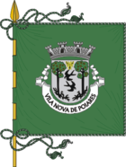
Vila Nova de Poiares
| Vila Nova de Poiares | ||||||
|---|---|---|---|---|---|---|
|
||||||
| Basic data | ||||||
| Region : | Centro | |||||
| Sub-region : | Region of Coimbra | |||||
| District : | Coimbra | |||||
| Concelho : | Vila Nova de Poiares | |||||
| Coordinates : | 40 ° 13 ′ N , 8 ° 15 ′ W | |||||
| Residents: | 4306 (as of June 30, 2011) | |||||
| Surface: | 28.81 km² (as of January 1, 2010) | |||||
| Population density : | 149 inhabitants per km² | |||||
| politics | ||||||
| Mayor : | João Miguel Sousa Henriques (PS) | |||||
| Vila Nova de Poiares district | ||||||
|
||||||
| Residents: | 7281 (as of June 30, 2011) | |||||
| Surface: | 84.45 km² (as of January 1, 2010) | |||||
| Population density : | 86 inhabitants per km² | |||||
| Number of municipalities : | 4th | |||||
| administration | ||||||
| Administration address: | Câmara Municipal de Vila Nova de Poiares Largo da República 3350-156 Vila Nova de Poiares |
|||||
| Website: | www.cm-vilanovadepoiares.pt | |||||
Vila Nova de Poiares is a vila and a district ( concelho ) in Portugal with 4306 inhabitants (as of June 30, 2011).

history
Finds prove a settlement by humans since the Neolithic . Also, Romans and Arabs left traces of their presence. At the time of the reign of Sancho I (1185-1211) there was a hostel here ( Portuguese : Albergaria ). The current place was officially mentioned for the first time as Albergaria de Poiares , when it was granted limited city rights ( Foral ) in connection with the hostel in 1195 .
The circle was first formed in 1836 as Santo André de Poyares . After several dissolutions and reorganizations, it remained an independent circle since January 13, 1898. On August 17, 1905, the localities Santo André de Poiares and Aldeia Nova were merged to the present day and elevated to Vila (small town).
administration
circle
Vila Nova de Poiares is the administrative seat of a district of the same name. The neighboring areas are (starting clockwise in the north): Penacova , Arganil , Góis , Lousã , Miranda do Corvo and Coimbra .
The following municipalities ( Freguesias ) are in the Vila Nova de Poiares district:
| local community | Population (2011) |
Area km² |
Density of population / km² |
LAU code |
|---|---|---|---|---|
| Arrifana | 1,440 | 23.84 | 60 | 061701 |
| Lavegadas | 204 | 11.26 | 18th | 061702 |
| Poiares | 4,306 | 28.81 | 149 | 061703 |
| Sao Miguel de Poiares | 1,331 | 20.54 | 65 | 061704 |
| Vila Nova de Poiares district | 7,281 | 84.45 | 86 | 0617 |
Population development
| Population in the district of Vila Nova de Poiares (1849–2011) | |||||||||
|---|---|---|---|---|---|---|---|---|---|
| 1849 | 1900 | 1930 | 1960 | 1981 | 1991 | 2001 | 2011 | ||
| 6 848 | 7 900 | 7 763 | 7 518 | 6 649 | 6 161 | 7 061 | 7 281 | ||
Town twinning
-
 France : Douchy-les-Mines ;
 -
 Poland : Mielec ;
 -
 East Timor : Liquiçá (since 2002);
 -
 Mozambique : Lichinga ;
 -
 Cape Verde : Maio ;
 -
 Sao Tome and Principe : Caué ;
in preparation:
-
 Germany : Hungen ;
 -
 Guinea-Bissau : Mansôa ;
 -
 Brazil : Búzios ;
 -
 Mozambique : Namaacha
Culture and sights
The Dolmen Dólmen de São Pedro Dias , a Stone Age burial site, is a listed building, as is the historic town center. A number of sacred buildings are also listed in the district.
In the multi-storey urban cultural center, the Centro Cultural de Poiares , a. Cinema, auditorium, library and municipal museum can be found.
Web links
- Map of the Freguesia Vila Nova de Poiares at the Instituto Geográfico do Exército
- Official website
Individual evidence
- ↑ www.ine.pt - indicator resident population by place of residence and sex; Decennial in the database of the Instituto Nacional de Estatística
- ↑ a b Overview of code assignments from Freguesias on epp.eurostat.ec.europa.eu
- ↑ www.ine.pt - indicator resident population by place of residence and sex; Decennial in the database of the Instituto Nacional de Estatística
- ↑ www.cm-vilanovadepoiares.pt , accessed on December 29, 2012
- ↑ www.verportugal.net , accessed December 29, 2012
- ↑ Municípios Portugueses: Geminações de Cidades e Vilas , accessed on January 7, 2018.
- ↑ www.monumentos.pt , accessed on December 29, 2012
- ↑ ditto
- ↑ www.cm-vilanovadepoiares.pt , accessed on December 29, 2012


